


Last Updated on March 26, 2025 7:45 am
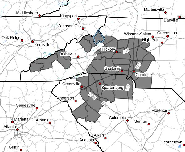
NCZ033-035>037-049>052-056>058-068>072-082-501-502-504-506-508-
510-SCZ008-009-011>014-019-106>109-261930-
Avery-Alexander-Iredell-Davie-Yancey-Mitchell-Swain-Haywood-
Catawba-Rowan-Graham-Cleveland-Lincoln-Gaston-Mecklenburg-
Cabarrus-Union-Caldwell Mountains-Greater Caldwell-Greater Burke-
Eastern McDowell-Greater Rutherford-Eastern Polk-Cherokee-York-
Abbeville-Laurens-Chester-Greenwood-Central Greenville-
Southern Greenville-Northern Spartanburg-Southern Spartanburg-
323 AM EDT Wed Mar 26 2025
…INCREASED FIRE DANGER FROM NOON EDT TODAY THROUGH
THIS EVENING…
Wednesday will again be very dry, with minimum relative humidity
in the 15-20% range expected across much of the region during the
afternoon. While winds are not expected to be quite as strong
today, gusts of at least 25mph are expected during the afternoon,
continuing the enhanced fire danger conditions.
Since the previous issuance of this product, zones in Northeast
Georgia, the western Upstate and mountains of South Carolina, and
parts of the North Carolina Blue Ridge have been upgraded to a Red
Flag Warning. See that bulletin for additional information.
A statewide burn ban remains in place for both North Carolina and
South Carolina.


