Last Updated on November 12, 2022 12:57 pm
WataugaOnline.com updates on the possible impacts of Storm Nicole on western North Carolina. Information will be updated as it becomes available and necessary.
A list of flood-prone areas in Watauga County is available at this link.
Flood Warning issued for Watauga & Ashe. More information at this link.
Flood Warning issued for Watauga. More information at this link.
Flood Watch issued for Watauga, Ashe & Wilkes. More information at this link.
Wind Advisory issued for Watauga & Ashe. More information at this link.
The Watauga High football game against Northwest Guilford this evening has been postponed until tomorrow due to the tornado watch in effect in the Guilford area and the flood warning issued for Boone and the county. Kickoff time for tomorrow is 6pm.
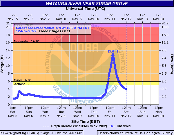
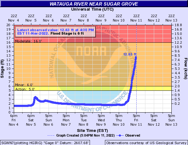
Watauga River gauge with peak flood stage of 12.63 feet at 4:30 pm
2:34pm – Many, if not all, of the low lying bridges listed in the flood-prone area link above are under water. Many of those same areas have been closed to motorists for safety. Use caution when traveling in any of the usual flood-prone areas.
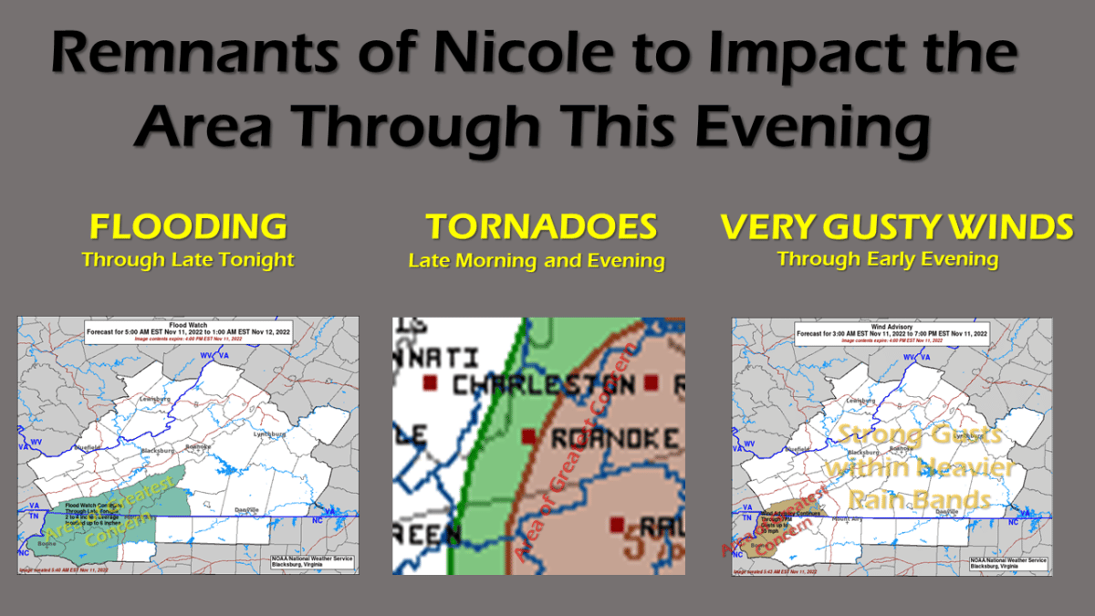
From the National Weather Service – November 11, 2022: The time of greatest risk will be between 10am and 7pm. A series of distinct rain bands will cross the area, each with the potential for locally heavy rain and isolated tornadoes. Winds will be gusty within these bands, and also in general today across the mountains of North Carolina and the Grayson Highlands of Virginia.
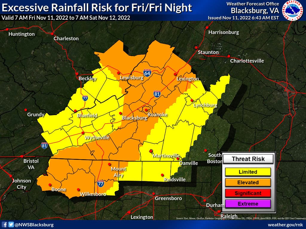
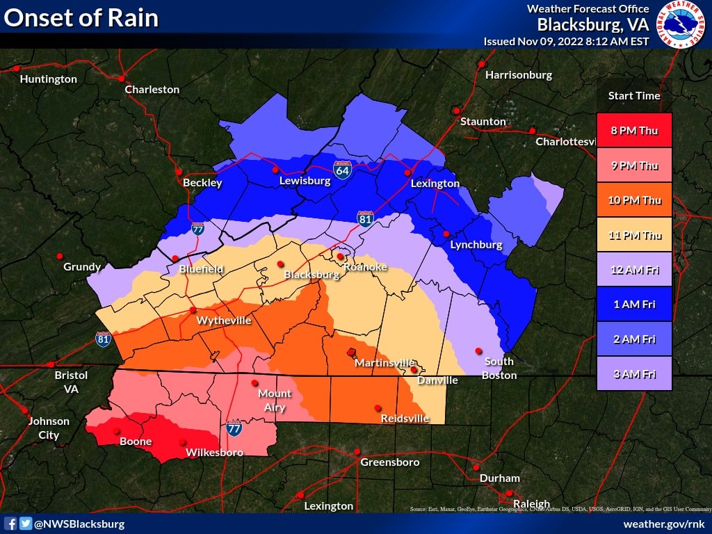
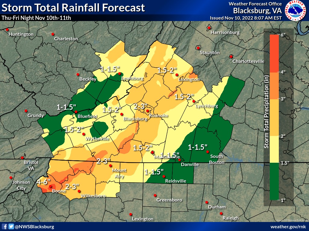
Graphics courtesy of National Weather Service Blacksburg.
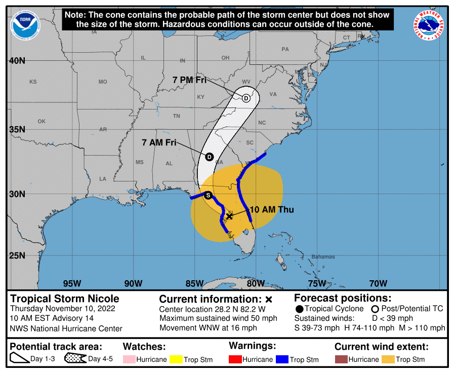
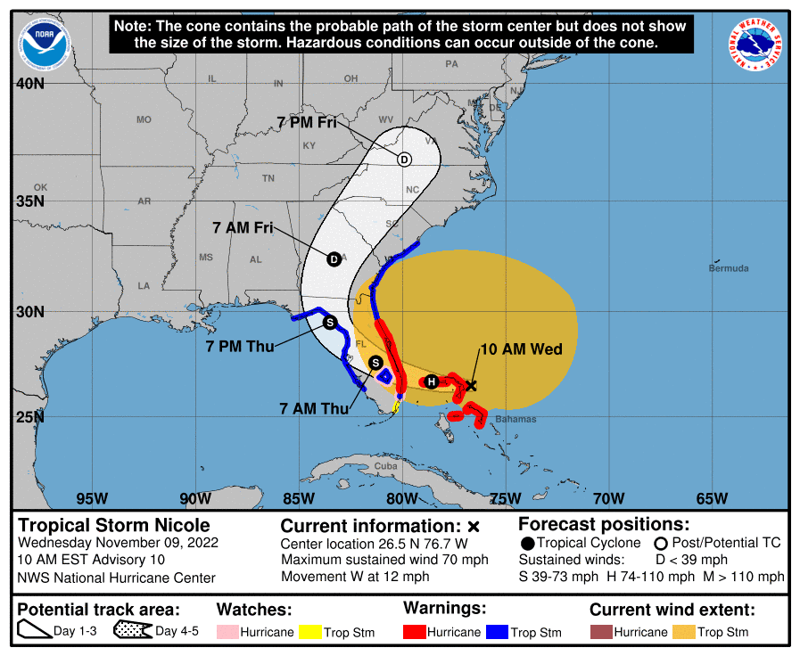
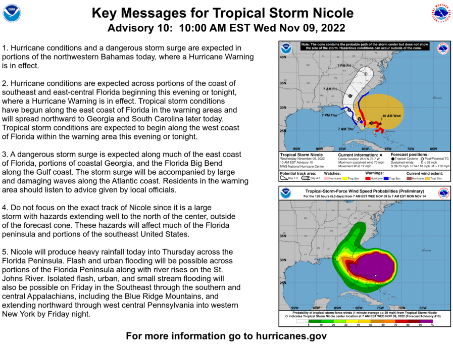
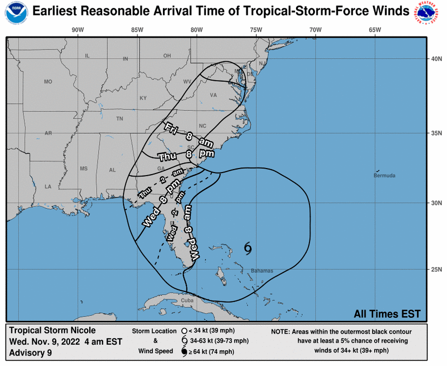
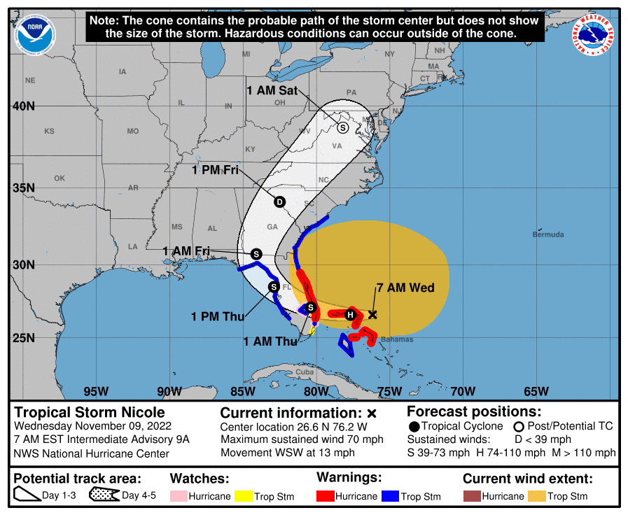
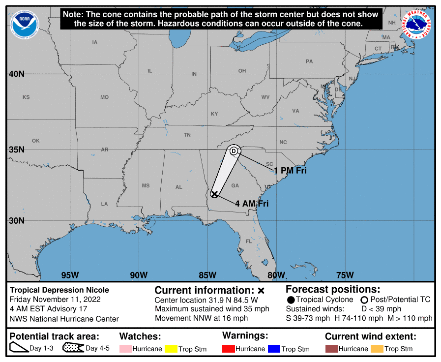
NWS Hazardous Weather Outlook 6:17am Wednesday November 9 – There is a risk of excessive rainfall Thursday through Friday as Tropical Cyclone Nicole tracks out of Florida. Flooding is possible on small streams and creeks and on tributaries of main stem rivers, depending on the amount of rain that falls. Thunderstorms may produce strong to damaging wind on Friday afternoon and evening. An isolated tornado is possible.