Last Updated on July 12, 2025 4:16 pm
NCC009-VAC077-130215-
/O.NEW.KRNK.FF.W.0042.250712T2010Z-250713T0215Z/
/00000.0.ER.000000T0000Z.000000T0000Z.000000T0000Z.OO/
BULLETIN – EAS ACTIVATION REQUESTED
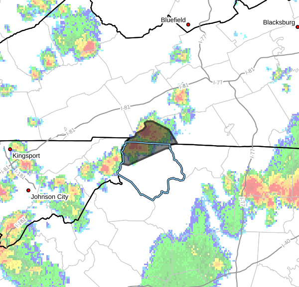
Flash Flood Warning
National Weather Service Blacksburg VA
410 PM EDT Sat Jul 12 2025
The National Weather Service in Blacksburg has issued a
- Flash Flood Warning for…
Northwestern Ashe County in northwestern North Carolina…
Southwestern Grayson County in southwestern Virginia… - Until 1015 PM EDT Saturday.
- At 410 PM EDT, Doppler radar indicated thunderstorms producing
heavy rain across the warned area. Between 2 and 3.5 inches of
rain have fallen. The expected rainfall rate is 2 to 3 inches in 1
hour. Additional rainfall amounts up to 3 inches are possible in
the warned area. Flash flooding is ongoing or expected to begin
shortly.
HAZARD…Flash flooding caused by thunderstorms.
SOURCE…Radar.
IMPACT…Flash flooding of small creeks and streams, urban
areas, highways, streets and underpasses as well as
other poor drainage and low-lying areas.
- Some locations that will experience flash flooding include…
Lansing… Whitetop…
Mouth Of Wilson… Nella…
Grayson Highlands State Park… Rugby…
Shatley Springs…
This includes the following streams and drainages…
Big Horse Creek, Big Laurel Creek, Guffey Creek, Helton Creek,
Bear Branch, Grassy Creek, Fox Creek, Comers Creek and Cut Laurel
Creek.
PRECAUTIONARY/PREPAREDNESS ACTIONS…
In hilly terrain there are hundreds of low water crossings which are
potentially dangerous in heavy rain. Do not attempt to cross flooded
roads. Find an alternate route.
When it is safe to do so, please send your reports of flooding,
including mudslides or flooded roads, to the National Weather
Service by calling toll free at 1…8 6 6…2 1 5…4 3 2 4. Reports
and pictures can also be shared on the National Weather Service
Blacksburg Facebook page and on X.