Last Updated on February 22, 2016 11:44 am
Video update from Brad Panovich on Tuesday afternoon.
Severe Weather Video Update for tomorrow. #cltwx #ncwx #scwx
Posted by Brad Panovich Meteorologist on Tuesday, February 23, 2016
National Weather Service update on Tuesday morning.

Patchy sunshine on Monday will give way to rain, snow and colder temperatures as a mix bag of weather ushers out February. With temperatures in the 50's at the Watauga Medical Center reporting station just before mid-day on Monday, it's a far different feeling than last week where 30's and 40's and snow were the main weather stories.
Much colder temperatures will return toward the end of the work week, however rain with the possibility of flooding will impact the county first. Rain is forecast to move into the area starting Monday afternoon and remain into Wednesday. Light freezing rain may be possible at elevations above 3500 feet around daybreak Tuesday, according to the National Weather Service.
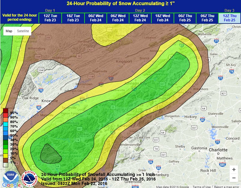
The heaviest rainfall, and possible thunderstorms, is expected Wednesday as a Flood Watch is likely to be issued for the High Country due to the amount of rain and already saturated ground from recent snow and rain. The Weather Service also notes that a Wind Advisory maybe issued Wednesday night into Thursday, and possibly a Winter Weather Advisory as the rain transitions to snow. Wind chills values in the single digits are expected Thursday night through Saturday.
Probability of snow accumulating greater than an inch through Thursday morning.