Last Updated on April 13, 2026 7:27 pm
North Carolina State Parks is actively working to reopen the Profile Trail at Grandfather Mountain State Park following the significant damage caused by Hurricane Helene. The trail and campsite remain closed, along with the Profile Trailhead, which includes the parking area and restrooms, as we continue working through this long recovery process. We will continue to update this blog post with the latest information.
The repair and restoration project involves a larger effort to strengthen the Profile Trail for long-term sustainability — improving trail alignment, reinforcing structures, and ensuring the trail is accessible and safe for visitors — while continuing to protect the mountain's exceptional biodiversity (Grandfather Mountain is designated as a UNESCO International Biosphere Reserve). We recognize that the prolonged closure has been disappointing, inconvenient, and/or frustrating to our visitors. At the same time, we want to create a safe, resilient, and sustainable trail that can withstand future storms, reduce maintenance needs, and ensure a high-quality experience for generations of hikers.
Remember: the trail is closed for your safety and the safety of our staff. And because of the severe damage, staying off the trail means you are not contributing to making an already complex project even more difficult or challenging. Cooperating with the closure protects natural resources and supports the work needed to reopen the trail safely.
What happened to the Profile Trail?
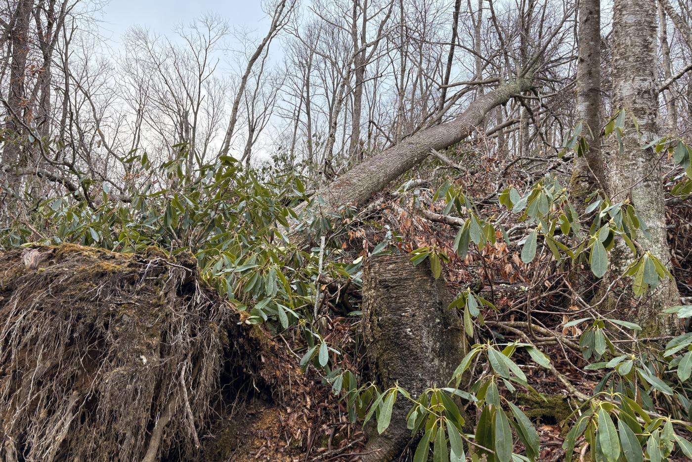
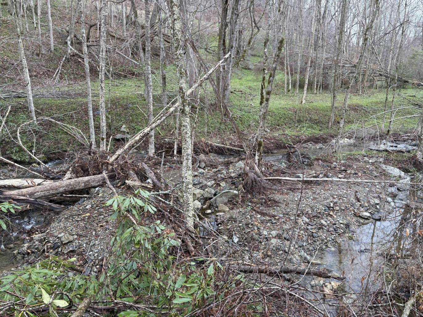
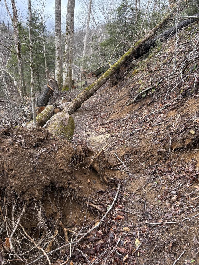
In fall 2024, Hurricane Helene hit western North Carolina and caused extensive damage across the state parks system. At Grandfather Mountain, the Profile Trail sustained significantly greater storm damage than other areas of the park, due to strong prevailing winds that caused extensive tree fall on the northwest side of the mountain. Because of the naturally steep terrain, uprooted trees pulled entire sections of the trail downhill. There was extensive debris and several downed and hazardous trees. In addition, multiple slope failures removed additional portions of the trail. The lower loop of the trail adjacent to the stream sustained severe damage, with slope failures removing large sections of trail. The steep topography then funneled flood-driven debris through the Watauga River corridor, washing out other areas and leaving heavy debris across the route.
At the end of 2024 and the beginning of 2025, park staff and partner agencies completed the initial, limited clearing that could be done safely. Much of the debris and damage requires specialized skills and equipment beyond what could be addressed during that early phase. Most of the debris needs to be professionally removed due to significant fire and safety hazards, as well as erosion and widespread trail damage caused by disrupted water flow. The professional removal of debris has been delayed largely due to logistical challenges, including funding and contracting. As of early spring 2026, the debris removal process has begun.
What happens after debris is removed?
Once debris removal is complete, the trail repair process begins. Profile Trail is an iconic, heavily used trail within a sensitive ecological area, which means:
- Repairs must minimize disturbance to rare plant communities and wildlife habitat.
- Construction techniques must follow best-practice sustainability standards to protect the environment.
- Long-term durability is essential to reduce future impacts from heavy foot traffic and severe weather.
Can I help with repairing the trail?
We frequently receive inquiries about volunteering to assist with the trail repair, and we are very grateful for the community's willingness to help. Because of the severity of the damage and the steep, unstable terrain, it is not safe for volunteers to work in the area. Ensuring everyone's safety is always our top priority.
For these reasons, the remaining repairs involve technical reconstruction, reroutes, slope stabilization, drainage improvements, and other specialized work that must be completed by a professional trail builder with the skills, equipment, and training required to safely carry out the project.
Where can I hike in the meantime?
Thankfully, the rest of Grandfather Mountain State Park remains open for day use and camping!
Hikers can park at the Boone Fork Parking Area on Blue Ridge Parkway, milepost 299.9, for the best access to the Asutsi, Cragway, Daniel Boone Scout, Nuwati, and Tanawha trails (including the Mountains-to-Sea State Trail). There is also the smaller Asutsi Parking Area on U.S. 221 / Blowing Rock Highway. All campers need to utilize Boone Fork or Asutsi parking areas. The National Park Service manages these areas, and there is no cost to park at either parking area.
Note: As of March 23, the National Park Service, which manages the Blue Ridge Parkway, has been intermittently closing the Boone Fork parking area for Helene repairs. We anticipate this closure to last a few weeks. When the parking area is closed, registered campers need to use the Asutsi Trail parking area on U.S. 221 / Blowing Rock Highway.
Hikers can also visit the Grandfather Mountain Stewardship Foundation (entrance fee charged) for the best access to Black Rock, Grandfather, Grandfather Extension, and Underwood trails. The Grandfather Mountain Stewardship Foundation does not allow overnight parking.
All photos taken in April 2025 by H. Nelson.