


Last Updated on July 1, 2025 4:01 pm
NCZ018-012030-
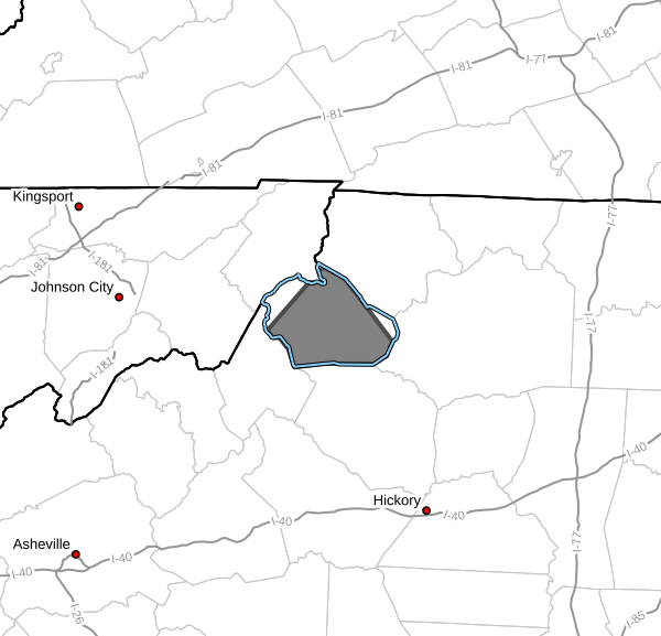
Watauga NC-
357 PM EDT Tue Jul 1 2025
…A STRONG THUNDERSTORM WILL IMPACT WATAUGA COUNTY THROUGH 430 PM
EDT…
At 357 PM EDT, Doppler radar was tracking a strong thunderstorm over
Moses Cone Memorial Park, or over Foscoe, moving northeast at 10 mph.
HAZARD…Wind gusts up to 40 mph and pea size hail.
SOURCE…Radar indicated.
IMPACT…Gusty winds could knock down tree limbs and blow around
unsecured objects.
Locations impacted include…
Boone…
Blowing Rock…
Beech Mountain…
Foscoe…
Sugar Grove…
Todd…
and Blowing Rock In Caldwell County.
PRECAUTIONARY/PREPAREDNESS ACTIONS…
If outdoors, consider seeking shelter inside a building.
Locally heavy rain will quickly reduce visibility and result in
ponding of water on roadways, standing water in low lying areas, and
minor flooding of creeks, streams, and areas of poor drainage.
Drivers are urged to slow down and use extra caution to avoid
hydroplaning.
Frequent cloud to ground lightning is occurring with this storm.
Lightning can strike 10 miles away from a thunderstorm. Seek a safe
shelter inside a building or vehicle.


