


Last Updated on June 12, 2025 7:03 pm
NCZ001-018-019-122345-
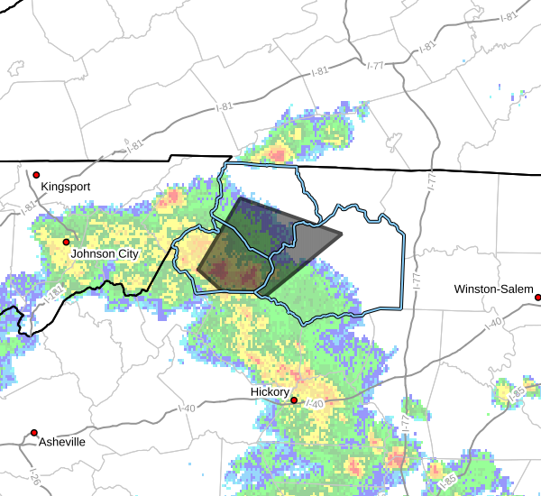
Ashe NC-Wilkes NC-Watauga NC-
650 PM EDT Thu Jun 12 2025
…A STRONG THUNDERSTORM WILL IMPACT
NORTHWESTERN WILKES…WATAUGA AND SOUTHERN ASHE COUNTIES THROUGH 745
PM EDT…
At 650 PM EDT, Doppler radar was tracking a strong thunderstorm over
Aho, or near Boone, moving northeast at 20 mph.
HAZARD…Wind gusts up to 40 mph and half inch hail.
SOURCE…Radar indicated.
IMPACT…Gusty winds could knock down tree limbs and blow around
unsecured objects. Minor hail damage to vegetation is
possible.
Locations impacted include…
Boone…
Jefferson…
West Jefferson…
Blowing Rock…
Glendale Springs…
Deep Gap…
and Mc Grady.
PRECAUTIONARY/PREPAREDNESS ACTIONS…
If outdoors, consider seeking shelter inside a building.


