


Last Updated on July 9, 2025 4:41 am
Hazardous Weather Outlook
National Weather Service Blacksburg VA
253 AM EDT Wed Jul 9 2025
NCZ001>003-018>020-VAZ007-009>020-022>024-032-WVZ042>044-507-508-
100700-
Ashe-Alleghany NC-Surry-Watauga-Wilkes-Yadkin-Tazewell-Smyth-Bland-
Giles-Wythe-Pulaski-Montgomery-Grayson-Carroll-Floyd-Craig-
Alleghany VA-Bath-Roanoke-Botetourt-Rockbridge-Patrick-Mercer-
Summers-Monroe-Eastern Greenbrier-Western Greenbrier-
253 AM EDT Wed Jul 9 2025
This Hazardous Weather Outlook is for north central North Carolina,
northwest North Carolina, southwest Virginia, west central Virginia
and southeast West Virginia.
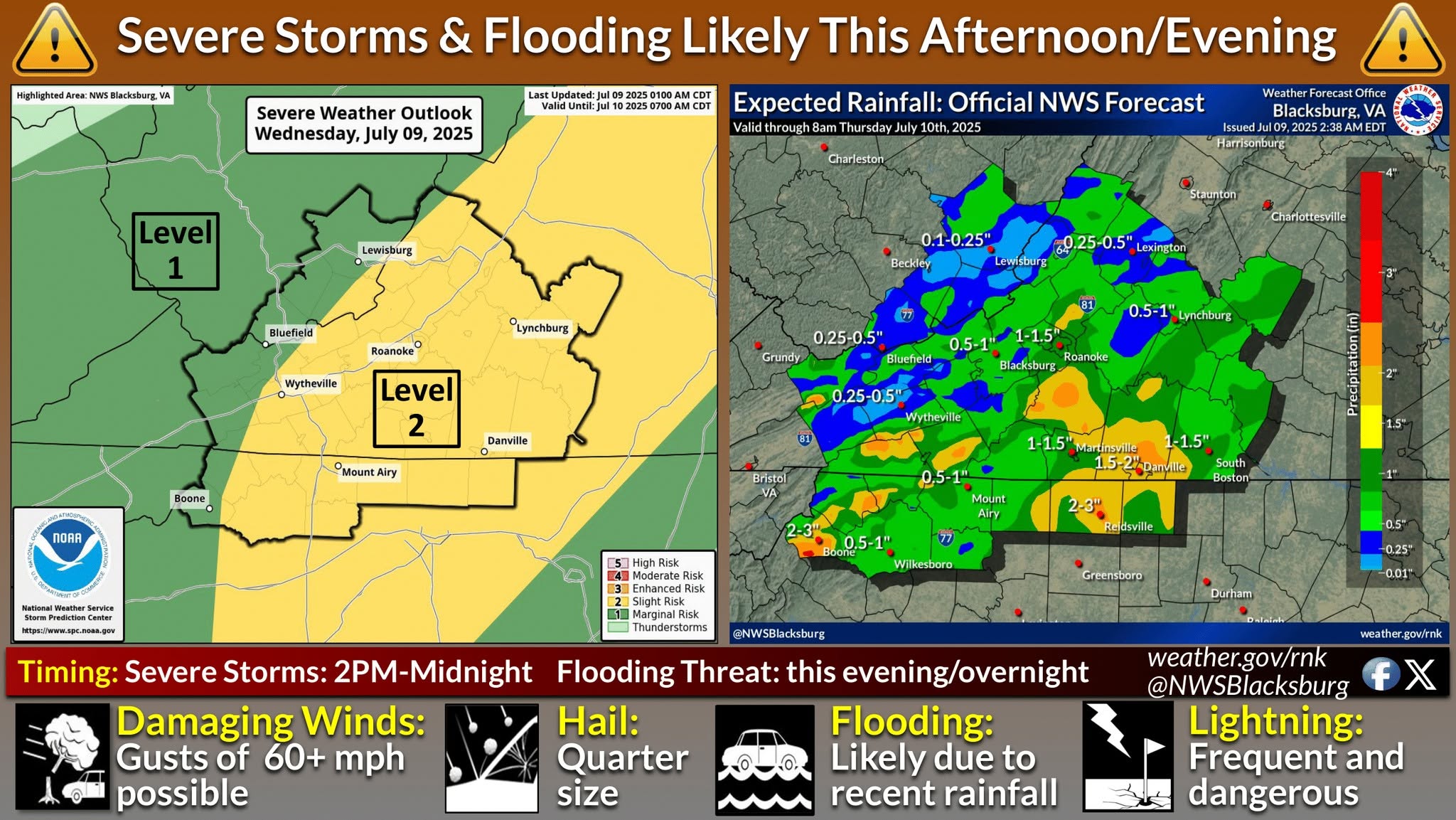
.DAY ONE…Today and tonight.
Scattered thunderstorms are possible today. Locally heavy rainfall
and isolated instances of flash flooding are possible. A few storms
today could also become strong to severe, with damaging wind gusts
the main threat.
.DAYS TWO THROUGH SEVEN…Thursday through Tuesday.
Scattered thunderstorms are possible Thursday and Friday. Locally
heavy rainfall and isolated instances of flash flooding are possible
each day. A few storms could also become strong to severe, with
damaging wind gusts the main threat.
.SPOTTER INFORMATION STATEMENT…
Spotter activation may be needed.


