


Last Updated on June 19, 2025 4:36 am
Hazardous Weather Outlook
National Weather Service Blacksburg VA
331 AM EDT Thu Jun 19 2025
NCZ001>006-018>020-VAZ007-009>020-022>024-032>035-043>047-058-059-
WVZ042>044-507-508-200745-
Ashe-Alleghany NC-Surry-Stokes-Rockingham-Caswell-Watauga-Wilkes-
Yadkin-Tazewell-Smyth-Bland-Giles-Wythe-Pulaski-Montgomery-Grayson-
Carroll-Floyd-Craig-Alleghany VA-Bath-Roanoke-Botetourt-Rockbridge-
Patrick-Franklin-Bedford-Amherst-Henry-Pittsylvania-Campbell-
Appomattox-Buckingham-Halifax-Charlotte-Mercer-Summers-Monroe-
Eastern Greenbrier-Western Greenbrier-
331 AM EDT Thu Jun 19 2025
This Hazardous Weather Outlook is for north central North Carolina,
northwest North Carolina, central Virginia, south central Virginia,
southwest Virginia, west central Virginia and southeast West
Virginia.
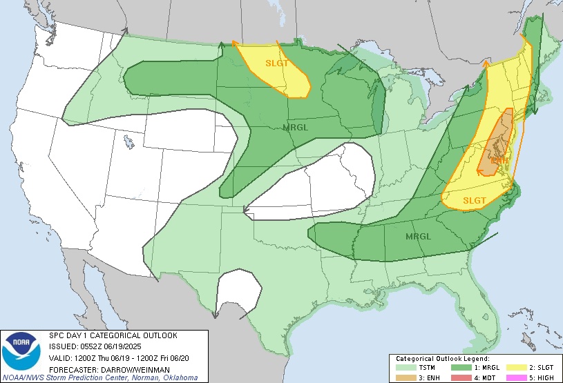
.DAY ONE…Today and tonight.
A Slight Risk (level 2 of 5) of severe weather is forecast for
Thursday with the potential for strong winds and hail.
A Marginal Risk (level 1 of 4) for excessive rainfall is forecast
for Thursday with the potential for localized flash flooding.
.DAYS TWO THROUGH SEVEN…Friday through Wednesday.
There is a low probability for widespread hazardous weather.
.SPOTTER INFORMATION STATEMENT…


