


Last Updated on July 10, 2025 4:49 am
Hazardous Weather Outlook
National Weather Service Blacksburg VA
240 AM EDT Thu Jul 10 2025
NCZ001>003-018>020-VAZ007-009>020-022>024-032>035-043-045>047-
WVZ042>044-507-508-110645-
Ashe-Alleghany NC-Surry-Watauga-Wilkes-Yadkin-Tazewell-Smyth-Bland-
Giles-Wythe-Pulaski-Montgomery-Grayson-Carroll-Floyd-Craig-
Alleghany VA-Bath-Roanoke-Botetourt-Rockbridge-Patrick-Franklin-
Bedford-Amherst-Henry-Campbell-Appomattox-Buckingham-Mercer-Summers-
Monroe-Eastern Greenbrier-Western Greenbrier-
240 AM EDT Thu Jul 10 2025
This Hazardous Weather Outlook is for north central North Carolina,
northwest North Carolina, central Virginia, south central Virginia,
southwest Virginia, west central Virginia and southeast West
Virginia.
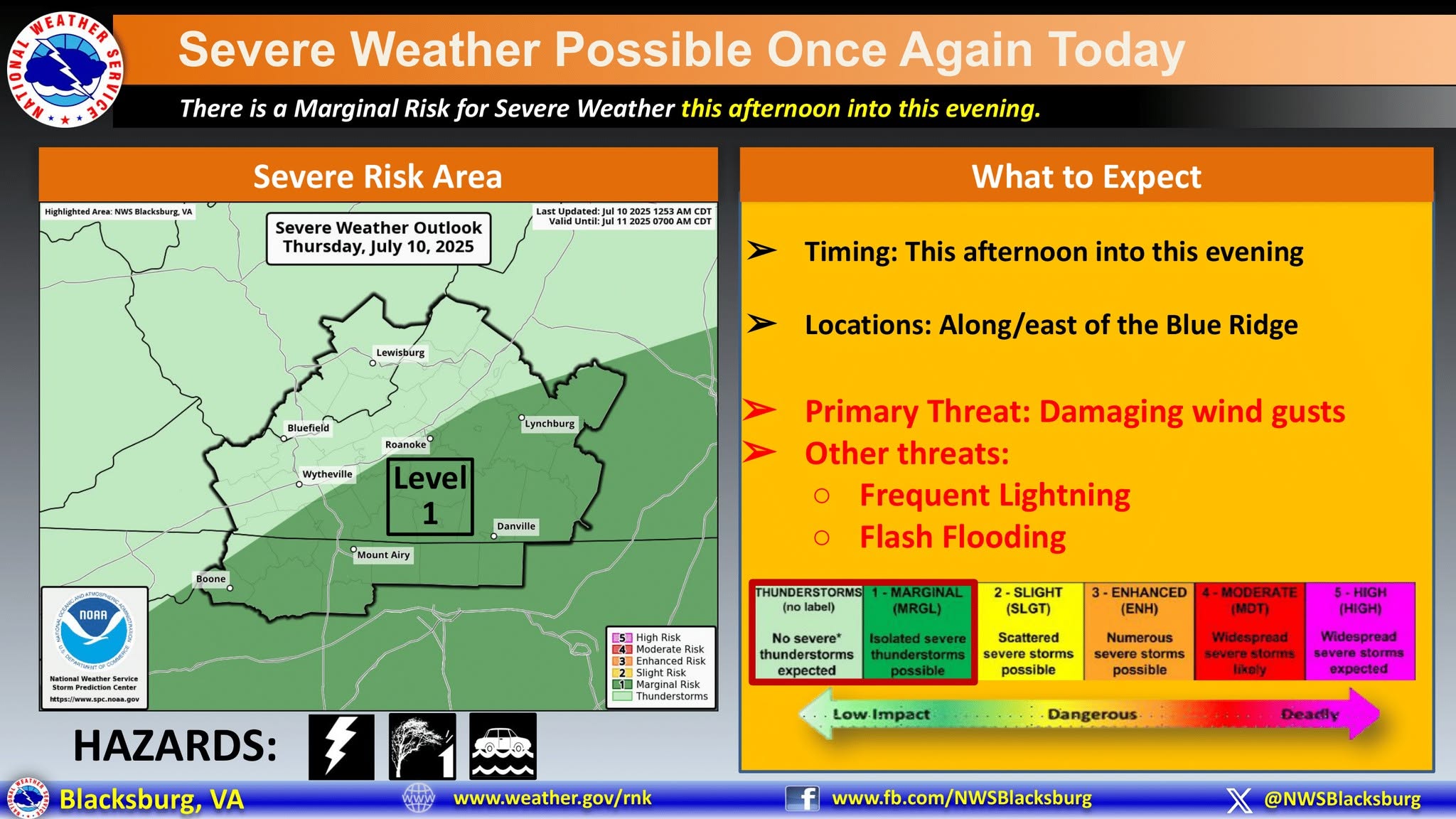
.DAY ONE…Today and tonight.
Isolated thunderstorms are possible again this afternoon and evening.
Locally heavy rainfall and gusty winds are possible.
.DAYS TWO THROUGH SEVEN…Friday through Wednesday.
Isolated thunderstorms are possible again Friday. Locally heavy
rainfall and gusty winds are possible.
.SPOTTER INFORMATION STATEMENT…
Spotter activation is not expected at this time.


