Last Updated on July 19, 2025 7:26 am
Hazardous Weather Outlook
National Weather Service Blacksburg VA
526 AM EDT Sat Jul 19 2025
NCZ001>003-018>020-VAZ007-009>020-WVZ042>044-507-508-200930-
Ashe-Alleghany NC-Surry-Watauga-Wilkes-Yadkin-Tazewell-Smyth-Bland-
Giles-Wythe-Pulaski-Montgomery-Grayson-Carroll-Floyd-Craig-
Alleghany VA-Bath-Mercer-Summers-Monroe-Eastern Greenbrier-
Western Greenbrier-
526 AM EDT Sat Jul 19 2025
This Hazardous Weather Outlook is for north central North Carolina,
northwest North Carolina, southwest Virginia, west central Virginia
and southeast West Virginia.
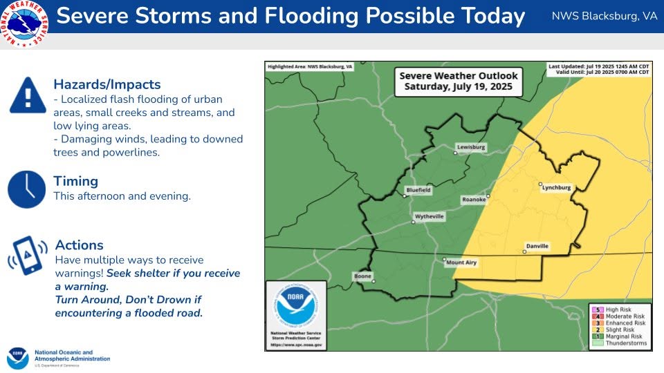
.DAY ONE…Today and tonight.
There is a Slight Risk (level 2 of 4) for excessive rainfall today
and potential for flooding. There is a Marginal Risk (level 1 of 5)
for severe storms which may contain damaging wind. Greatest storm
coverage is expected during the afternoon and evening.
.DAYS TWO THROUGH SEVEN…Sunday through Friday.
Hazardous weather is expected Sunday through Monday with focus on
storms which are expected to occur during the afternoon having
potential for localized flash flooding and isolated wind damage.
.SPOTTER INFORMATION STATEMENT…
Spotter activation is not expected at this time.