Last Updated on January 5, 2022 8:42 am
After getting the first taste of winter, though be it in a big way, on Monday more snow is possible to end the workweek.
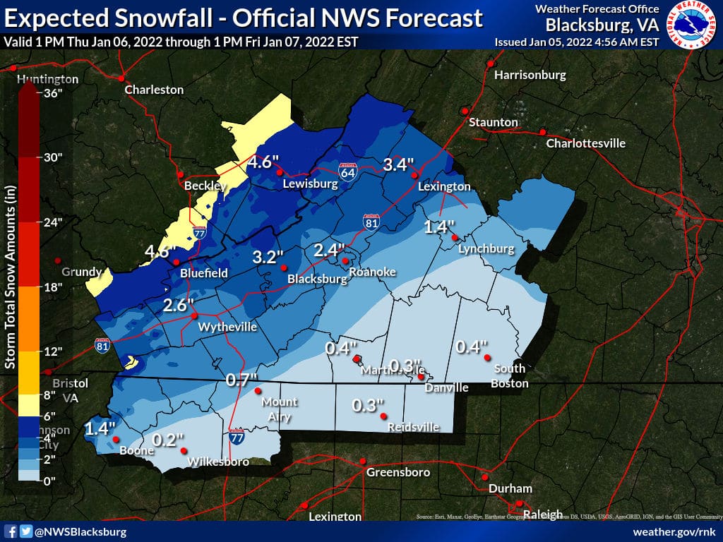
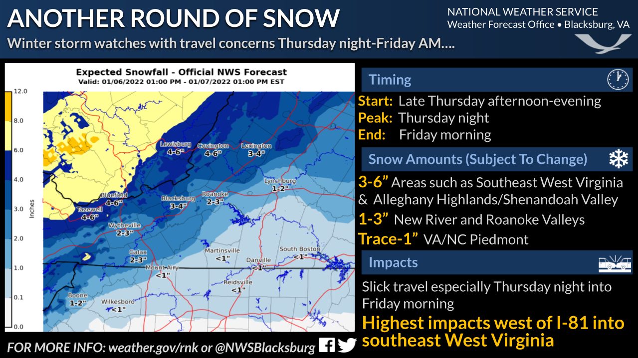
The National Weather Service (NWS) forecast calls for snow likely Thursday night and Friday morning. As of midday Tuesday, NWS says that confidence remains high for at least 2 inches or more of snow
in areas west of the Blue Ridge with the highest confidence of 4″ or better along the western facing slopes of southeast West Virginia.
NWS also notes that, “We are still 3 days out so these totals are subject to change. A shift in track to the north or south 15 to 25 miles could mean the difference of totals going up or down.”
Snowfall reports from Monday's storm can be viewed at this link.
Graphics NWS
