


Last Updated on May 12, 2025 1:17 pm
NCZ001>003-018>020-VAZ015-016-130315-
/O.EXT.KRNK.FA.A.0006.000000T0000Z-250514T0000Z/
/00000.0.ER.000000T0000Z.000000T0000Z.000000T0000Z.OO/
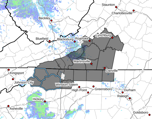
Ashe-Alleghany NC-Surry-Watauga-Wilkes-Yadkin-Grayson-Carroll-
Including the cities of Volney, West Jefferson, Yadkinville,
Independence, Whitetop, Boone, Galax, Troutdale, Sparta, Dobson,
and Wilkesboro
102 PM EDT Mon May 12 2025
…FLOOD WATCH NOW IN EFFECT THROUGH TUESDAY EVENING…
- WHAT…Flooding caused by excessive rainfall continues to be
possible. - WHERE…Portions of North Carolina, including the following areas,
Alleghany NC, Ashe, Surry, Watauga, Wilkes and Yadkin and
southwest Virginia, including the following areas, Carroll and
Grayson. - WHEN…Through Tuesday evening.
- IMPACTS…Excessive runoff may result in flooding of rivers,
creeks, streams, and other low-lying and flood-prone locations.
Creeks and streams may rise out of their banks. Flooding may occur
in poor drainage and urban areas. - ADDITIONAL DETAILS…
- Storm total rainfall of 2 to 4 inches is expected, with
locally higher amounts of 4 to 6 inches possible along the
eastern slope of the Blue Ridge. - http://www.weather.gov/safety/flood
PRECAUTIONARY/PREPAREDNESS ACTIONS…
You should monitor later forecasts and be alert for possible Flood
Warnings. Those living in areas prone to flooding should be prepared
to take action should flooding develop.


