


Last Updated on June 16, 2025 3:20 am
NCZ001>006-018>020-VAZ010>020-022-023-032>034-043-044-WVZ042>044-507-
508-161600-
/O.NEW.KRNK.FA.A.0011.250616T1600Z-250617T0400Z/
/00000.0.ER.000000T0000Z.000000T0000Z.000000T0000Z.OO/
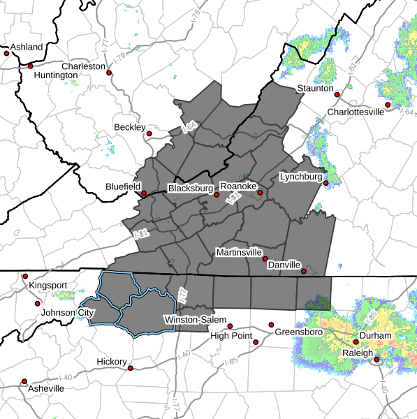
Ashe-Alleghany NC-Surry-Stokes-Rockingham-Caswell-Watauga-Wilkes-
Yadkin-Bland-Giles-Wythe-Pulaski-Montgomery-Grayson-Carroll-Floyd-
Craig-Alleghany VA-Bath-Roanoke-Botetourt-Patrick-Franklin-
Bedford-Henry-Pittsylvania-Mercer-Summers-Monroe-Eastern
Greenbrier-Western Greenbrier-
Including the cities of Pearisburg, Hot Springs, Floyd, Bedford,
Boone, Dobson, Wytheville, Eden, Hinton, Lewisburg, Martinsville,
Blacksburg, Salem, Yadkinville, Bluefield, Danville, Stuart,
Union, Duo, Alderson, Galax, Yanceyville, Flat Top, Danbury,
Fincastle, Volney, Rocky Mount, Hix, New Castle, Roanoke,
Rainelle, Whitetop, Covington, Sparta, Wilkesboro, Troutdale,
White Sulphur Springs, West Jefferson, Radford, Quinwood, Bland,
Clifton Forge, Pulaski, and Independence
252 AM EDT Mon Jun 16 2025
…FLOOD WATCH IN EFFECT FROM NOON EDT TODAY THROUGH THIS EVENING…
- WHAT…Flooding caused by excessive rainfall is possible.
- WHERE…Portions of North Carolina, including the following areas,
Alleghany NC, Ashe, Caswell, Rockingham, Stokes, Surry, Watauga,
Wilkes and Yadkin, Virginia, including the following areas,
Alleghany VA, Bath, Bedford, Bland, Botetourt, Carroll, Craig,
Floyd, Franklin, Giles, Grayson, Henry, Montgomery, Patrick,
Pittsylvania, Pulaski, Roanoke and Wythe, and southeast West
Virginia, including the following areas, Eastern Greenbrier,
Mercer, Monroe, Summers and Western Greenbrier. - WHEN…From noon EDT today through this evening.
- IMPACTS…Excessive runoff may result in flooding of rivers,
creeks, streams, and other low-lying and flood-prone locations.
Creeks and streams may rise out of their banks. Low-water
crossings may be flooded. - ADDITIONAL DETAILS…
- Moderate to heavy rain leading to flash, urban, and small
stream flooding looks likely given expected precipitation
amounts, past recent rainfall, saturated grounds in some
areas, and expected slow storm motion. - http://www.weather.gov/safety/flood
PRECAUTIONARY/PREPAREDNESS ACTIONS…
You should monitor later forecasts and be alert for possible Flood
Warnings. Those living in areas prone to flooding should be prepared
to take action should flooding develop.


