


Last Updated on July 18, 2025 7:58 am
NCZ001>006-018>020-VAZ007-009>020-022>024-032>035-043>047-058-059-
WVZ042>044-507-508-181500-
/O.NEW.KRNK.FA.A.0020.250718T1600Z-250719T0400Z/
/00000.0.ER.000000T0000Z.000000T0000Z.000000T0000Z.OO/
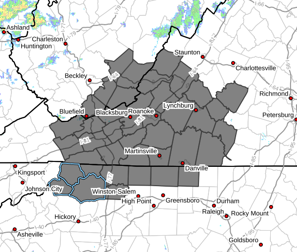
Ashe-Alleghany NC-Surry-Stokes-Rockingham-Caswell-Watauga-Wilkes-
Yadkin-Tazewell-Smyth-Bland-Giles-Wythe-Pulaski-Montgomery-
Grayson-Carroll-Floyd-Craig-Alleghany VA-Bath-Roanoke-Botetourt-
Rockbridge-Patrick-Franklin-Bedford-Amherst-Henry-Pittsylvania-
Campbell-Appomattox-Buckingham-Halifax-Charlotte-Mercer-Summers-
Monroe-Eastern Greenbrier-Western Greenbrier-
Including the cities of Blacksburg, Troutdale, Keysville, White
Sulphur Springs, Danville, Dobson, Wilkesboro, Hot Springs,
Independence, Buena Vista, Tazewell, Whitetop, Stuart, Alderson,
Eden, West Jefferson, Volney, Marion, Appomattox, Rocky Mount,
Union, Hix, Flat Top, Galax, Covington, Floyd, Lexington,
Fincastle, Bluefield, Hinton, South Boston, Yanceyville, Amherst,
Bedford, Lewisburg, Quinwood, Rainelle, Bland, New Castle,
Sparta, Lynchburg, Yadkinville, Duo, Danbury, Wytheville, Clifton
Forge, Pearisburg, Roanoke, Pulaski, Boone, Radford, Salem, and
Martinsville
253 AM EDT Fri Jul 18 2025
…FLOOD WATCH IN EFFECT FROM NOON EDT TODAY THROUGH THIS EVENING…
- WHAT…Flooding caused by excessive rainfall is possible.
- WHERE…Portions of North Carolina, including the following areas,
Alleghany NC, Ashe, Caswell, Rockingham, Stokes, Surry, Watauga,
Wilkes and Yadkin, Virginia, including the following areas,
Alleghany VA, Amherst, Appomattox, Bath, Bedford, Bland,
Botetourt, Buckingham, Campbell, Carroll, Charlotte, Craig, Floyd,
Franklin, Giles, Grayson, Halifax, Henry, Montgomery, Patrick,
Pittsylvania, Pulaski, Roanoke, Rockbridge, Smyth, Tazewell and
Wythe, and southeast West Virginia, including the following areas,
Eastern Greenbrier, Mercer, Monroe, Summers and Western Greenbrier. - WHEN…From noon EDT today through this evening.
- IMPACTS…Excessive runoff may result in flooding of rivers,
creeks, streams, and other low-lying and flood-prone locations. - ADDITIONAL DETAILS…
- Scattered to numerous thunderstorms are expected to develop
this afternoon and persist through this evening. Rain rates
of 2 to 4 inches an hour are expected. If these storms sit
over an area for even a short amount of time, poor drainage
flooding may occur. If storms merge or train over the same
area, resulting in persistent, or repetitive rounds of
rainfall, then flash flooding may occur. - http://www.weather.gov/safety/flood
PRECAUTIONARY/PREPAREDNESS ACTIONS…
You should monitor later forecasts and be alert for possible Flood
Warnings. Those living in areas prone to flooding should be prepared
to take action should flooding develop.


