Last Updated on November 13, 2024 11:48 am
ASHEVILLE – As Hurricane Helene barreled toward the Southeast, Chad Franklin received a warning from his colleagues who specialize in stormwater and flooding management for the N.C. Department of Transportation.
The NCDOT engineers with the agency’s Hydraulics Unit were poring over data, and they didn’t like what they saw. Their flood-warning system was predicting that a mile of Interstate 40 near the French Broad River in Buncombe County would flood by two feet. It was Wednesday, Sept. 25, a day before Helene would make landfall in Florida.
“I was shocked when they told me that,” recalled Franklin, who is NCDOT’s regional intelligent transportation systems engineer for the state’s 17 most-western counties. “It had never flooded before.”
As Helene approached Western North Carolina and the rainfall forecasts intensified, the flood tool predicted an even higher flood stage for I-40. Before daybreak on Friday, Sept. 27, Franklin dispatched the roadside assistance crews he supervises to I-40 near mile marker 47. They were told to close the road immediately if it started to flood.
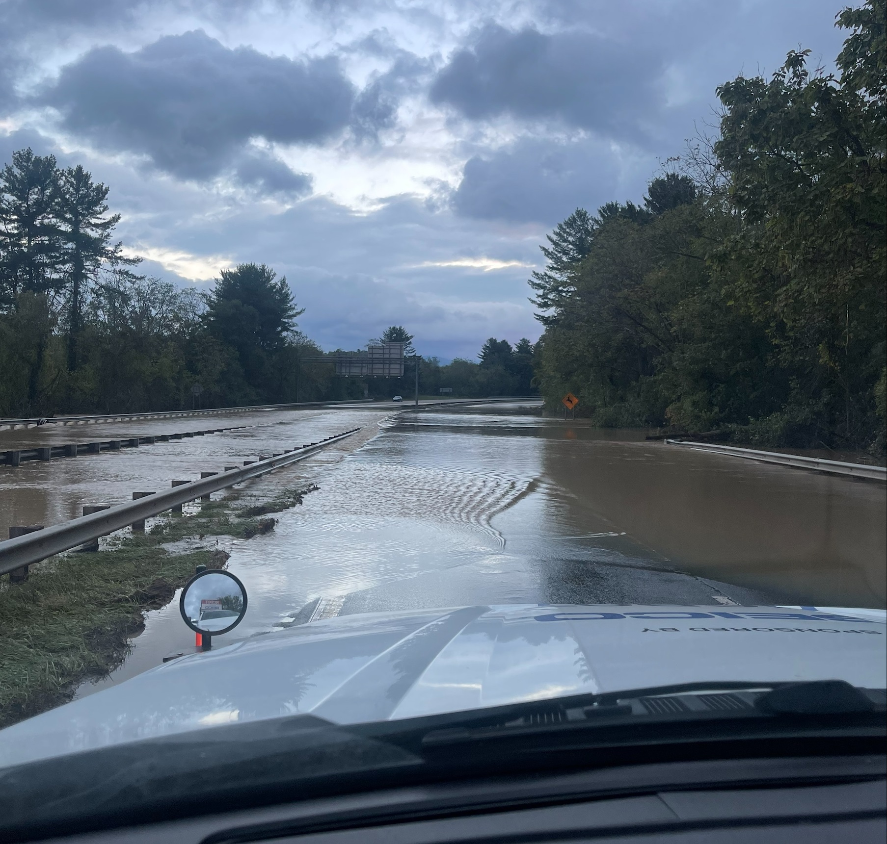
Torrential rains pushed the water over the banks of the French Broad River. As soon the murky water reached the pavement later that Friday, Franklin’s crews, other NCDOT staff and the N.C. State Highway Patrol turned on their flashing lights and used their vehicles to close I-40. The floodwaters eventually reached about eight feet over I-40.
“That flooding was more than we’d ever seen before in that area,” Franklin. “Had we not closed it that soon, we might have had people driving onto a flooded highway, and the results could have been deadly.”
Instead, NCDOT and State Highway Patrol troopers were able to safely detour traffic onto I-240 around Asheville. They would reopen I-40 on Saturday evening, Sept. 28, after the waters had receded.
During the storm, the tool was used to monitor and close a number of roads that quickly deteriorated as Helene swept through Western North Carolina. Just as important, though, was NCDOT employees were getting important information from first-responders, law enforcement and emergency management officials to better respond to the storm.
“The flood warning tool did its job, and we’re grateful it did,” Franklin said.
Flood Warning System Proves Valuable
The storm was the largest test yet for the department’s nationally recognized flood warning system since becoming operational in 2022. The system provides critical, real-time information that helps NCDOT prepare for, respond to and recover from severe storms. With it, engineers are able to monitor more than 15,000 bridges and culverts and 2,000 miles of state-maintained roads, including Interstate 40.
The flood warning system has proven instrumental in safeguarding North Carolina's transportation infrastructure. During Tropical Storm Idalia, which led to significant flooding in eastern North Carolina, including downtown Whiteville, the system generated 109 alerts, enabling staff to proactively respond. During another event last summer in the mountains, an alert directed NCDOT's bridge maintenance team in Polk County to inspect a bridge, which led to its immediate closure following the confirmation of storm damage.
During Hurricane Helene, the department’s Hydraulics Unit identified process improvements for the flood warning system. The large volume of alerts created an overwhelming influx of text messages for NCDOT employees, and some river gauges went offline due to disrupted cell service. To address these issues, the unit plans to implement a summary alert system during major storms to streamline communications. Additionally, the unit's engineers are working on adding satellite communication capabilities to critical gauges to ensure reliable data transmission even during cell service outages.
“Our goal is to save lives,” State Hydraulics Engineer Matt Lauffer said. “So, we’re taking the lessons we learn from each storm and applying those to make this tool even better.”


