Last Updated on September 26, 2025 7:20 pm
NCC189-193-270215-
/O.NEW.KRNK.FA.Y.0211.250926T2314Z-250927T0215Z/
/00000.N.ER.000000T0000Z.000000T0000Z.000000T0000Z.OO/
Watauga NC-Wilkes NC-
714 PM EDT Fri Sep 26 2025
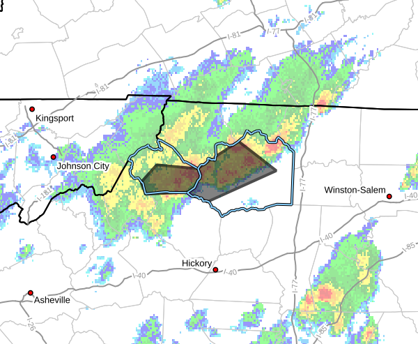
…FLOOD ADVISORY IN EFFECT UNTIL 1015 PM EDT THIS EVENING…
* WHAT…Flooding caused by excessive rainfall is expected.
* WHERE…A portion of northwest North Carolina, including the
following counties, Watauga and Wilkes.
* WHEN…Until 1015 PM EDT.
* IMPACTS…Minor flooding in low-lying and poor drainage areas.
* ADDITIONAL DETAILS…
– At 714 PM EDT, Doppler radar indicated heavy rain due to
thunderstorms. Minor flooding is ongoing or expected to begin
shortly in the advisory area. Between 1 and 2 inches of rain
have fallen.
– This includes the following streams and drainages…
Darnell Creek, Big Bugaboo Creek, Dutch Creek, Elk Creek,
Clear Branch, Bee Tree Branch, East Prong Roaring River,
Brushy Fork, Craborchard Creek, Dugger Creek, Fall Creek,
Camp Branch, Cane Creek and Church Branch.
Additional rainfall amounts up to 1 inch are expected over
the area. This additional rain will result in minor flooding.
– Some locations that will experience flooding include…
Boone… North Wilkesboro…
Wilkesboro… Blowing Rock…
Wilbar… Deep Gap…
Mc Grady…
– http://www.weather.gov/safety/flood
PRECAUTIONARY/PREPAREDNESS ACTIONS…
Turn around, don't drown when encountering flooded roads. Most flood
deaths occur in vehicles.
When it is safe to do so, please send your reports of flooding,
including mudslides or flooded roads, to the National Weather
Service by calling toll free at 1…8 6 6…2 1 5…4 3 2 4. Reports
and pictures can also be shared on the National Weather Service
Blacksburg Facebook page and on X.