


Last Updated on January 16, 2013 7:30 pm
*UPDATED 7:30pm*
Parents of school children got a call tonight that Watauga schools may dismiss early tomorrow if needed due to the weather. Make sure to send a note to school if your student will have special plans for making it home.
*UPDATED 4:20pm Wednesday afternoon*
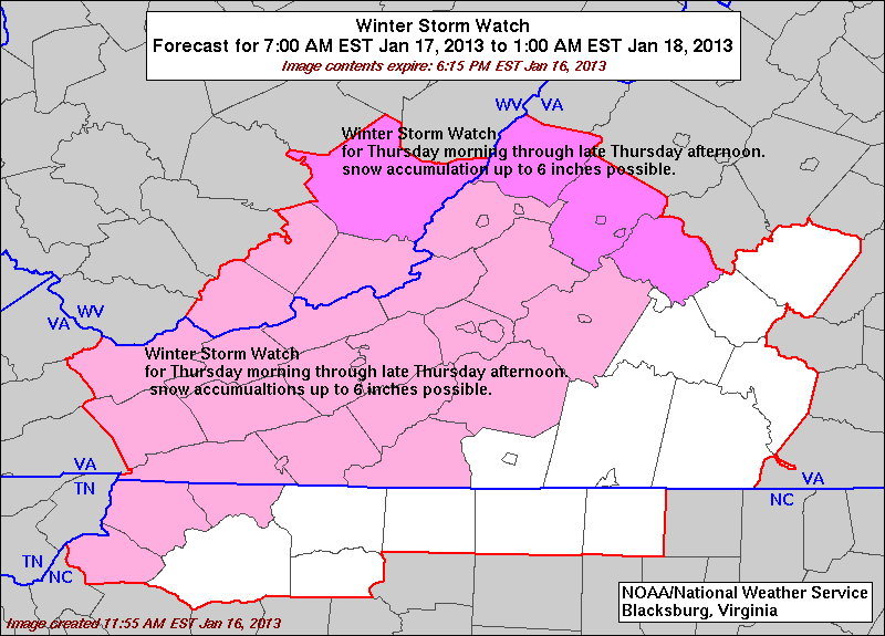
Winter Storm Warning for Watauga, Ashe from noon Thursday to 1am Friday. 4-8 inches possible for High Country.
Winter Weather Advisory for Wilkes County for same time frame with 2-5 inches possible.
Flood Watch from 1am Thursday through Thursday morning for Watauga, Ashe & Wilkes.
Winter Storm Warning for Caldwell from 1pm Thursday to midnight Thurs night.
Winter Storm Watch for Avery from 7am Thursday to 12am Thursday night.
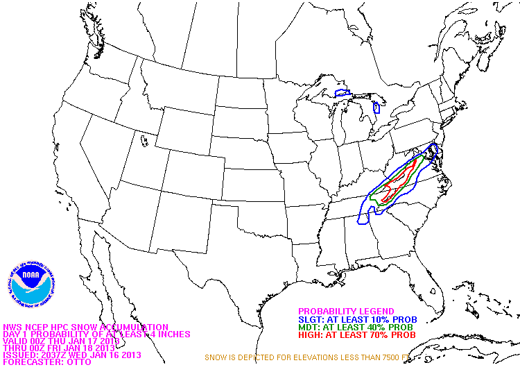
NWS graphic showing snow accumulation probability of at least 4 inches through Friday.
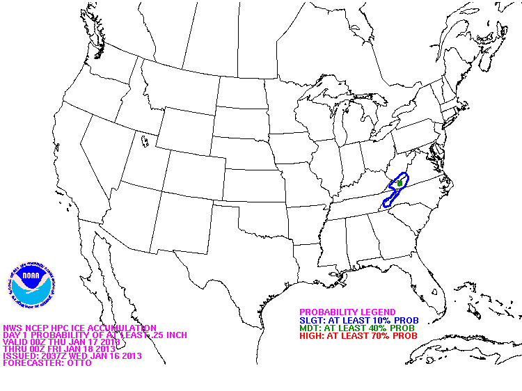
NWS graphic showing ice accumulation probability of at least .25 inch through Friday.
———————————————————————————————————-
Wednesday 10:28am – Our next round of winter weather is forecast to start on Thursday. Most forecast are putting the High Country into the 3-6 inch range, some higher elevations near the NC/TN state line could get 8 inches. With the heavy rainfall this week a concern will be for icing underneath the snow and downed trees and power lines.
A Winter Storm Watch goes into effect for Watauga, Ashe, Avery and Johnson County TN starting at 7am Thursday morning.
Here's the National Weather Service probability of snow for the High Country. This graphic shows the probability of at least 4 inches through Friday.
The High Country is just on the fringe of the probability of ice of at least .25 inch

NWS Video Update
Behind this snow is bitter cold, with high temps next week only in the 20s & 30s and wind chill values in the single digits.


