






Last Updated on November 13, 2026 3:02 pm
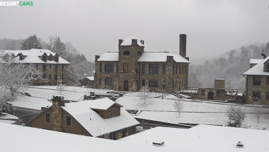
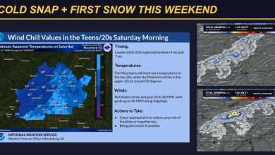
UPDATED 2:59 PM FRIDAY, NOV. 13, 2026: Snow showers will continue at times this afternoon and tonight across the higher elevations of North Carolina’s High Country, and two National Weather Service offices have issued Special Weather Statements. These are not warnings or advisories, but slippery spots are possible.
Ashe and Watauga Counties: NWS Blacksburg
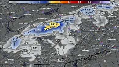
The National Weather Service in Blacksburg, Va., issued a Special Weather Statement at 2:32 PM Friday for Ashe and Watauga counties. Snow showers are expected at times at the higher elevations into this evening. Light accumulations of an inch or less are possible, which could lead to slippery spots, especially at elevations above 4,000 feet.
The statement includes West Jefferson and Boone, and also covers Tazewell, Smyth and Grayson counties in Virginia.
Avery, Mitchell and Yancey Counties: NWS Greenville-Spartanburg
The National Weather Service in Greenville-Spartanburg, S.C., issued a Special Weather Statement at 2:25 PM Friday for Avery, Mitchell and Yancey counties. Periods of snow showers continue through tonight along the Tennessee border. Up to 2 inches of snow are expected, mainly above 3,500 feet, with locally higher amounts mainly above 5,000 feet. Wind gusts up to 35 mph are also expected.
Lower elevations may see some snow showers, but no significant accumulations are expected. The statement includes Banner Elk, Newland, Spruce Pine and Burnsville, and also covers Madison, Swain, Haywood and Graham counties.
Traveling?
If you are driving any higher-elevation roads, be alert for slippery conditions and gusty winds.
For the full day’s conditions, closings and photos, see our First Snow of the Season coverage.
Forecast courtesy of the National Weather Service