






Last Updated on November 11, 2026 1:09 pm
The High Country is about to get its first real taste of winter. The National Weather Service in Blacksburg says Wednesday is the last warm day for the foreseeable future, with a cold snap beginning Thursday that will last through the weekend and could bring the first snow of the season to the highest elevations.
Rain Thursday, Then Snow Showers
Light rain showers return to the mountains Thursday as a weather system moves into the southern and central Appalachians. Precipitation will be very light.
Thursday night, colder air arrives and the rain mixes with and changes over to light snow showers as a northwest upslope flow sets up. That pattern continues into Saturday morning. Amounts will be low each day, and it will be hard for snow to stick to the warmer ground at first. As the event continues, some light accumulations are possible.
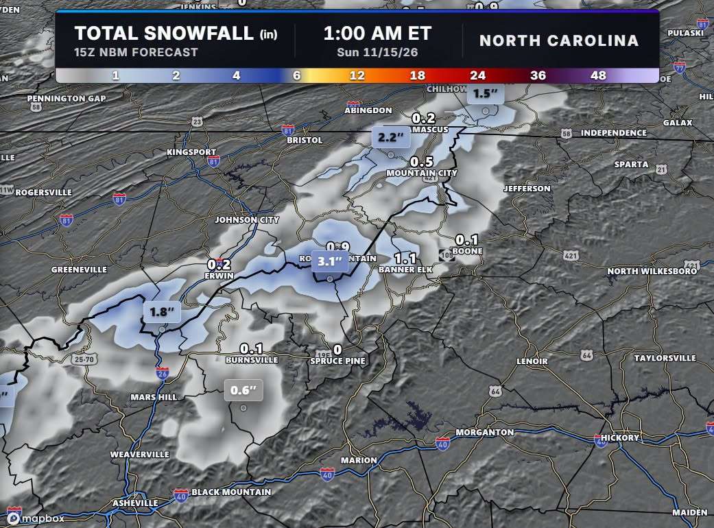
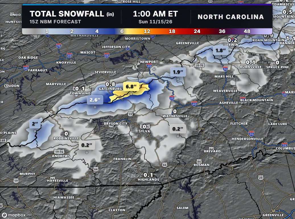
NBC Charlotte Chief Meteorologist Brad Panovich says this is strictly a northwest flow event at elevation, so lower areas will not see much. Higher up near the Tennessee line, the first few inches of snow this season are possible. The key is wind direction and the Great Lakes connection, with the best window Friday night and Saturday morning.
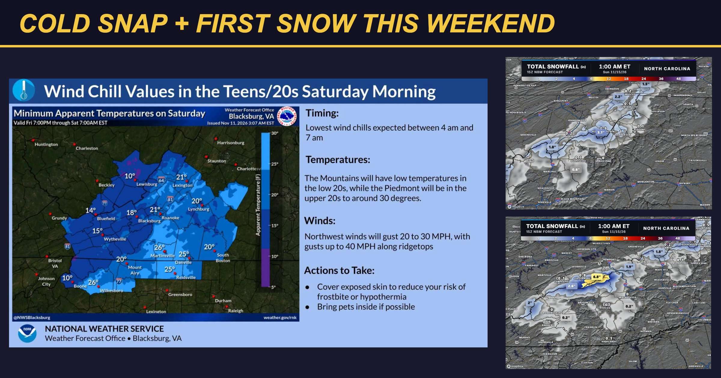
Panovich’s forecast graphics show the highest totals along the North Carolina and Tennessee border. Boone shows around 0.1 inch and Banner Elk about 1.1 inches. No snow is expected east of the mountains. It will not last long, but the cold and wind will stick around all weekend. No major travel issues are expected on the main interstate and roads until you get high up near the Tennessee line Friday night.
Hard Freezes and Dangerous Wind Chills
Highs will only reach the 30s and 40s in the mountains Friday and Saturday. Lows fall into the 20s and 30s Thursday night, followed by several nights of hard, killing freezes beginning Friday morning. Gardeners should bring in or cover anything that cannot take the cold.
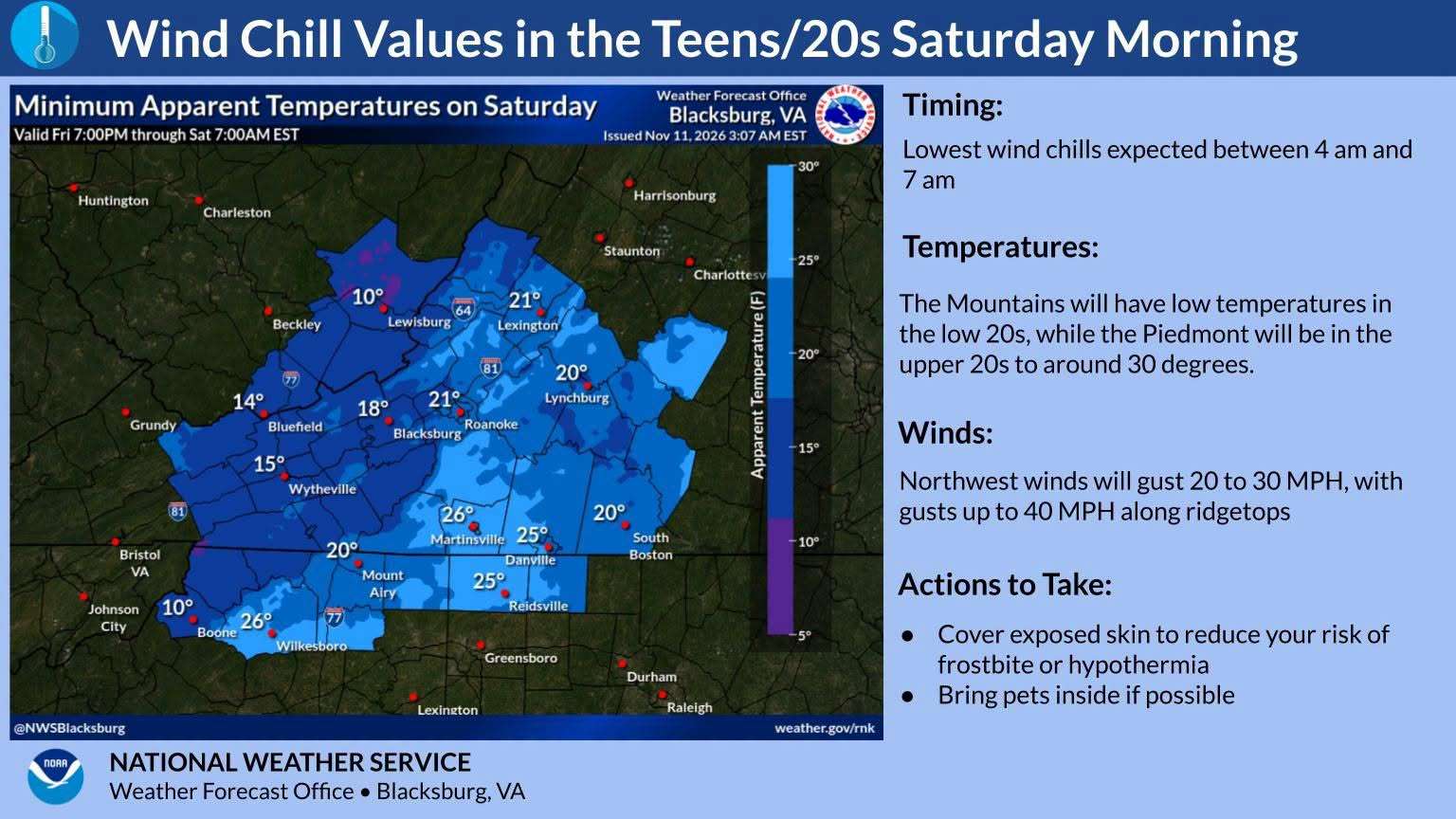
Strong, gusty west and then northwest winds begin Thursday and continue into the weekend. Gusts of 30 to 40 mph are possible on the mountain ridges and higher elevations. Wind chills will be worst Friday night and Saturday night, when parts of the mountains will feel like 12 to 20 degrees. The National Weather Service says temperatures will be a few degrees too warm for Cold Weather Advisories, but it will still be a shock to the system.
The lowest wind chills Saturday morning are expected between 4 a.m. and 7 a.m. The forecast map shows Boone near 10 degrees, with low to mid teens common across the mountains and single digits possible at the highest elevations. Northwest winds will gust 20 to 30 mph, with gusts up to 40 mph along ridgetops.
What to Do
The National Weather Service recommends covering exposed skin to reduce your risk of frostbite or hypothermia and bringing pets inside if possible.
Looking Ahead
High pressure builds in by Sunday, and the rest of the weekend will be dry but cold. Temperatures rebound some early next week.