Last Updated on July 10, 2022 9:29 am
NOAA-NWS-ALERTS-NC1264003E7788.SpecialWeatherStatement.1264003F2D90NC.RNKSPSRNK.5139838c80b0557b3adcf38a02e7a685
w-nws.webmaster@noaa.gov
2022-07-10T08:34:00-04:00
Actual
Alert
Public
Alert for Alleghany; Ashe; Watauga (North Carolina) Issued by the National Weather Service
Met
Special Weather Statement
Expected
Minor
Observed
SAME
SPS
2022-07-10T18:26:00-04:00
2022-07-10T13:00:00-04:00
NWS Blacksburg (Southwest Virginia)
Special Weather Statement issued July 10 at 8:34AM EDT by NWS Blacksburg
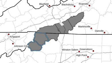
…Dense Fog Expected Along the Higher Terrain of the Blue
Ridge…
Light rain continues to fall across the region in association with
a weak cold front that has drifted just south of the area. The
combination of the persistent light rain and moist easterly flow
along the Blue Ridge has resulted in low clouds intersecting the
higher terrain of the Blue Ridge and thus equating to very dense
fog. Elevations at or above 2500 ft. will be particularly
susceptible to very dense fog with visibility near 0 miles in
these areas. This will include the vast majority of the Blue Ridge
Parkway across northwest North Carolina into southwest Virginia.
This will also include portions of Interstate 77 from the
Virginia/North Carolina line through Fancy Gap and Hillsville.
Many other roads that track across the higher terrain of the Blue
Ridge and surrounding mountains with elevations above 2500 ft.
will be impacted as well such as U.S. 52 and U.S. 58.
If you are planning travel in these areas through early afternoon
today, including most of the Blue Ridge Parkway and portions of
Interstate 77, U.S. 52, U.S. 58, as well as other roads and
highways in these areas, be alert as you climb into and traverse
the higher terrain for areas of very dense fog with visibility
near zero. Reduce speed, use low beam headlights, leave extra
distance between you the vehicle in front of you, and allow extra
time to reach your destination. Keep in mind that deer and other
animals may dart out in front of your vehicle with little advanced
warning and will be nearly impossible to see in such dense fog.
Conditions should begin to slowly improve during the early
afternoon as precipitation decreases and clouds begin to lift a
bit higher.
The latest weather information, including watches, warnings and
advisories, can always be obtained on our web site at
www.weather.gov/rnk.
WMOHEADER
UGC
NCZ001-002-018-VAZ015>017-032
VTEC
TIME…MOT…LOC
Alleghany; Ashe; WataugaFIPS6
037005
FIPS6
037009
FIPS6
037189
UGC
NCZ001
UGC
NCZ002
UGC
NCZ018


