Last Updated on March 27, 2025 6:15 pm
The National Weather Service Greenville-Spartanburg office has released a wind damage assessment from Helene. Their full statement is below:
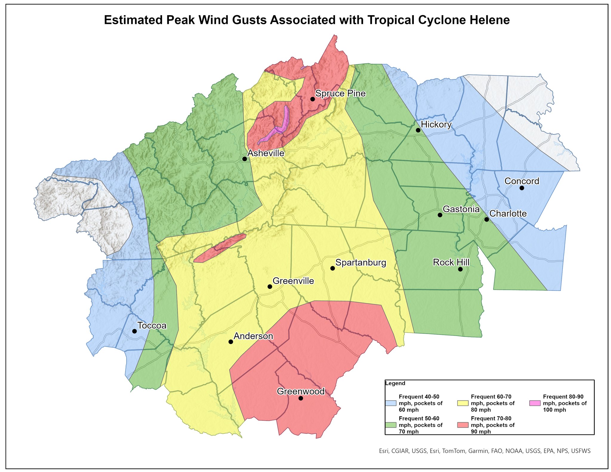
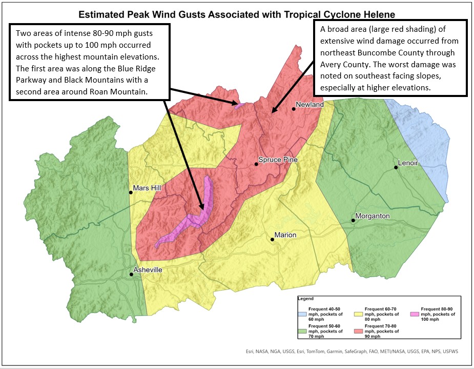
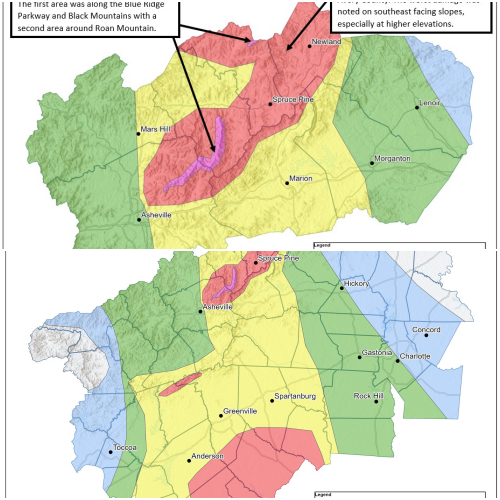
We've completed our wind damage assessment of Helene and the resulting wind analysis can be viewed on the maps below. We want to thank everyone for your patience as this was an extensive process that involved piecing together hundreds of crowd sourced damage pictures/videos, drone and aerial imagery, and high resolution satellite imagery.
Extensive damage to trees and power infrastructure occurred across much of the area with structural damage (not from falling trees) noted in some of the hardest hit locations. Each color shading on the map represents the frequents gusts along with the estimated peak winds within concentrated pockets of greater damage. Across the mountains, there was a very sharp increase in winds on the northeast side of Asheville, especially with higher elevation. Southeast facing slopes across much of the mountains form northeast of Asheville to Avery County sustained the most extreme damage. The highest measured wind gust was 106mph on Mt. Mitchell. A second pocket of extreme wind also occurred in the vicinity of Roan Mountain, mainly above 6,000 ft.
Several factors to keep in mind that were taken into consideration with the analysis is that these wind gusts were persistent for multiple hours, compared to a thunderstorm where the most intense winds last for only a few minutes. A longer duration of high-end wind gusts combined with very saturated soils and full foliage on trees resulted in an incredible amount of trees downed. In many cases, trees were rocked back and forth by frequent gusts until the soaked soils could no longer support them, leading to the eventual falling of the tree. The winds also changed direction as the center of circulation passed by to the west, thus resulting in trees falling across each other and not necessarily in one direction.
