Last Updated on May 13, 2025 10:12 am
NCC005-009-189-131800-
/O.NEW.KRNK.FA.W.0020.250513T1119Z-250513T1800Z/
/00000.0.ER.000000T0000Z.000000T0000Z.000000T0000Z.OO/
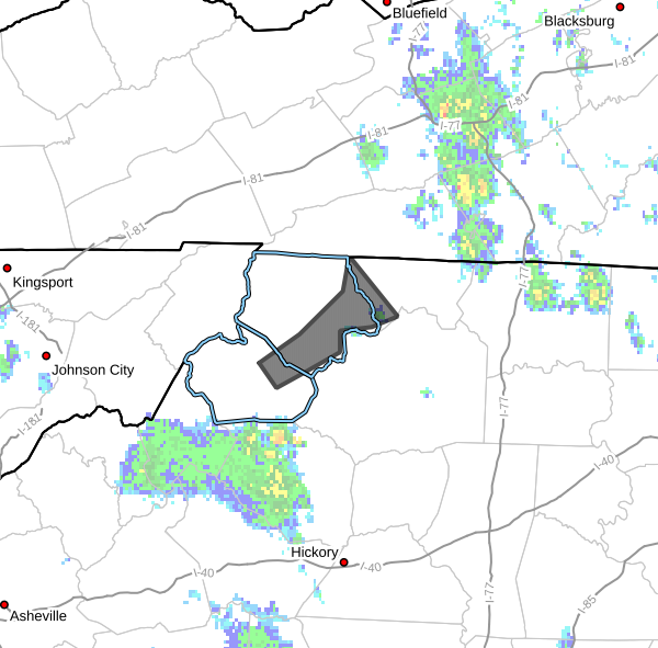
Alleghany NC NC-Ashe NC-Watauga NC-
719 AM EDT Tue May 13 2025
…FLOOD WARNING IN EFFECT UNTIL 2 PM EDT THIS AFTERNOON…
- WHAT…Flooding caused by excessive rainfall is expected.
- WHERE…A portion of northwest North Carolina, including the
following counties, Alleghany NC, Ashe and Watauga. - WHEN…Until 200 PM EDT Tuesday.
- IMPACTS…Flooding of rivers, creeks, streams, and other low-lying
and flood-prone locations is imminent or occurring. Streams
continue to rise due to excess runoff from earlier rainfall. - ADDITIONAL DETAILS…
- At 714 AM EDT, Doppler radar and automated rain gauges
indicated heavy rain. Flooding is ongoing or expected to
begin shortly in the warned area. Between 2 and 4 inches of
rain have fallen. - Some locations that will experience flooding include…
Jefferson, West Jefferson, Glendale Springs, Laurel Springs,
Todd, Othello and Wagoner. - On the South Fork of the New River at Brownwood, the stage
was 12.2 feet and slowly rising. At Jefferson the stage was
7.3 feet and was cresting. The river will crest and begin
falling by late morning. - http://www.weather.gov/safety/flood
PRECAUTIONARY/PREPAREDNESS ACTIONS…
Turn around, don't drown when encountering flooded roads. Most flood
deaths occur in vehicles.
When it is safe to do so, please send your reports of flooding,
including mudslides or flooded roads, to the National Weather
Service by calling toll free at 1…8 6 6…2 1 5…4 3 2 4. Reports
and pictures can also be shared on the National Weather Service
Blacksburg Facebook page and on Twitter.