Last Updated on January 5, 2026 5:33 pm
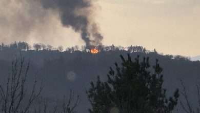
The National Interagency Fire Center is forecasting above normal wildfire potential for the southern Appalachians and Carolinas through April 2026, citing ongoing drought conditions, below-normal precipitation, and debris from Hurricane Helene as contributing factors.
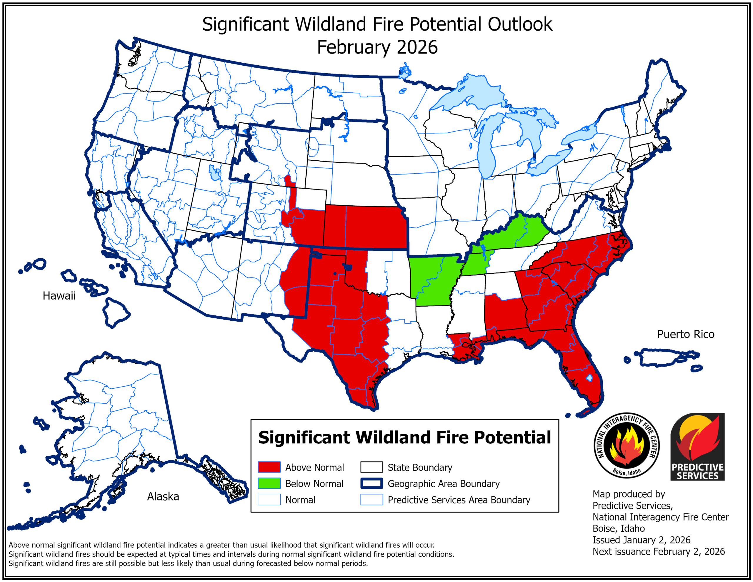
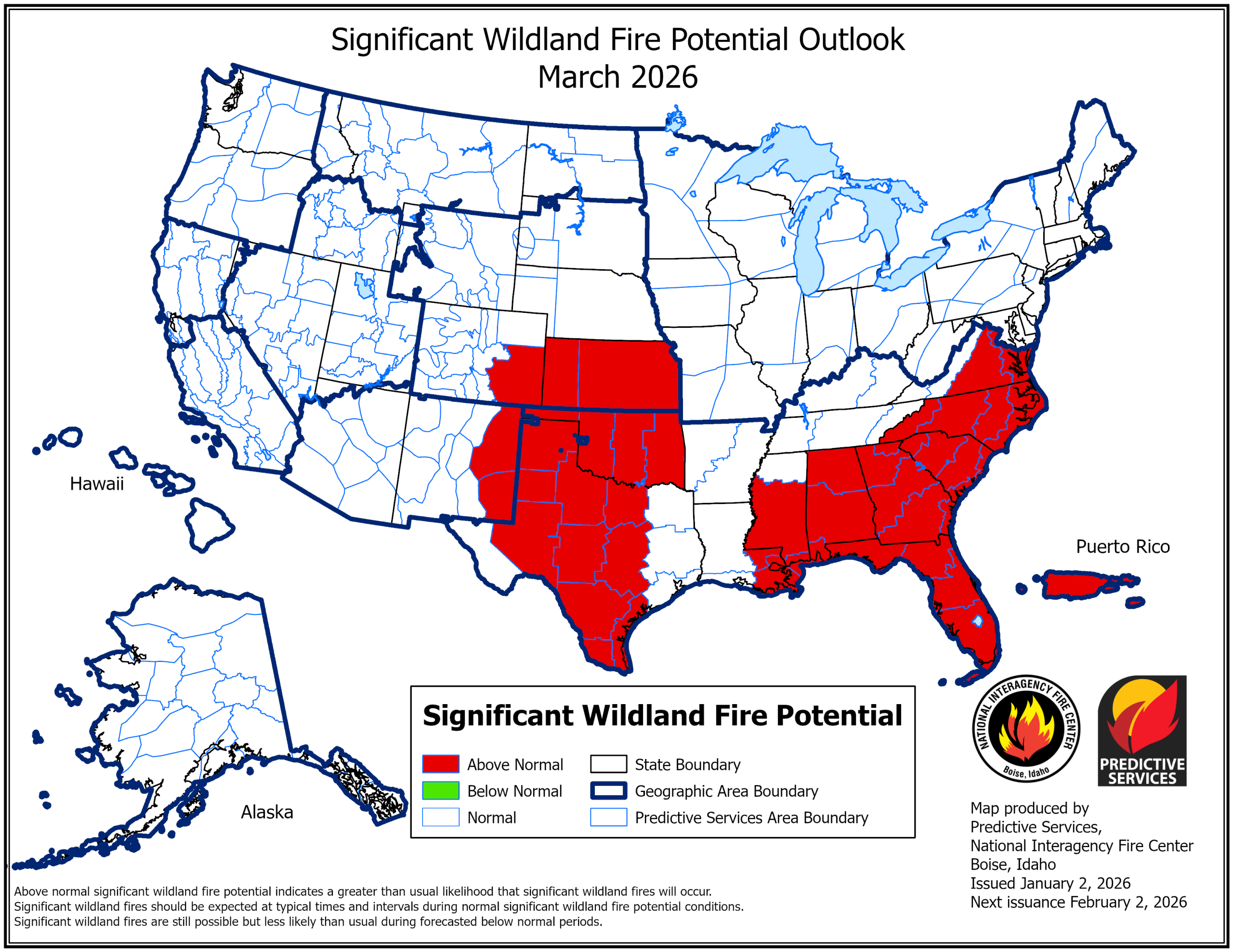
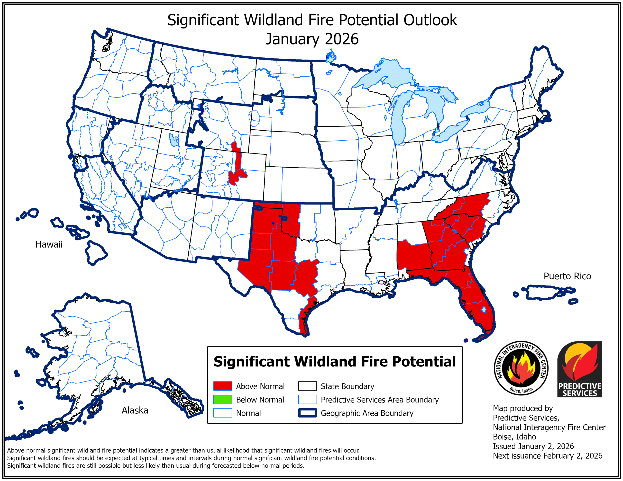
The agency's January outlook, issued January 2, covers January through April and paints a concerning picture for the Southeast region that includes North Carolina's High Country.
Drought Conditions Persist
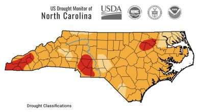
December precipitation was below normal across the Appalachians and Mid-Atlantic, according to the report. Drought developed and intensified from the Mid-Mississippi Valley to the southern Appalachians during the month.
Large areas from the Mississippi Valley into the Southeast are experiencing rainfall deficits of 5 to 15 inches since summer. Deep layer soil moisture is below the 10th percentile in many areas, meaning soils are drier than 90 percent of historical readings.
Nearly 43 percent of the country remains in drought as of late December.
Helene Debris Adds to Risk
The federal outlook specifically identifies debris from Hurricane Helene as a factor increasing fire risk in the region.
“Further-cured debris from Helene is likely to contribute to above normal significant fire potential from northern Florida to the southern Appalachians until green-up sets in and soil moisture is replenished,” the report states.
Fuel loads from 2023's drought, beetle infestations, and storm damage are also expected to enhance wildfire risk throughout the region.
Month-by-Month Outlook
The forecast calls for elevated fire potential across the Southeast throughout the outlook period:
January: Above normal fire potential across much of the Southeast, including Florida, based on December's dryness and expectations for dry cold fronts.
February: Above normal potential expands to cover the northern Gulf Coast into the Carolinas. The period from mid-February into March could be especially active.
March: The most expansive coverage of above normal potential, extending east of the Mississippi River to the Carolinas and Virginia.
April: Most of the country returns to normal fire potential, but above normal conditions are expected to persist along the Southeast coast.
La Niña Driving the Pattern
A weak La Niña weather pattern is driving the warmer and drier conditions across the southern United States. The Climate Prediction Center forecasts this pattern to persist into early spring before transitioning to neutral conditions, likely by March.
Under La Niña, temperatures are expected to remain above normal across the southern third of the country through winter, then spread up the East Coast during early spring. Precipitation is expected to trend below normal for the southern tier of the United States.
What This Means Locally
Residents should remain vigilant about fire safety through the spring months. Outdoor burning should only be conducted when conditions are safe and in compliance with local burn permits.
The National Preparedness Level remained at one, the lowest level on a scale of 1-5, at the end of December due to low fire activity nationally. However, conditions can change rapidly, particularly during dry and windy periods.
For current fire weather conditions and burn permit information, residents can contact their local fire department or the North Carolina Forest Service.
The full National Significant Wildland Fire Potential Outlook is available at nifc.gov.