


Last Updated on February 13, 2022 8:45 am
UPDATE Thursday, November 22 9:07 pm
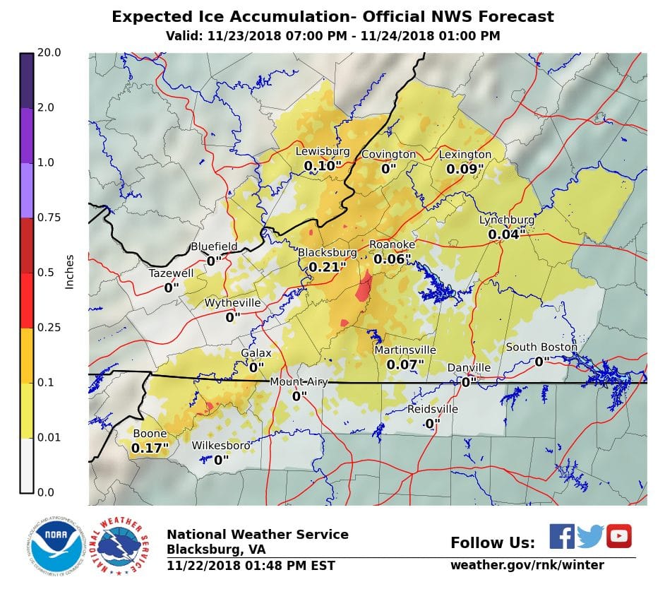
Expected Ice Accumulation from 7 pm Friday to 1 pm Saturday
UPDATE Thursday, November 22 2:58 pm – The National Weather Service (NWS) continues to warn of the possibility of icy conditions on Friday night into Saturday.
In a Thursday afternoon statement NWS says, “An accumulation of sleet and freezing rain may create hazardous travel conditions Friday night into Saturday. Strong, gusty winds are expected, especially at the higher elevations, Sunday night into Monday.”
Wednesday November 21, 2018 9:20am – As the Thanksgiving travel days are upon us, High Country motorists should be aware of possible winter impacts, and changing conditions, this weekend.
The National Weather Service (NWS) says, there is a minor threat for light wintry precipitation Friday night into early Saturday, which most likely will be in the form of sleet and/or freezing rain, possibly snow at the very highest elevations.
In a Wednesday update NWS goes on to add, “any wintry precipitation is likely to change over to rain during the day Saturday. There is a good deal of uncertainty in terms of how much impact any of the wintry precipitation would have, and the timing of how soon it would change over to all rain. If the winter weather threat materializes, it may result in travel disruptions Friday night and Saturday morning.
NWS also adds, “In addition, strong gusty northwest winds are expected behind another cold front Sunday night and Monday. A Wind Advisory will likely be needed during that time frame.”


