Last Updated on February 12, 2023 8:45 am
Sunday, February 12 Updates
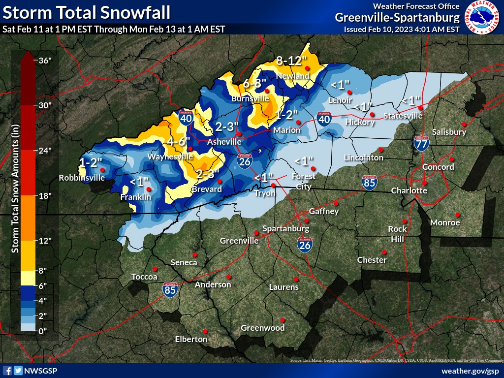
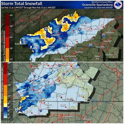
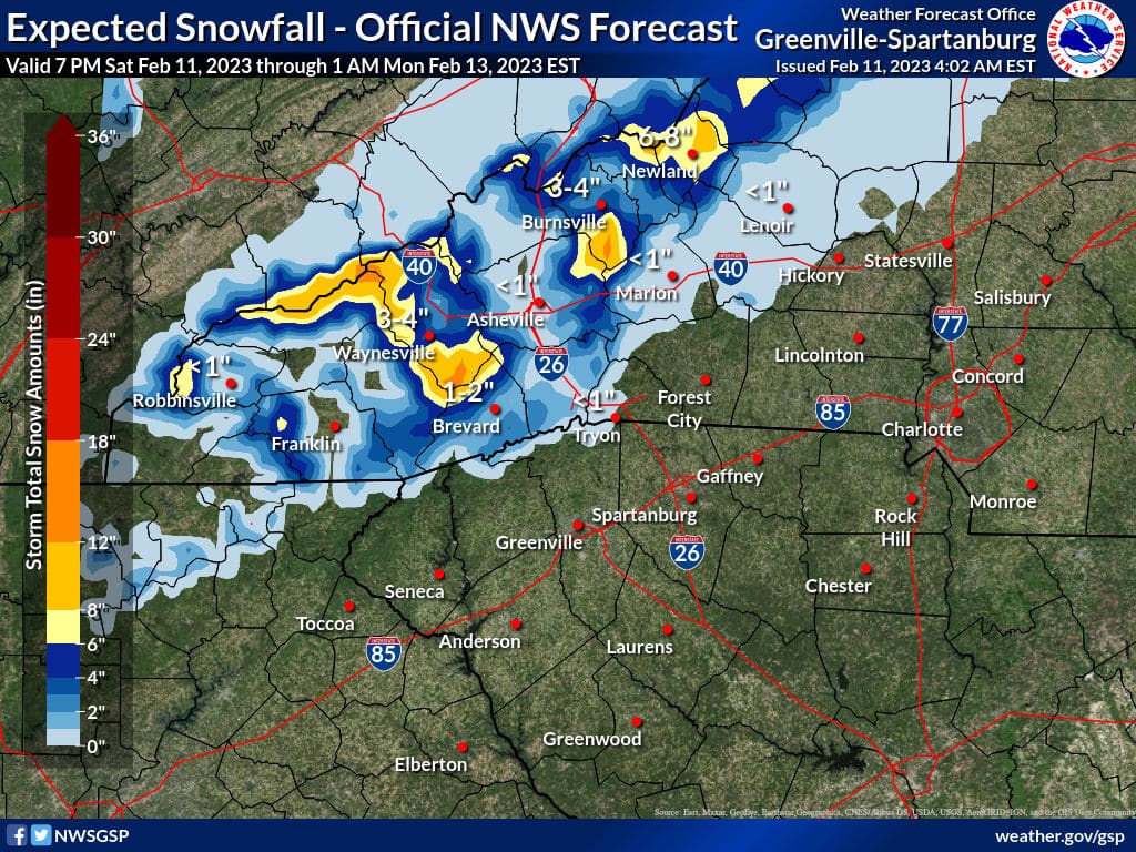
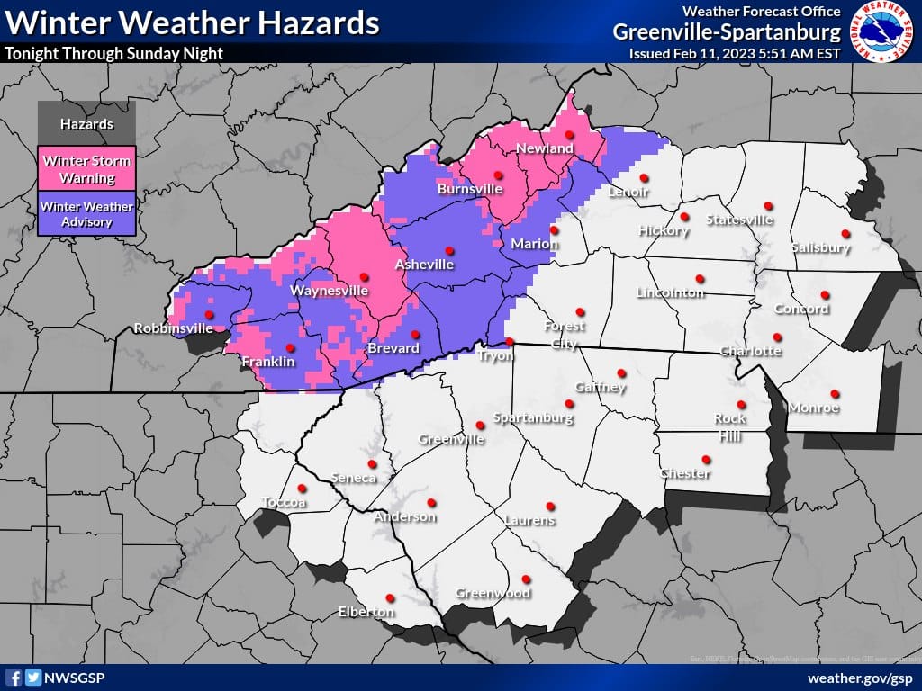
Weather graphics courtesy of National Weather Service offices in Blacksburg and Greenville/Spartanburg
Saturday, February 11 Updates
Zionville Fire Department ready to respond to winter weather this weekend. Click here for more information.
Update – Video from Brad Panovich during the 10 am hour on Saturday.
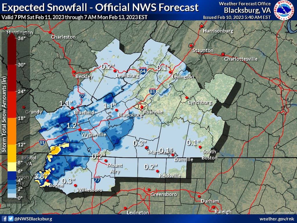
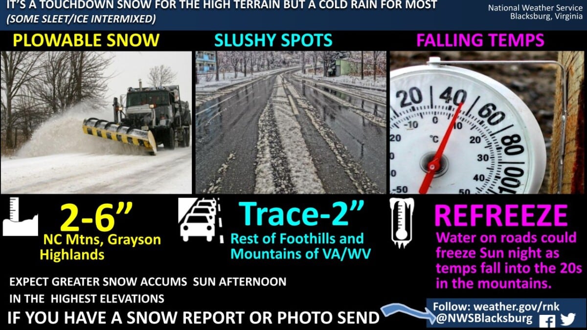
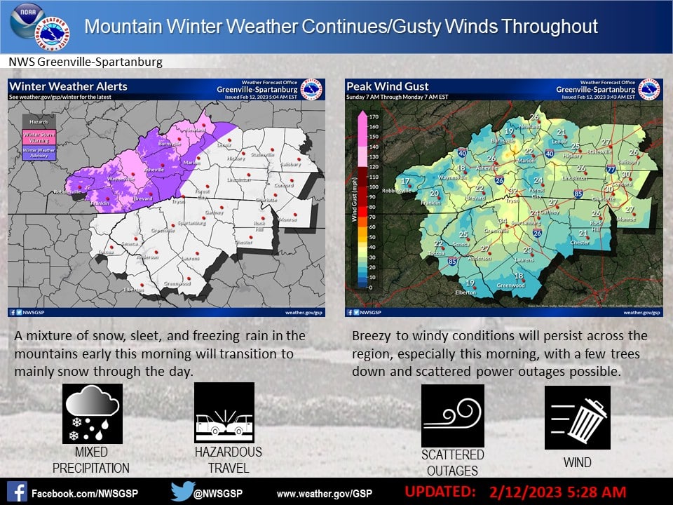
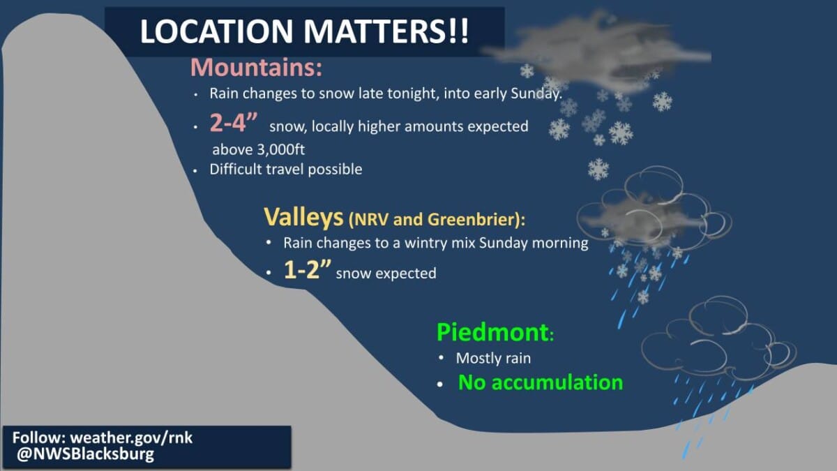
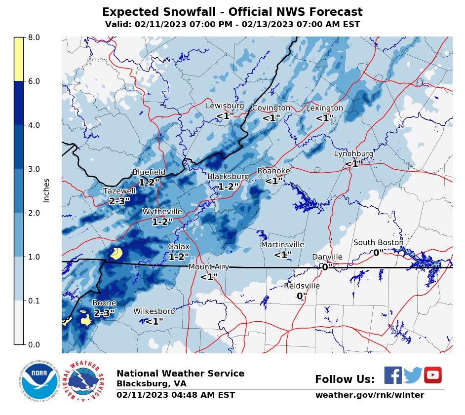
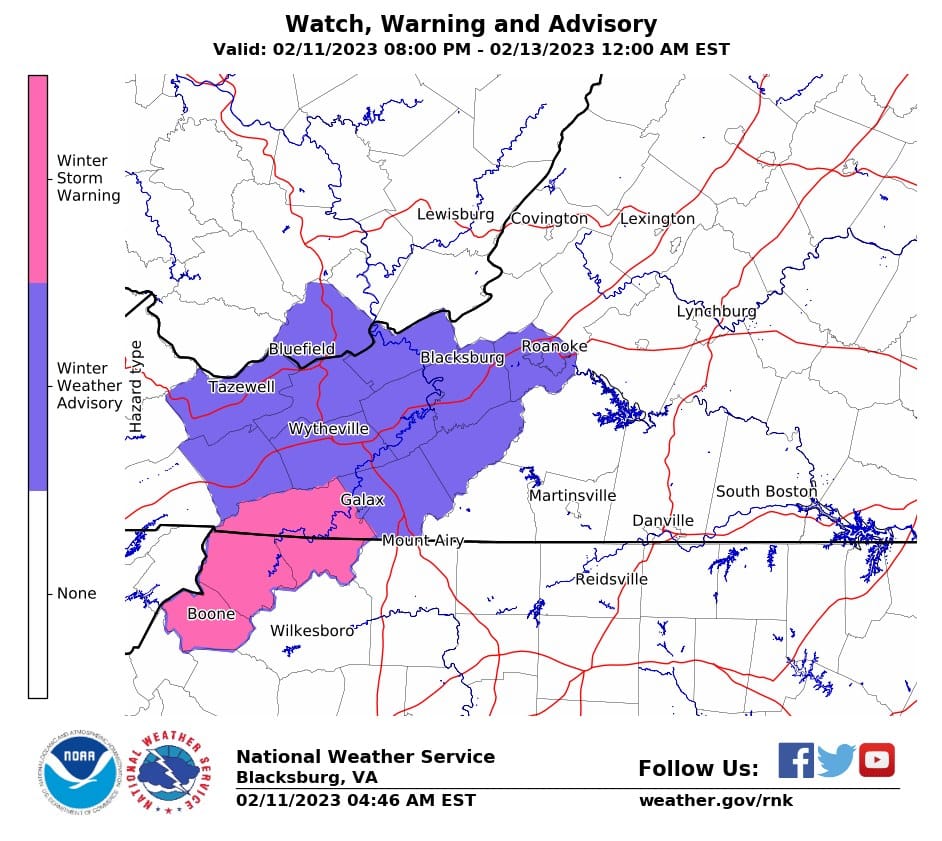
Weather graphics courtesy of National Weather Service offices in Blacksburg and Greenville/Spartanburg
With the forecasted winter storm this weekend, the Town of Boone Public Works Department would like to take a moment to remind residents of our downtown snow removal procedures. Learn more at this link.
Update Saturday, February 11, 4:50 am – Winter Storm Warning for Watauga County, NC, Ashe County, NC. Click here for more information.
Update Saturday, February 11, 4:49 am – Winter Storm Warning for Avery County, NC – February 11-12, 2023. Click here for more information.
Update – Governor Roy Cooper and state emergency leaders remind people to pay close attention to their local forecast ahead of potential winter weather this weekend. Click here for more information.
Update 2:37 pm Friday – a Winter Storm Watch has been issued for Avery & Caldwell. Click here for more information.
Update 2:31 pm Friday – a Winter Storm Watch has been issued for Watauga & Ashe. Click here for more information.
Blue Ridge Energy is prepared for any possible winter impacts. Click here for more information.
Update – Video from Brad Panovich during the 10 am hour on Friday.
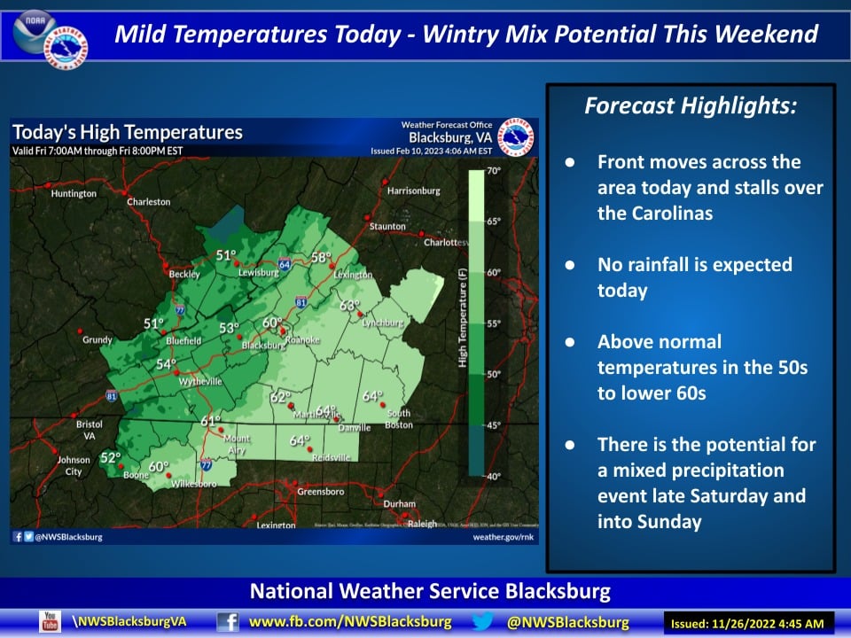
Snow lovers will have their eyes to the skies this weekend and more exactly for Super Bowl Sunday as moderate to heavy snow is possible.
Rain and snow are currently forecast to begin Saturday evening and continue through Sunday night. Accumulations will depend on how much cold air arrives when the upper low arrives. Some of the higher elevations have the potential to receive up to a foot of snow.
In a Friday morning weather update the National Weather Service Blacksburg office, which forecast area includes Watauga and Ashe, stated “Will also have mixed winter precipitation, with some light freezing rain and sleet adding to the travel impact but lessening the potential snow totals. Snow to liquid ratios are forecast to be 3-4:1…meaning a very wet snow. So impact from evergreens possible where there is enough snow.”
The National Weather Service Greenville-Spartanburg office, which forecast area includes Avery County, noted on Friday morning that there is still some uncertainty in the forecast, so after collaboration with neighboring forecast offices they will hold off issuing any watches or warning for now but that could change as we get closer to the event.
Gusting winds could also be a part of the weather story for the entire weekend.
WataugaOnline.com will continue with updates all weekend as this complex weather system changes ahead of its arrival.
Graphics: National Weather Service