Last Updated on March 26, 2022 2:55 pm
WataugaOnline.com updates on the possible impacts from Hurricane Irma to western North Carolina.
Wednesday September 13
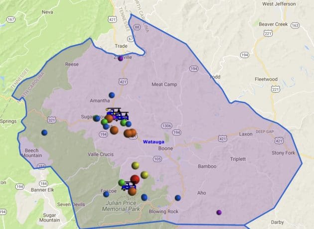
Local fire department members, law enforcement and EMS units stayed quite busy due to the storm. Taylor Marsh, Watauga County Emergency Management Director, tells WataugaOnline.com that at one point he was estimating around 30 fallen trees were keeping various departments busy throughout Monday night. The hardest hit areas appeared to be the Foscoe/Zionville/Cove Creek area.
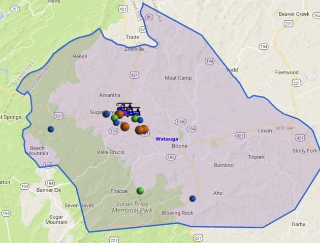
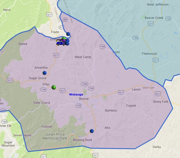
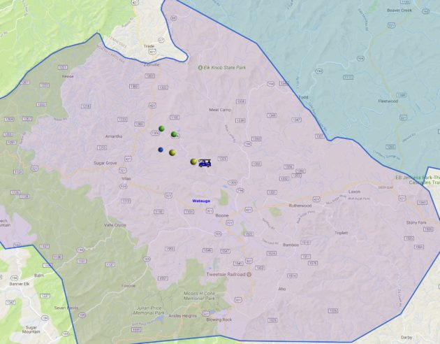
According to data provided by Watauga County Communications to WataugaOnline.com, here is a list of calls that were received by the communications center and associated with the storm. The 911 Center answered a total of 379 emergency and non emergency telephone calls during the storm, 83 of those were 911 calls.
Citizen Assist 35
DOT 3
Alarms (due to wind) 26
Electrical Hazards 5
Rescue Squad Stand By 5
Vehicle Accidents 10
Broken Down/Stranded Vehicles 4
Direct Traffic 5
Clean up continues on the Blue Ridge Parkway due to the storm. For updated details visit this article.
Power was fully restored on Tuesday night to Blue Ridge Energy members that had lost power. For more details visit this article.
Tuesday Sept 12
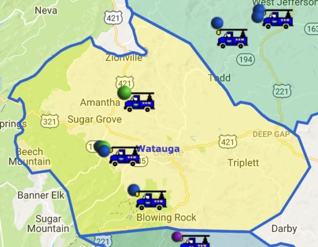
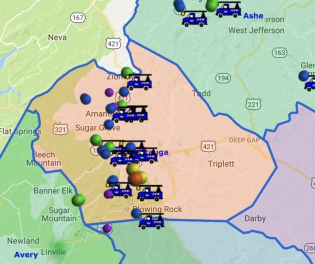
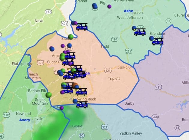
Power outages: 54 in Watauga at 5:44 pm
N.C. Forest Service offers guidance for assessing tree damage after Irma. For more information visit this article.
Power outages: 83 in Watauga at 4:11 pm
Power outages: 168 in Watauga at 11:40am
Power outages: 757 in Watauga at 11:03am
Power outages: 296 in Watauga at 10:16am
The Parkway remains closed from MP 165 through MP 469 as crews assess damage and remove debris.
9am – Wind Advisory has ended, but continued gusts up to 35mph are forecast for rest of today.
Power outages: 335 in Watauga at 8:37am
5:40am -If you have to be out this early morning use caution. Getting several reports of debris on the roads.
Power outages: 1113 in Watauga at 5:30am
Watauga County Schools are on a 2 hour delay for Tuesday Sept 12.
Monday Sept 11
9:45pm – WataugaOnline.com is concluding the coverage of the impacts of Irma for the night. Updates will continue Tuesday morning.
8:55pm – Tree down on 105 near Shulls Mill Road.
8:44pm – Tree blocking Deerfield Road just past Bamboo Road (airport end). Boone Fire en-route.
8:40pm – Tree down blocking US 321 between Bethel Road and McGuire Road. Beaver Dam VFD on-scene.
8:25pm – Power outages in Watauga has jumped to 1730
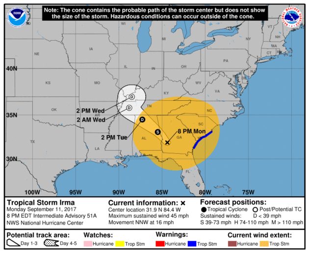
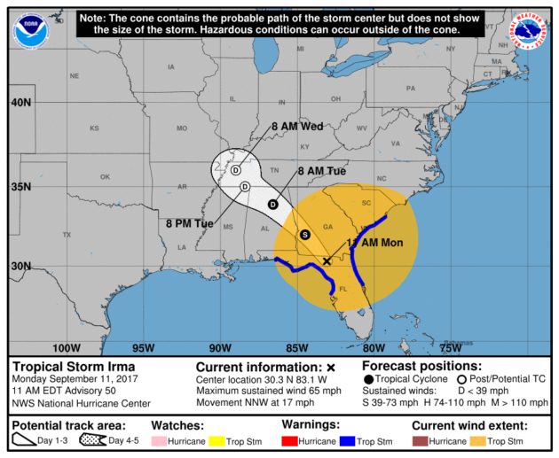
Irma is still a tropical storm as of 8 pm. MAXIMUM SUSTAINED WINDS…45 MPH…75 KM/H
PRESENT MOVEMENT…NNW OR 330 DEGREES AT 16 MPH…26 KM/H
MINIMUM CENTRAL PRESSURE…986 MB…29.12 INCHES .
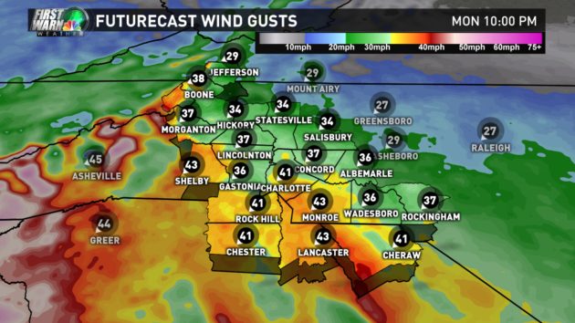
Locally, Wind Advisory in effect until 9am Tuesday. Winds 15 to 25 mph with gusts up to 50 mph.
7:33pm – Power outages in Watauga has jumped to 796 mainly due to a line down in Vilas.
6:28pm – Power outages down to 71 in Watauga.
6:22pm – A tree and possibly power line down on a house on Adam's Cemetery Road per scanner dispatches.
5:25pm – Both lanes of Silverstone Road were closed for a time due to a down tree. The road is back open.
Blue Ridge Energy: Prepared For Monday Evening/Tuesday Morning Severe Weather. For more information visit this link.
3:27pm -Power Outages: 225 in Watauga
1:10 pm – Heavy rain possible starting later this evening, according to the National Weather Service.Wind Advisory in effect until 9am Tuesday. Winds 15 to 25 mph with gusts up to 50 mph.
Blue Ridge Parkway closing in North Carolina. See this link for more information.
Irma is still a tropical storm as of 11am. Locally, Wind Advisory in effect from noon until 9am Tuesday. Winds 15 to 25 mph with gusts up to 50 mph.
Irma is now a tropical storm as of 8am. Locally, Wind Advisory in effect from noon until 9am Tuesday. Winds 15 to 25 mph with gusts up to 50 mph.
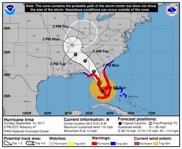
Irma 5pm update Sunday Sept 10 – Irma is a Category 2 storm, with maximum sustained winds of 110 mph and moving north at 14 mph.
…WIND ADVISORY IN EFFECT FROM NOON MONDAY TO 9 AM EDT TUESDAY…
The National Weather Service in Blacksburg has issued a Wind
Advisory, which is in effect from noon Monday to 9 AM EDT
Tuesday.
* Locations…Mainly across the North Carolina mountains including Grayson and Carroll counties along the Blue Ridge in Virginia.
* Hazards…Strong easterly winds which could combine with wet soils to bring down trees and power lines.
* Winds…East winds 20 to 30 mph with gusts up to 50 or 55 mph. Locally stronger winds possible across the highest elevations.
* Timing…Monday afternoon through early Tuesday with the strongest winds Monday night.
* Impacts…Trees and power lines could be toppled.
PRECAUTIONARY/PREPAREDNESS ACTIONS…
A Wind Advisory is issued when sustained winds are forecast to be 31 to 39 MPH or gusts will range between 46 and 57 MPH.
Winds of these magnitudes may cause minor property damage without extra precautions. Motorists in high profile vehicles should use extra caution until the winds subside.
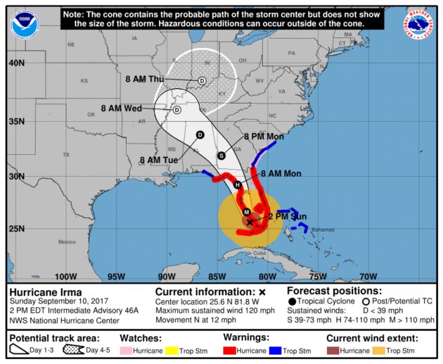
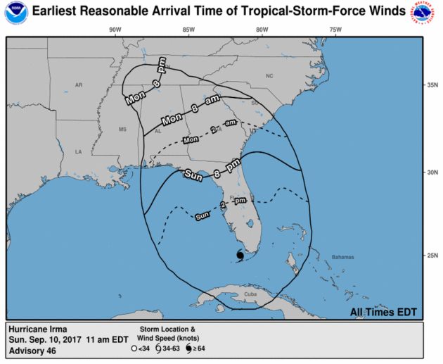
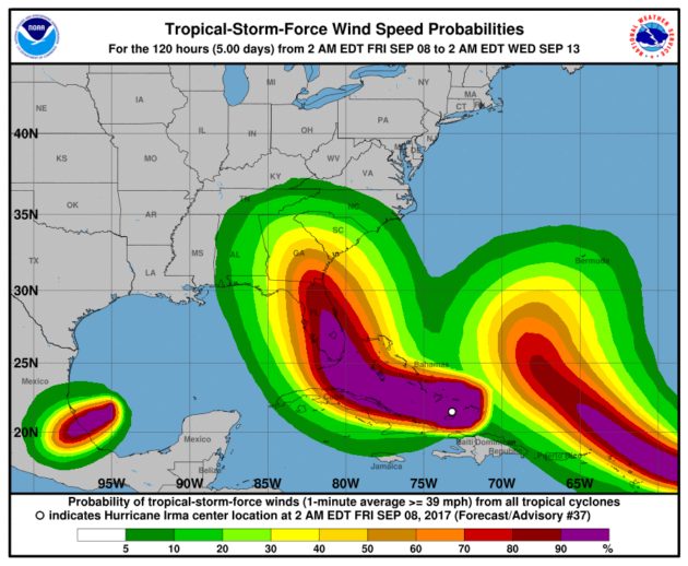
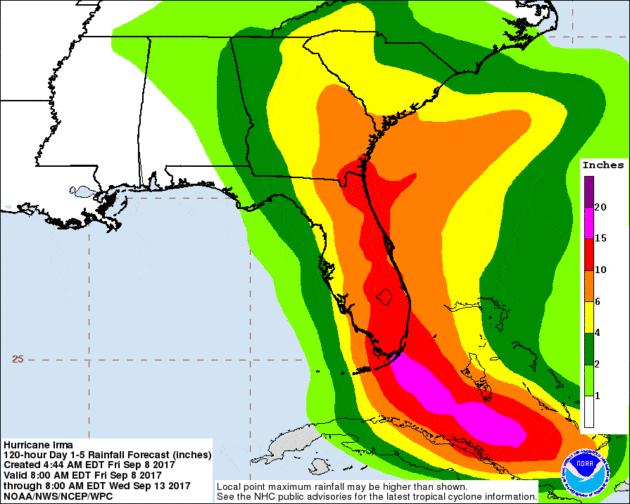
Irma 2pm update Sunday Sept 10 – Irma is a Category 3 storm, with maximum sustained winds of 120 mph and moving north at 12 mph. Below are the latest forecast track possibilities.
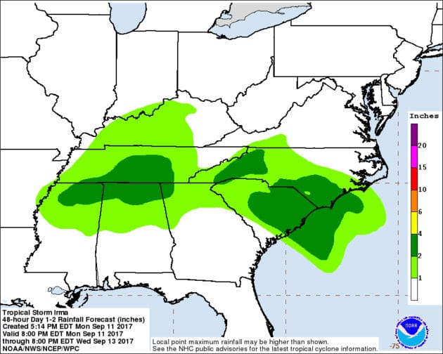
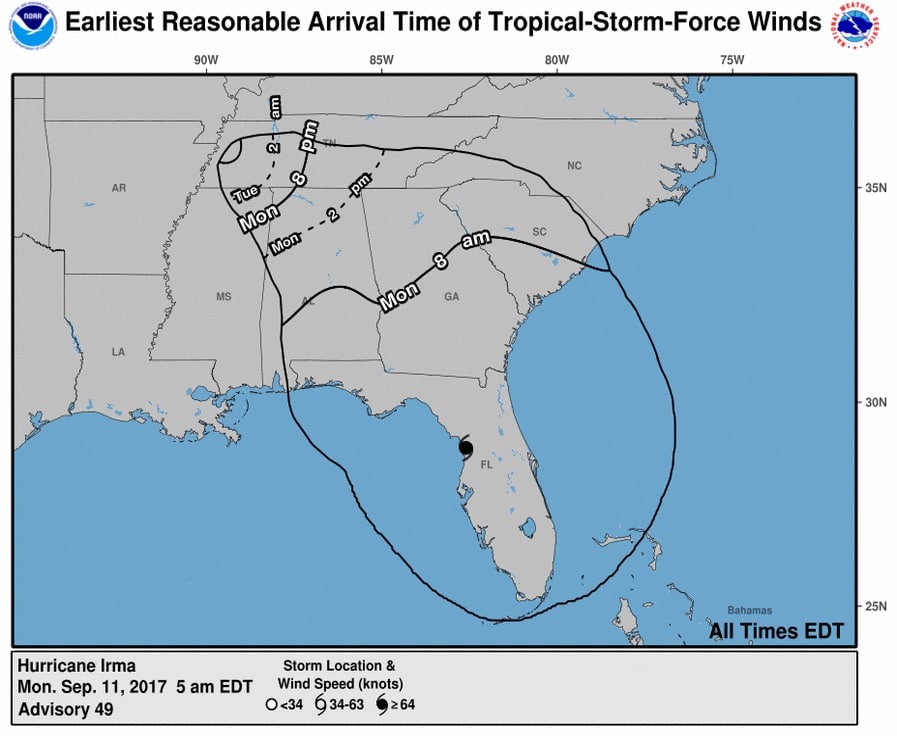
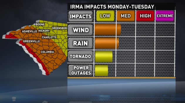
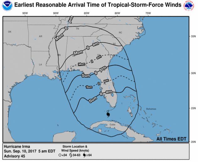
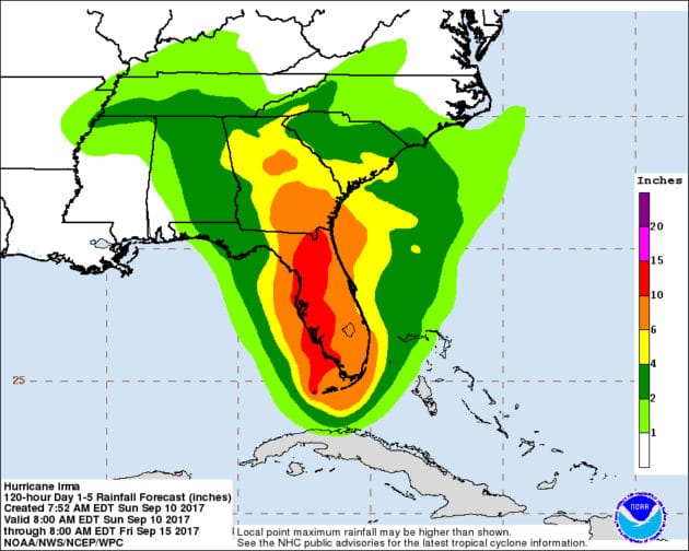
From the National Weather Service on Sunday morning: Based on the forecast track of Irma, strong easterly winds may occur late Monday into early Tuesday, with the higher gusts across the ridges. Heavy rain is also possible and localized flooding could occur, especially along and near the Blue Ridge.
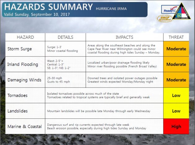
From North Carolina Emergency Management
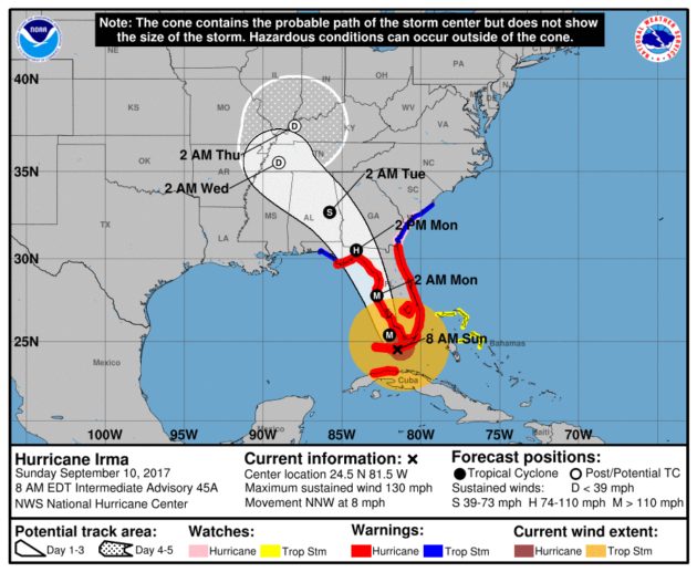
Irma 8am update Sunday Sept 10 – Irma is a Category 4 storm, with maximum sustained winds of 130mph and moving north-northwest at 8 mph. Below are the latest forecast track possibilities.
A Saturday evening note about Irma: Starting to get more social media comments and emails asking why locally we should still be watching the storm, when “the cone” has moved so far west over the last few days. Keep in mind that the tropical winds extend out as far as 300 miles, maybe more, from the eye. We will see impacts from Irma, which at this time appears to be possible wind damage and still a chance of possible localized flooding, according to US National Weather Service Blacksburg VA and Brad Panovich of NBC Charlotte. We are also going to have to see how much energy the storm loses over Florida, Georgia and South Carolina before moving into or farther away from North Carolina. Continued updates will be posted until there are no local threats from Irma.
5pm video update from NBC Charlotte Chief Meteorologist Brad Panovich.
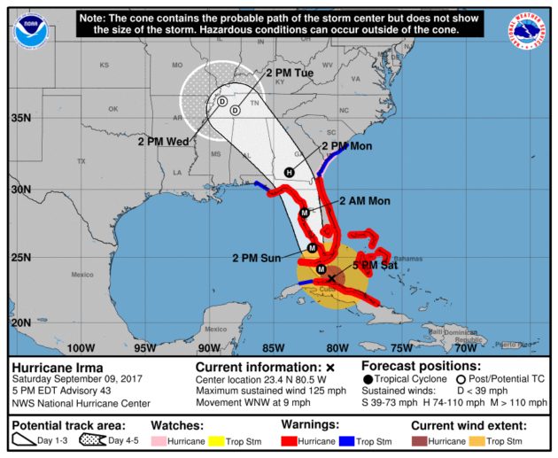
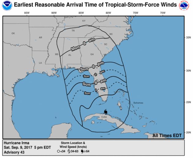
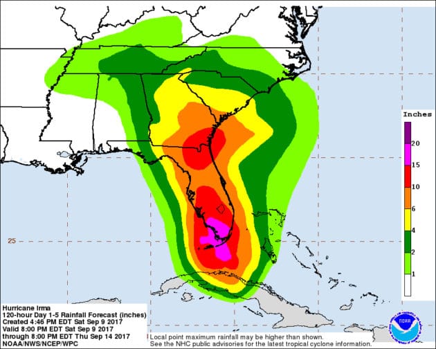
Irma 5pm update Saturday Sept 9 – Irma is a Category 3 storm, with maximum sustained winds of 125mph and moving west-northwest at 9 mph. Below are the latest forecast track possibilities.
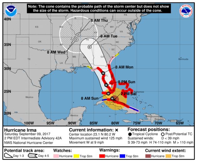
Irma 2pm update Saturday Sept 9 – Irma is a Category 3 storm, with maximum sustained winds of 125mph and moving west at 9 mph. Below are the latest forecast track possibilities.
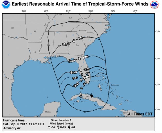
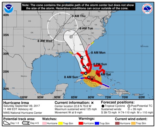
Irma 11am update Saturday Sept 9 – Irma is a Category 3 storm, with maximum sustained winds of 125mph and moving west at 9 mph. Below are the latest forecast track possibilities.
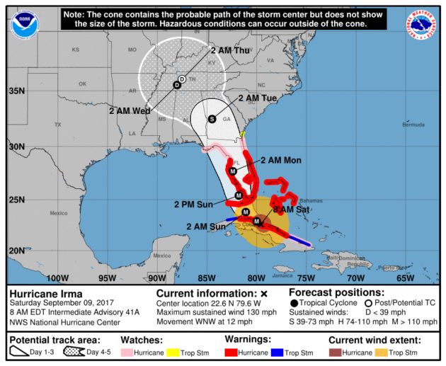
Irma 8am update Saturday Sept 9 – Irma is a Category 4 storm, with maximum sustained winds of 130mph and moving west-northwest at 12 mph. Below are the latest forecast track possibilities.
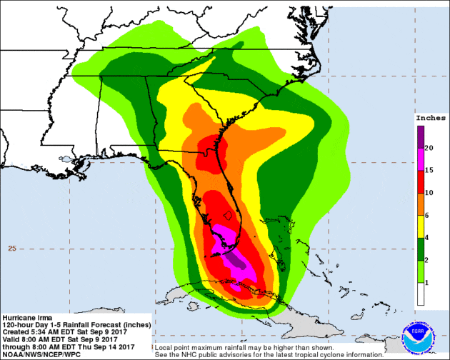
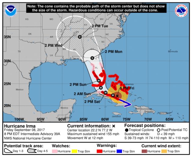
Irma 8pm update Friday Sept 8 – Irma is a Category 4 storm, with maximum sustained winds of 155mph and moving west at 12 mph. Below are the latest forecast track possibilities.
As we await the possible impacts from Irma there's been a few questions come in to the WataugaRoads.com & WataugaOnline.com Facebook page and Twitter feed about previous wind gust speeds in the area. Here's a resource put out last year and updated this evening. https://wataugaonline.com/boone-wind-gust-history/
September 8, 2017 – The Southern Region of the USDA Forest Service is immediately waiving fees and making all campgrounds available for individuals displaced by the recent and forthcoming hurricanes, including Hurricane Irma. For more information visit this link.
Blue Ridge Energy is monitoring the evolving path of Irma and prepared to respond if outages result:
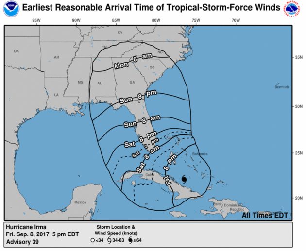
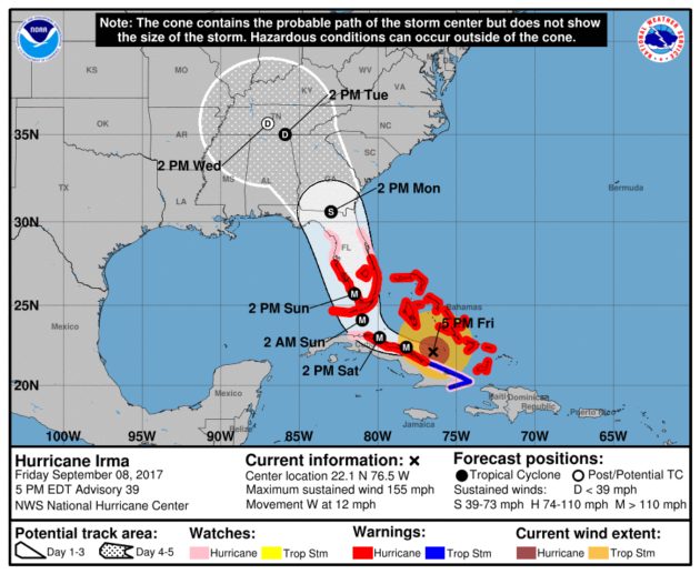
Irma 5pm update Friday Sept 8 – Irma is a Category 4 storm, with maximum sustained winds of 155mph and moving west at 12 mph. Below are the latest forecast track possibilities.
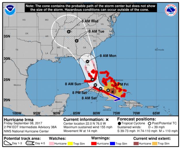
Irma 2pm update Friday Sept 8 – Irma is a Category 4 storm, with maximum sustained winds of 155mph and moving west-northwest at 14 mph. Below are the latest forecast track possibilities.
Watauga County School system taking proactive approach to Irma. For more information visit this article.
North Carolina Governor Roy Cooper held a briefing at noon to update the state's response to possible impacts from Irma. The Governor said repositioning resources will take place as the threat appears to be moving toward the western part of the state. He also noted that rip currents at the coast could be an issue.
North Carolina Emergency Management Director Mike Sprayberry said that local EM directors are working hard to prepare. The state EOC remains activated and repositioning of resources is taking place. Sprayberry also said that staging areas will be set up in Greensboro & Asheville in concert with partners prepared for sheltering/feeding.
With shifting resources to the west officials are most concerned about mudslides/rockslides in the mountain areas.
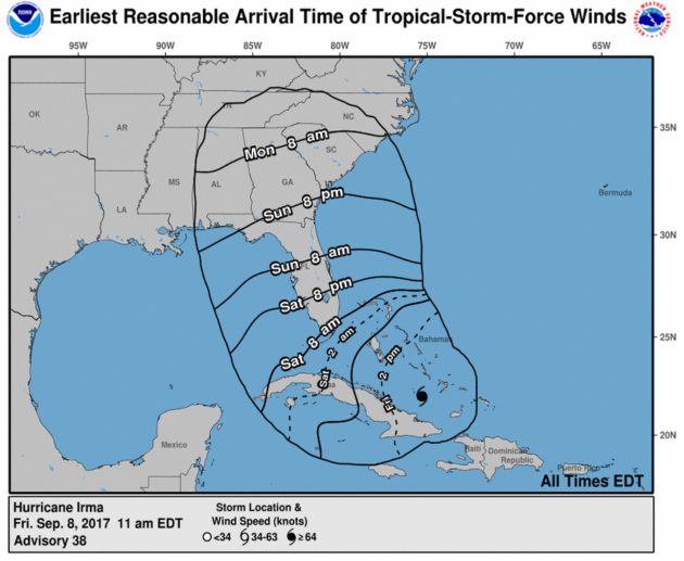
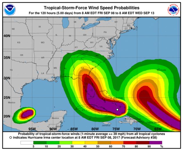
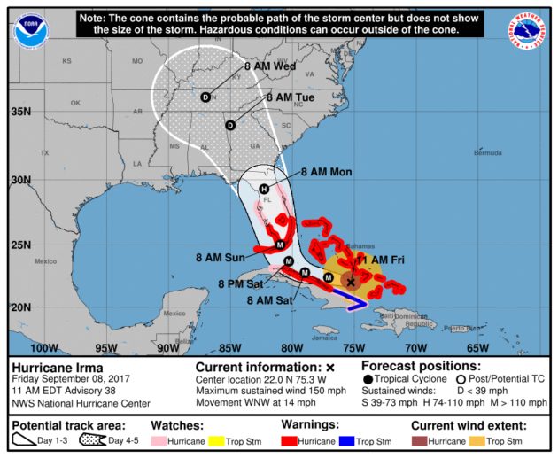
Irma 11am update Friday Sept 8 – Irma is a Category 4 storm, with maximum sustained winds of 150mph and moving west-northwest at 14 mph. as of early Friday morning. Below are the latest forecast track possibilities. It's too soon to know right now what the impacts will be locally, due to Irma moving farther west, losing strength and possible speed across FL, Ga & SC.
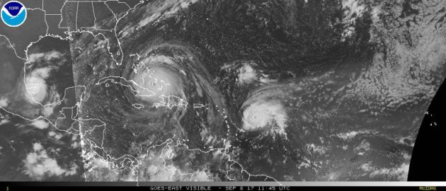
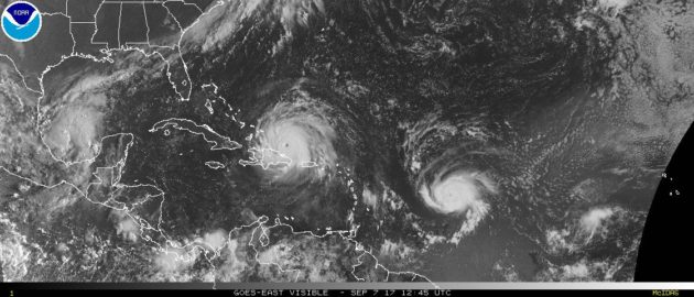
Here's a look at Irma & Jose & Katia together on Friday morning.
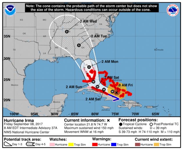
Irma 8am update Friday Sept 8 – The storm has been downgraded to a Category 4 as of early Friday morning. Below are the latest forecast track possibilities. Maximum sustained winds are 155mph and the storm is moving west-northwest near 16 mph. It's too soon to know right now what the impacts will be locally, due to Irma losing strength and possible speed across FL, Ga & SC.
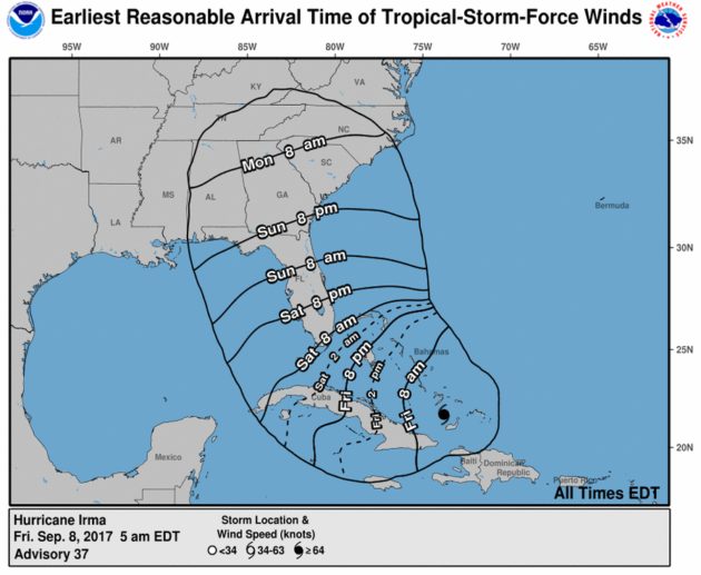
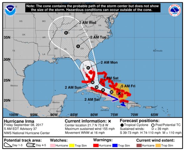
Irma 5am update Friday Sept 8 – The storm has been downgraded to a Category 4. Below are the latest forecast track possibilities. Maximum sustained winds are 155mph and the storm is moving west/northwest at 16mph. It's too soon to know right now what the impacts will be locally. Will have to see how much power it loses across FL, Ga & SC.
Thursday September 7 9:26pm – A big box chain of stores locally is running out of bottled water, according to reports coming into WataugaOnline.com tonight. These photo provided by shoppers in Boone and West Jefferson.
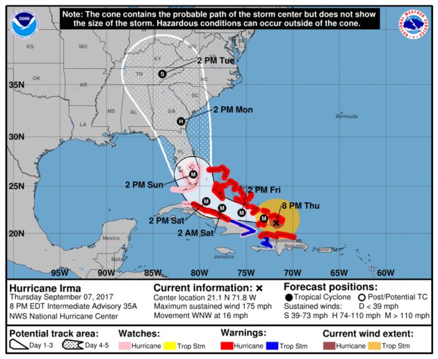
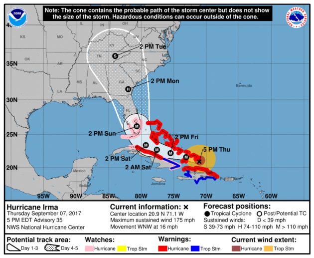
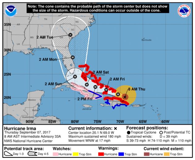
Irma 8pm update Sept 7 – The storm is still a Cat 5. Below are the latest forecast track possibilities. Maximum sustained winds are 175mph and the storm is moving at 16mph. The impact to the High Country is not known at this time, as it will depend on how much power Irma loses as it moves across Florida, Georgia, South Carolina and into western North Carolina.
BULLETIN
Hurricane Irma Intermediate Advisory Number 35A
NWS National Hurricane Center Miami FL       AL112017
800 PM EDT Thu Sep 07 2017

...IRMA PUMMELING THE TURKS AND CAICOS ISLANDS...


SUMMARY OF 800 PM EDT...0000 UTC...INFORMATION
----------------------------------------------
LOCATION...21.1N 71.8W
ABOUT 55 MI...85 KM WSW OF GRAND TURK ISLAND
ABOUT 90 MI...145 KM E OF GREAT INAGUA ISLAND
MAXIMUM SUSTAINED WINDS...175 MPH...280 KM/H
PRESENT MOVEMENT...WNW OR 285 DEGREES AT 16 MPH...26 KM/H
MINIMUM CENTRAL PRESSURE...919 MB...27.14 INCHES
Thursday September 7 – Appalachian State University Physical Plant Department is preparing for the possible effects from Hurricane Irma. In a Facebook post on Thursday afternoon the department says they are preparing by
1) All drains and culverts are being checked and cleared so excess water can flow freely.
2) Pallets of sandbags are being dropped in low areas on campus where we know we have flooding issues (Rankin West/Duncan, Peacock and Legends, for example.)
3) Work trucks are being gassed and parked at the ready for quick response.
4) Trash barrels and other “loose” items will be picked up immediately after Saturday's football game to reduce risk of flying debris.
Irma has set a record by having sustained maximum wind speeds of 185 miles per hour for more than 24 hours. The last hurricane to do so was Allen, which hit northern Mexico and southern Texas in 1980. Allen had winds of 180 mph and above for around 18 hours with a top wind speed of 190 mph. Irma has become the most powerful Atlantic Ocean hurricane in recorded history.
Irma 5pm update Sept 7 – The storm is still a Cat 5. Below are the latest forecast track possibilities. Maximum sustained winds are 175mph and the storm is moving at 16mph.
Road Work and Lane Closure Suspensions Starting Friday to Accommodate Evacuees
Thursday September 7, 2017 RALEIGH – To aid with Hurricane Irma evacuations, starting Friday night at 7 p.m., NCDOT will suspend road work and lane closures on major highways that would impact traffic flow.
An exception to the lane closure plan is on I-85 between Henderson and the Virginia line in Vance and Warren Counties. It will remain in a two-way pattern with a single lane in each direction over 20 miles, as there are no additional lanes to open due to the nature of the construction project at that location.
There is an alternate route for northbound drivers to avoid possible congestion through the work zone. Drivers can go on I-40 East at the I-40/85 interchange in Orange County, then I-540 East in Durham, followed by I-87 North on the east side of Raleigh to access I-95 North in Rocky Mount.
NCDOT has planned ahead for potential debris removal. Crews around the state have prepared equipment ahead of the storm. Crews and equipment also stand ready to be dispatched to other areas of the state.
When roads are flooded, or there is potential for flooding, drivers should use alternate routes. A foot of water, for example, can cause vehicles to float, while two feet of rushing water can carry away vehicles, including SUVs and pick-up trucks.
Falling trees can bring down power lines. If drivers see trees entangled in power lines in the road, they should not approach them.
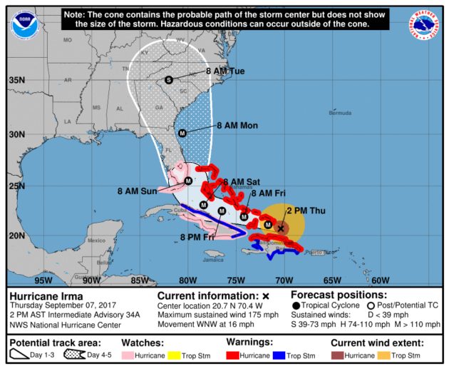
Irma 2pm update Sept 7 – The storm is still a Cat 5. Below are the latest forecast track possibilities.
Statement from Agriculture Commissioner Steve Troxler on waiving of motor vehicle regulations to help farmers
Thursday Sept 7, 2017 RALEIGH – Agriculture Commissioner Steve Troxler released the following statement regarding Gov. Roy Cooper’s issuance of Executive Orders 20 and 21 in preparation for Hurricane Irma:
“Hurricane Irma is a formidable storm that could result in severe economic loss of livestock, poultry and crops in our state. At my recommendation and as allowed by state law, the Governor has directed the Department of Public Safety to temporarily suspend weighing vehicles used to transport livestock, poultry, feed and crops in the state.
“This Executive Order will allow our farmers the opportunity to harvest as much of their crops as possible before the storm hits. The order also will help ensure that livestock, poultry, crops and feed can be moved as necessary. The order also temporarily suspends the maximum hours of service for drivers.
“In addition to the waiving of motor vehicle regulations, our department is temporarily suspending health certificate requirements on livestock traveling through the state from areas in Hurricane Irma’s path.
“I urge everyone to prepare for this storm. Check your generators, fuel and emergency kits. We don’t know what impact this storm will have yet on our state. But we do know that preparation saves lives and protects property.”
Irma 8am update Sept 7 – The storm is still a Cat 5. Below are the latest forecast track possibilities.
satellite image of #Irma and #Jose on Thursday morning.
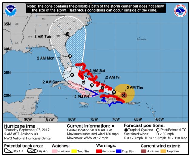
Irma 5am update Sept 7 – The storm is still a Cat 5. Below are the latest forecast track possibilities.
Wednesday September 6, 2017 – North Carolina Governor Roy Cooper has declared a State of Emergency, which will take effect at 8am Thursday, for the entire state in preparation for Hurricane Irma.
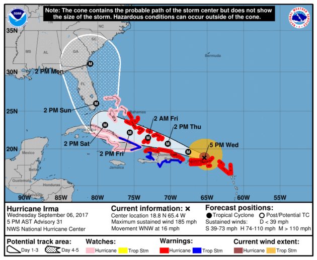
As of 5pm Wednesday, Irma was still a Category 5 storm and was located near the Virgin Islands and heading toward St Thomas, with maximum sustained winds still at 185mph. Governor Cooper joins the Governors of Florida, Georgia and South Carolina in declaring a state of emergency ahead of Irma's unknown US landfall.
The Governor noted that Irma is still five days or so away from North Carolina, but it's not too soon to get ready. He also noted that since the exact track is not known anywhere from the mountains to the coast could be impacted. He said the state is preparing and coordinating with FEMA, local partners and surrounding states to get ready. He is asking residents all across the state to to get ready, update emergency kit, stay informed on weather updates, and to visit ReadyNC.org for information. The Governor reiterated that, “There's a lot we don't know, but we do know that it's time for North Carolinians to get ready.”
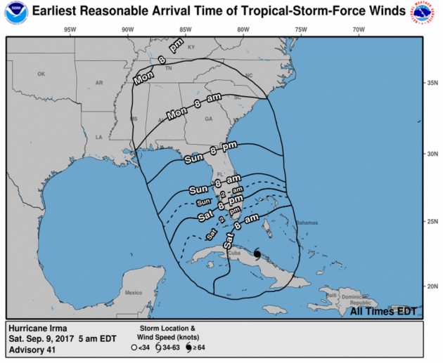
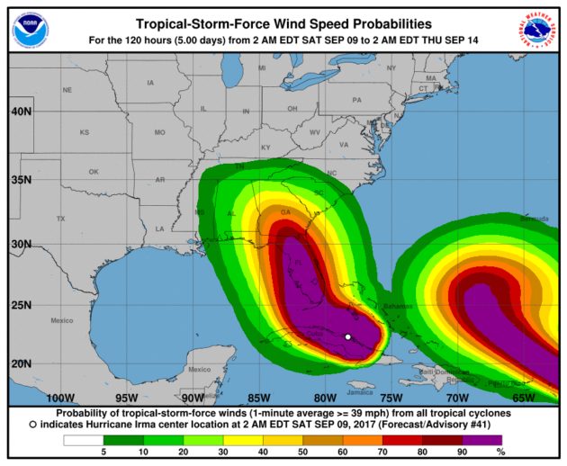
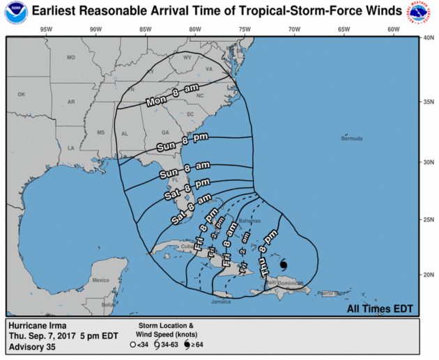
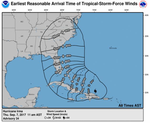
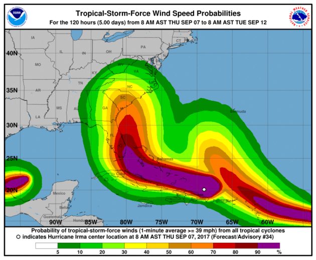
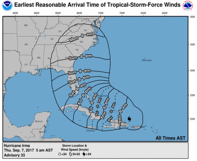
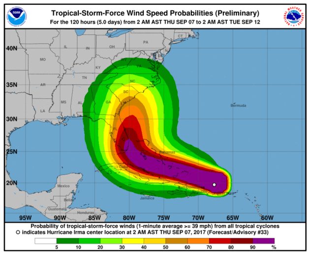
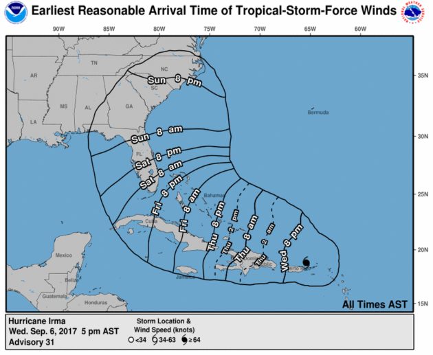
Graphics below are from NOAA and the National Weather Service as of 5pm Wednesday Sept 6 and show the possible forecast track and possible arrival time of Tropical storm force winds.


