Last Updated on October 1, 2022 6:41 pm
WataugaOnline.com updates on the possible impacts of Hurricane Ian on western North Carolina. Information will be updated as it becomes available and necessary.
A list of flood-prone areas in Watauga County is available at this link.
Saturday, October 1, 6:40 pm – WataugaOnline.com has ended coverage of storm Ian. Thanks for checking out all the information over the last week.
Saturday October 1 – While the High Country was largely spared by Ian, as of 10:38 am there are nearly 296,000 across the state without power. Map courtesy of NCDPS

Friday September 30 – Flood Watch for Watauga County, NC, Ashe County, NC, Wilkes County, NC. Read more at this link.
Friday September 30 – Wind Advisory for Watauga County, NC, Ashe County, NC, Wilkes County, NC. Read more at this link.
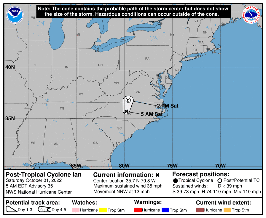
5 am National Hurricane Center update Saturday October 1, 2022
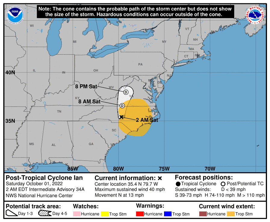
2 am National Hurricane Center update Saturday October 1, 2022
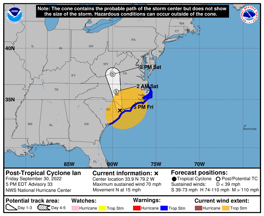
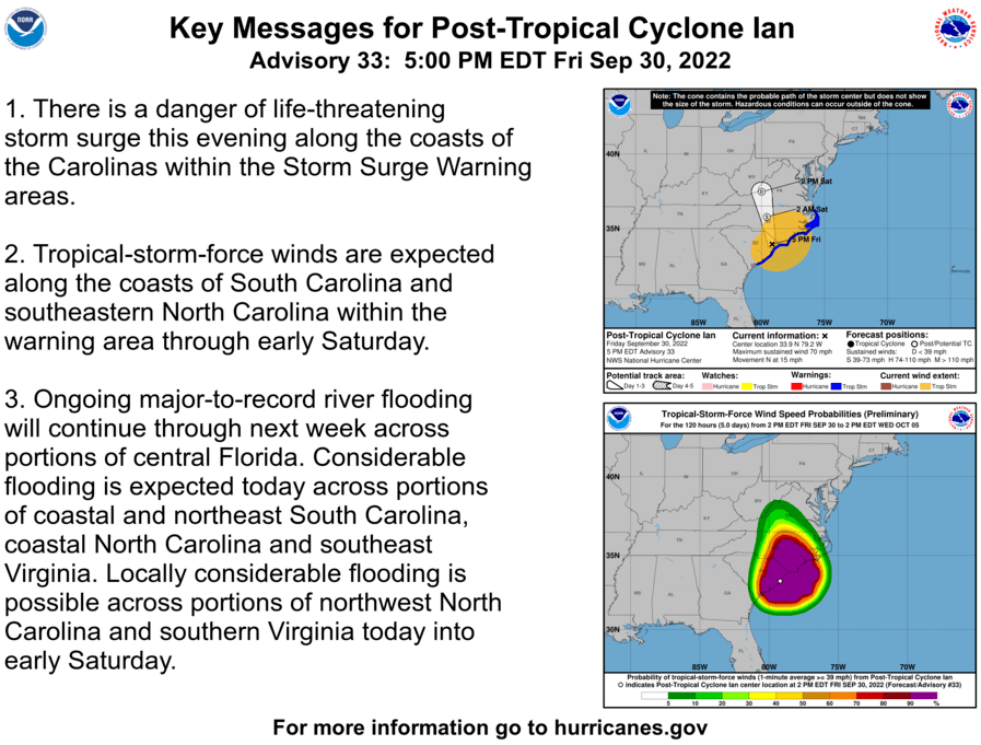
5 pm National Hurricane Center update Friday September 30, 2022
2 pm National Hurricane Center update Friday September 30, 2022

Friday, September 30 – Governor Cooper, and Emergency Management officials shared an update on severe weather. Broadcast provided by PBS Carolina.
Blue Ridge Energy Ready to Respond if Severe Weather Causes Outages. For more information visit this link.
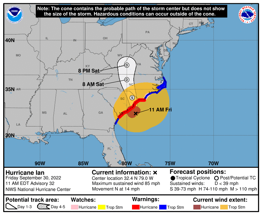
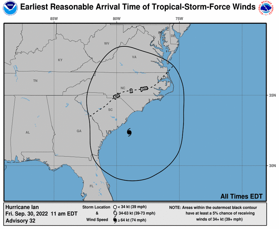
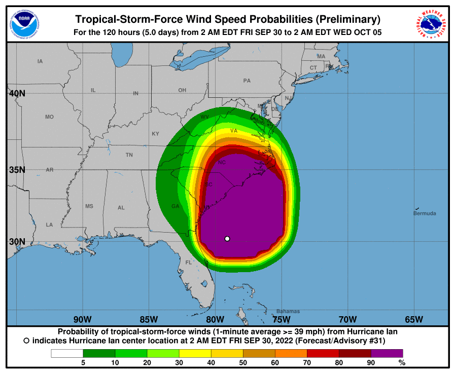
11 am National Hurricane Center update Friday September 30, 2022

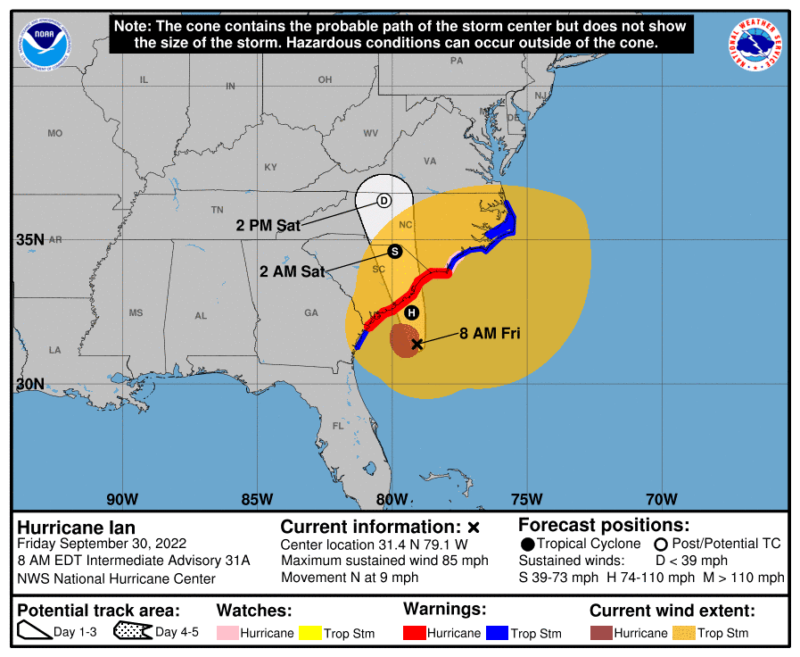
8 am National Hurricane Center update Friday September 30, 2022
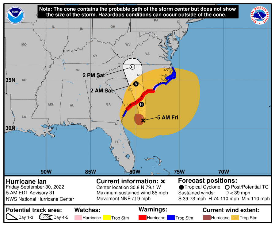
5 am National Hurricane Center update Friday September 30, 2022
Thursday, September 29 – Tropical Storm Ian Local Statement Advisory Number 29 – This product covers the western Carolinas and Northeast Georgia. Read more at this link.
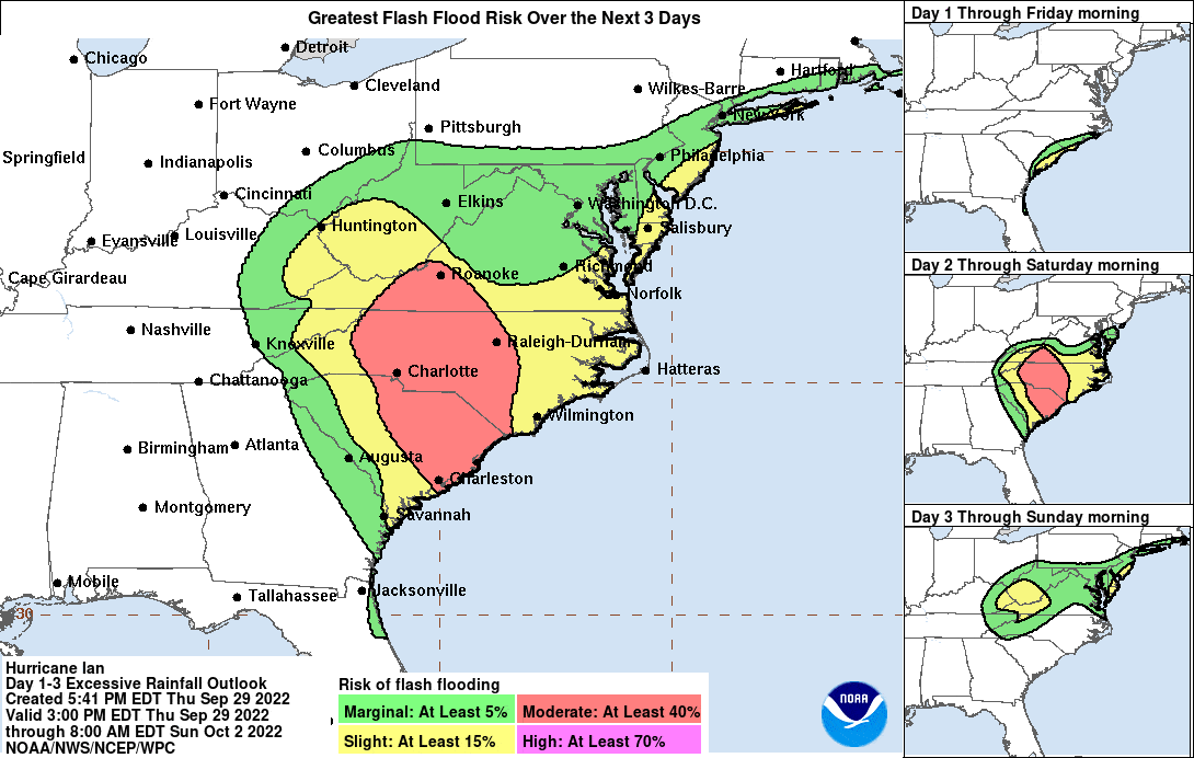
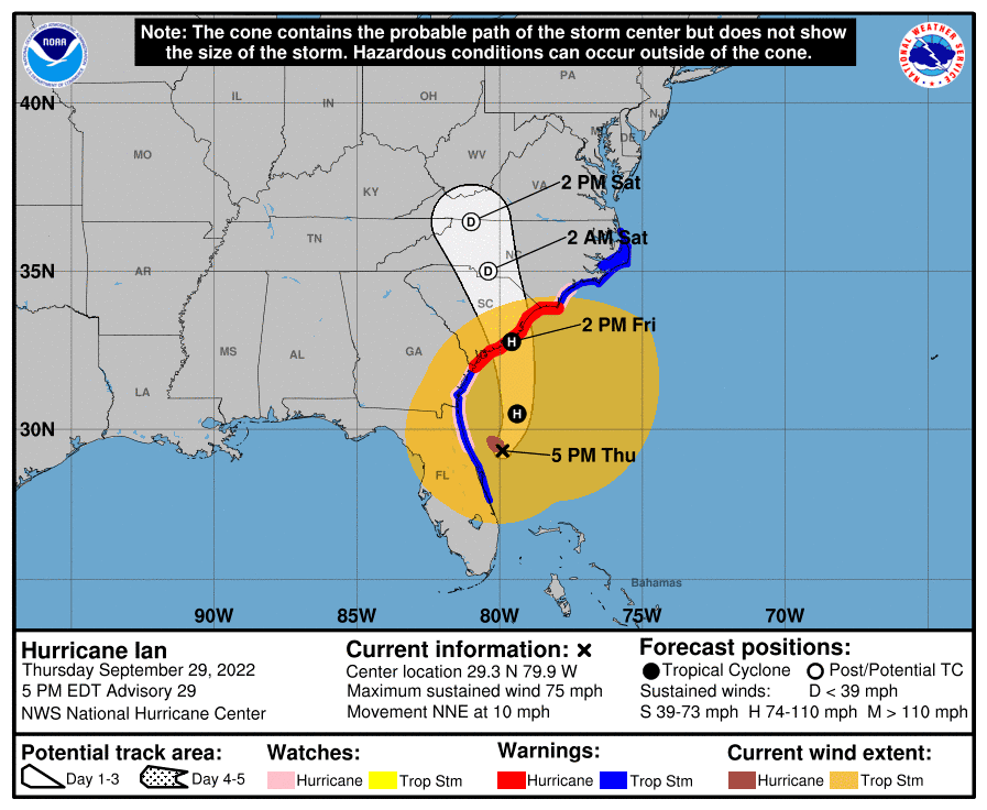
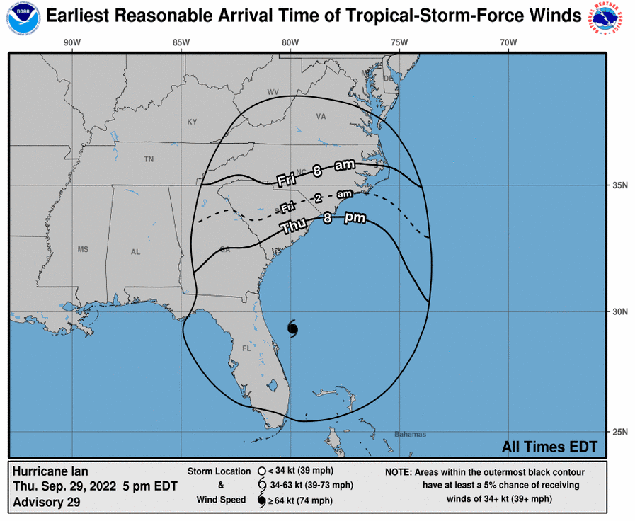
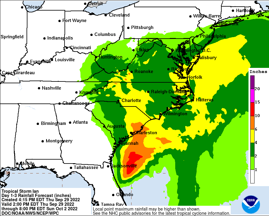
5 pm National Hurricane Center update Thursday, September 29, 2022
Thursday, September 29 – Wind Advisory including Avery County, NC. Read more at this link.
Thursday, September 29 – Flood Watch including Avery County, NC. Read more at this link.
Due to the forecasted severe weather from hurricane Ian, Tweetsie Railroad will be closed Friday, Saturday and Sunday (Sept. 30 – Oct. 2).
Thursday, September 29 – Tropical Storm Ian Local Statement Advisory Number 28 – This product covers the western Carolinas and Northeast Georgia. Read more at this link.
Thursday, September 29 – Ashe County Emergency Management Coordinator Patty Gambill is asking residents to prepare for the impact of storm Ian. Read more at this link.
Thursday, September 29 – Governor Cooper, and Emergency Management officials shared an update on severe weather. Broadcast provided by PBS Carolina.
Thursday, September 29 – The U.S. Forest Service is closely tracking the forecast for Hurricane Ian and is temporarily closing some campgrounds and recreation areas on the Pisgah and Uwharrie National Forests in advance of the storm. Read more at this link.
Thursday, September 29 – Blue Ridge Parkway initiates preemptive closures along southern portion of route. For more information visit this link.
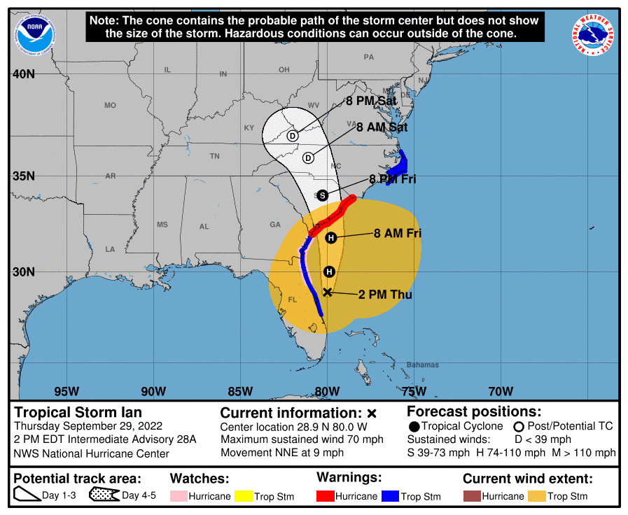
2 pm National Hurricane Center update Thursday, September 29, 2022
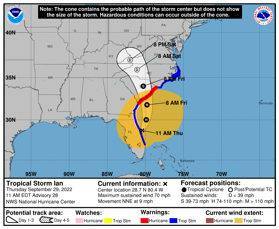
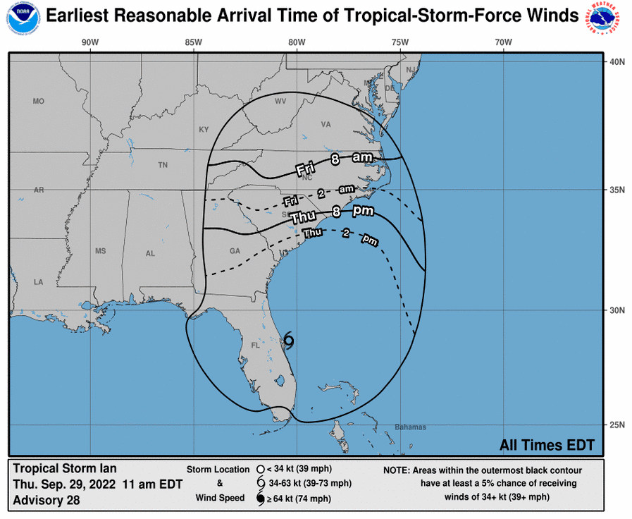
11 am National Hurricane Center update Thursday, September 29, 2022
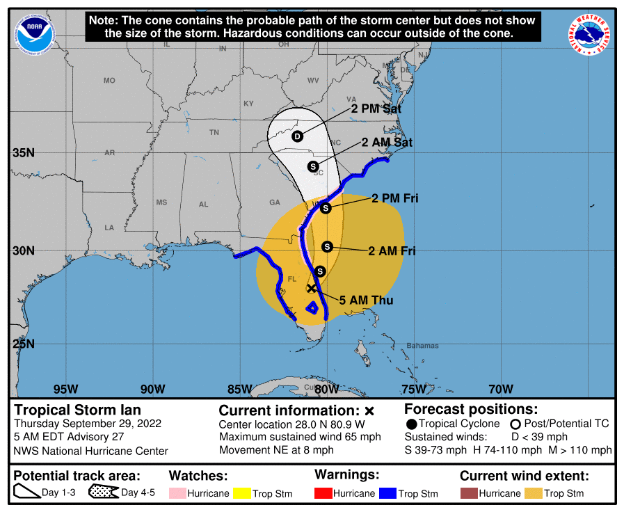
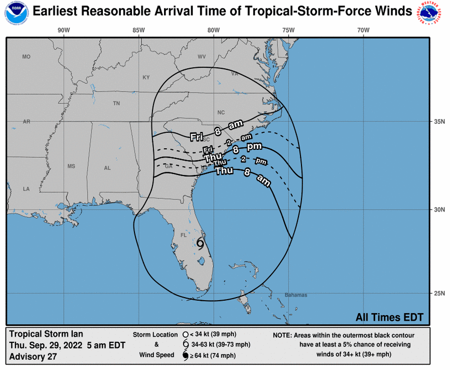
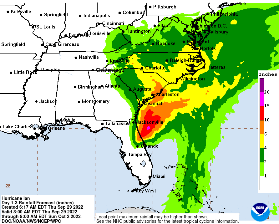
5 am National Hurricane Center update Thursday, September 29, 2022
Wednesday, September 28 – In advance of Hurricane Ian’s remnants moving through the state, Governor Roy Cooper declared a State of Emergency today. Read his press release at this link.
422 AM EDT Thursday September 29 2022 – This Hazardous Weather Outlook is for north central North Carolina, northwest North Carolina, central Virginia, south central Virginia,
southwest Virginia, west central Virginia and southeast West Virginia.
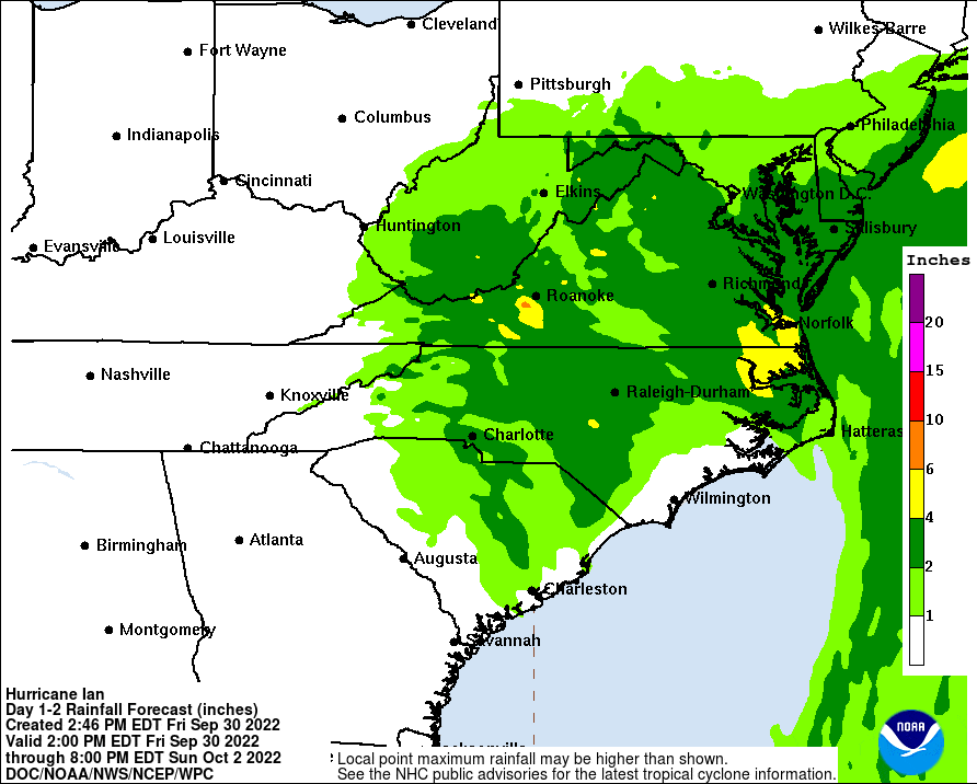
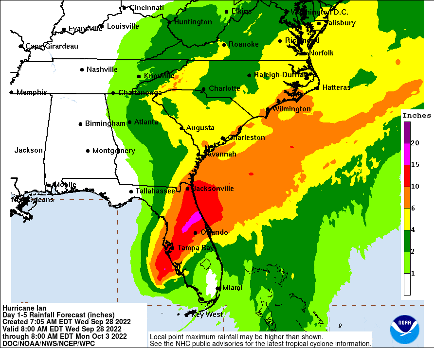
The remnants of Ian are expected to bring widespread moderate to
heavy rainfall to southwestern Virginia and western North Carolina
beginning late Friday, and continuing through the upcoming weekend.
This may bring an increased risk for flash flooding, as well as
flooding of poor drainage areas. Gusty winds will also be possible
Friday night and Saturday, especially in higher terrain areas.
There is still uncertainty in the track and timing of this system.
Please continue to monitor the forecast throughout this week for
updated information on Ian.
Wednesday September 28 – This NWS Hazardous Weather Outlook is for north central North Carolina,
northwest North Carolina, central Virginia, south central Virginia,
southwest Virginia, west central Virginia and southeast West
Virginia.
The remnants of Ian are expected to bring widespread moderate to
heavy rainfall to southwestern Virginia and western North Carolina
beginning late Friday, and continuing through the upcoming weekend.
This may bring an increased risk for flash flooding, as well as
flooding of poor drainage areas. Gusty winds will also be possible
Friday night and Saturday, especially in higher terrain areas.
There is still uncertainty in the track and timing of this system.
Please continue to monitor the forecast throughout this week for
updated information on Ian.
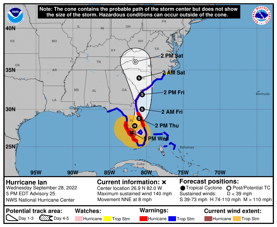
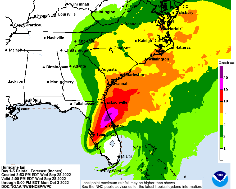
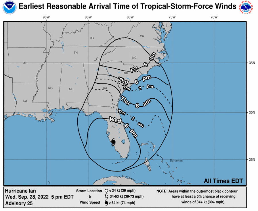
5 pm National Hurricane Center update Wednesday, September 28, 2022
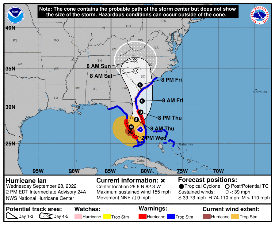
2 pm National Hurricane Center update Wednesday, September 28, 2022
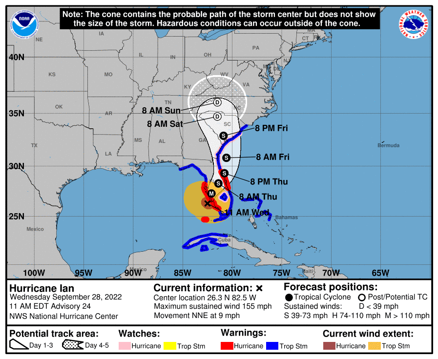
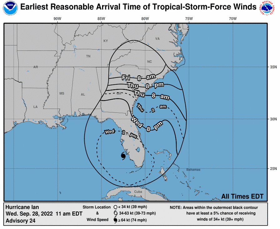
11 am National Hurricane Center update Wednesday, September 28, 2022
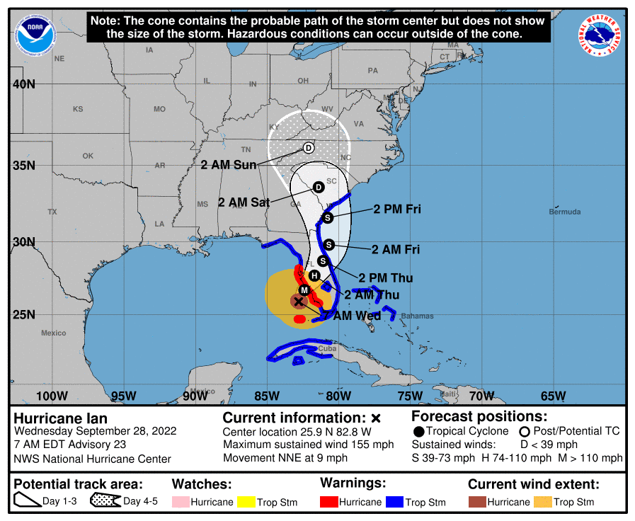
7 am National Hurricane Center update Wednesday, September 28, 2022
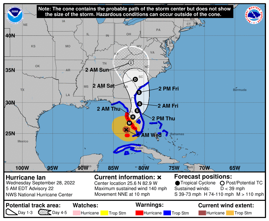
5 am National Hurricane Center update Wednesday, September 28, 2022

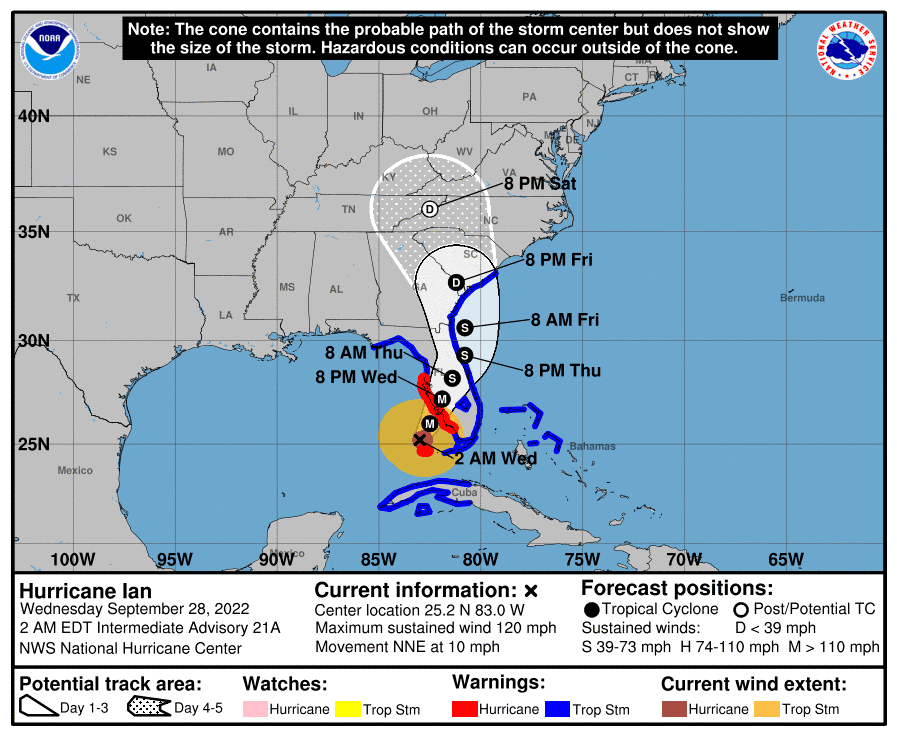
2 am National Hurricane Center update Wednesday, September 28, 2022
North Carolina is preparing for heavy rainfall and possible flooding on Friday and Saturday from the remnants of Hurricane Ian. Governor Cooper reminds residents that now is the time to complete their personal preparations. View the Governor's press release at this link.
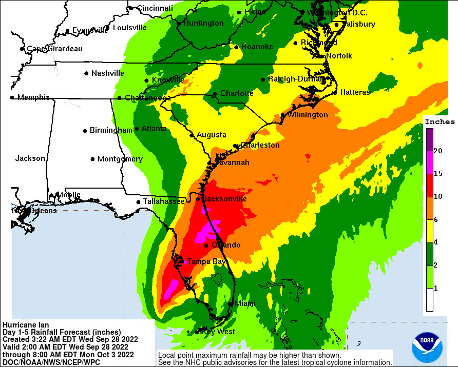
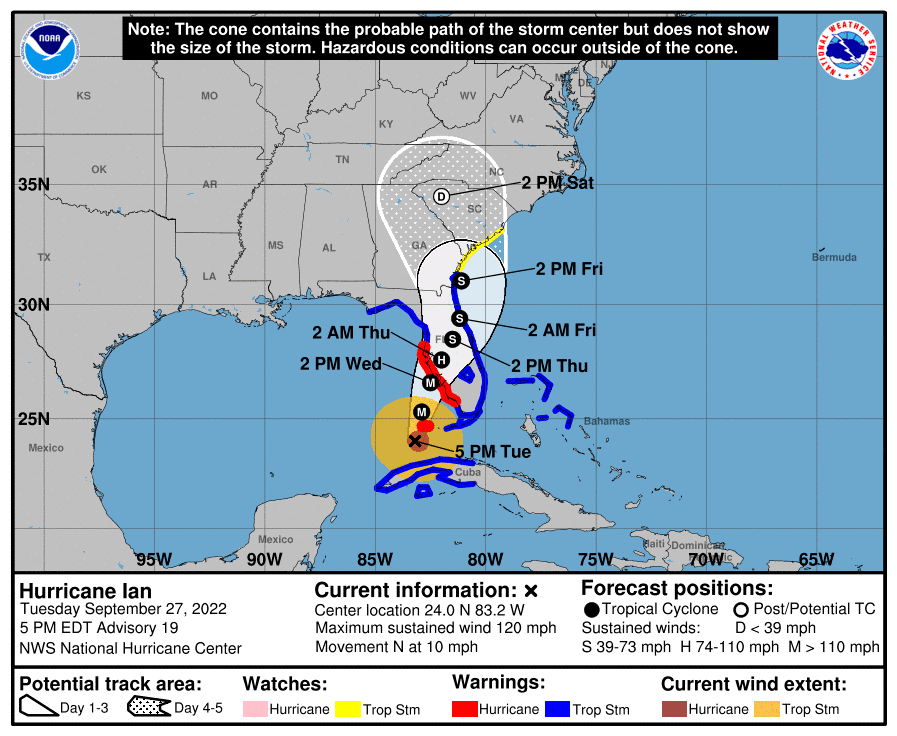
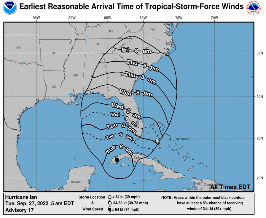
5 pm National Hurricane Center update Tuesday, September 27, 2022
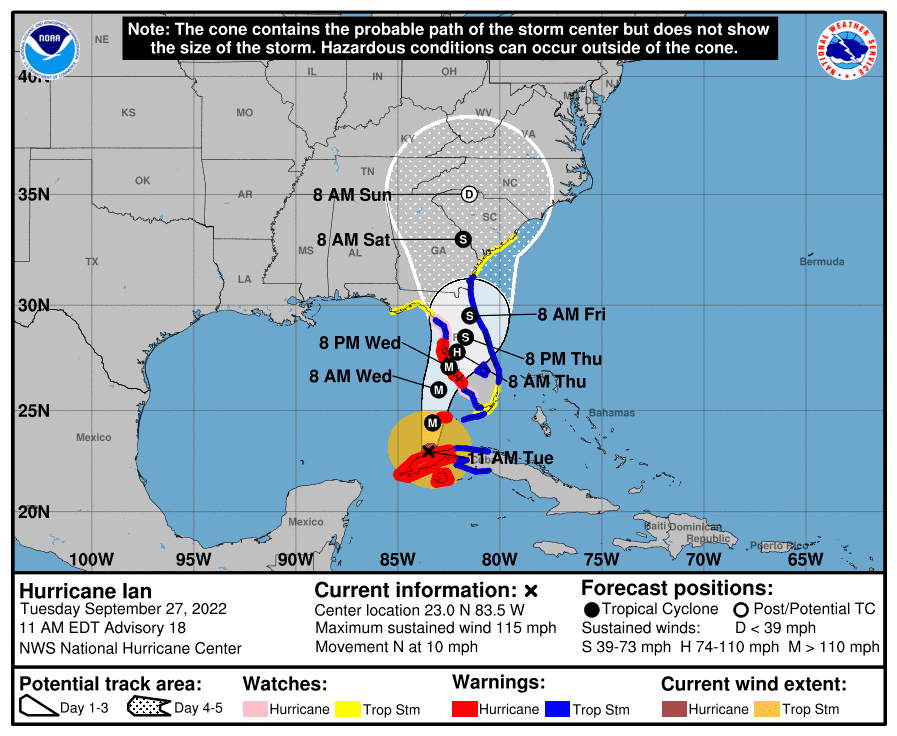
11 am National Hurricane Center update Tuesday, September 27, 2022
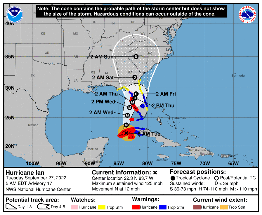
5 am National Hurricane Center update Tuesday, September 27, 2022
2:42 am Tuesday September 27 – This National Weather Service Hazardous Weather Outlook is for north central North Carolina, northwest North Carolina, central Virginia, south central Virginia,
southwest Virginia, west central Virginia and southeast West Virginia.
Tuesday through Sunday: Confidence is increasing that the remnants of Tropical Cyclone Ian moving northward from the southeastern U.S. will likely impact the region beginning Friday and continuing through the weekend. Current forecasts have the remnants of Ian tracking either near or through the forecast area late this weekend. Widespread moderate to heavy rain and gusty winds will be possible leading to concerns for flooding and wind damage. There remains considerable uncertainty with regard to the exact path of Ian but confidence is certainly increasing that the region will be impacted. Consequently, the latest forecasts should be monitored closely as the week progresses for the latest on Tropical Cyclone Ian and how it may impact our forecast area this weekend into early next week.
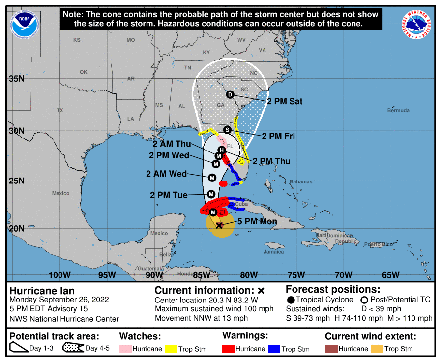
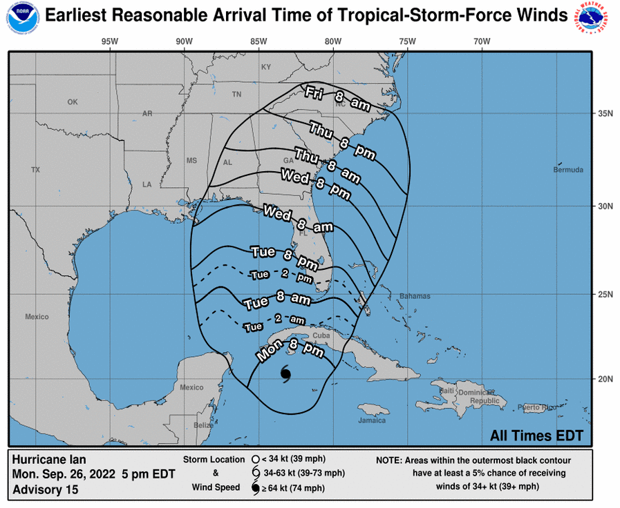
5 pm National Hurricane Center update Monday, September 26, 2022
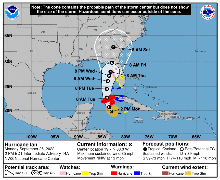
2 pm National Hurricane Center update Monday, September 26, 2022
Monday, September 26 – The Watauga High JV and Varsity football games have been moved due to possible impacts from the storm. The JV game will be played Wednesday at 7 pm, while the Varsity contest is now Thursday at 7:30 pm. Both games will still take place at South Caldwell as originally scheduled.
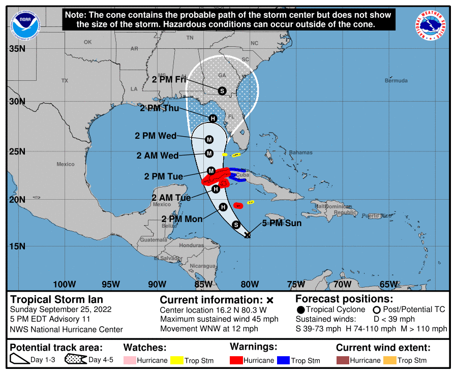
5 pm National Hurricane Center update Sunday, September 25, 2022