Last Updated on March 27, 2025 6:10 pm
Helene Local Watch/Warning Statement/Intermediate Advisory Number 15A
National Weather Service Greenville-Spartanburg SC AL092024
434 AM EDT Fri Sep 27 2024
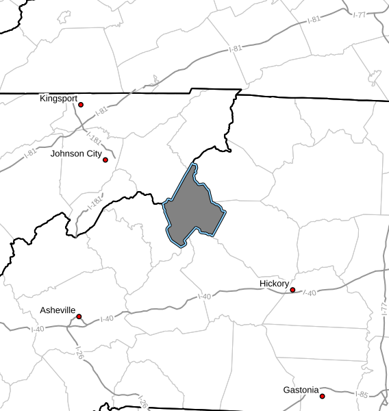
NCZ033-271645-
/O.CON.KGSP.TR.W.1009.000000T0000Z-000000T0000Z/
Avery-
434 AM EDT Fri Sep 27 2024
…TROPICAL STORM WARNING REMAINS IN EFFECT…
- LOCATIONS AFFECTED
- Banner Elk
- WIND
- LATEST LOCAL FORECAST: Equivalent Tropical Storm force wind
- Peak Wind Forecast: 30-40 mph with gusts to 70 mph
- THREAT TO LIFE AND PROPERTY THAT INCLUDES TYPICAL FORECAST
UNCERTAINTY IN TRACK, SIZE AND INTENSITY: Potential for wind 39
to 57 mph- The wind threat has remained nearly steady from the
previous assessment. - PLAN: The sustained wind should remain less than tropical
storm force. Conditions may still be gusty. - PREPARE: Listen for any instructions from local officials.
- ACT: Ensure emergency readiness should the forecast change.
- The wind threat has remained nearly steady from the
- REALIZED IMPACTS: Being Assessed
- Little to no additional wind impacts expected. Community
officials are now assessing the extent of actual wind
impacts accordingly.
- Little to no additional wind impacts expected. Community
- LATEST LOCAL FORECAST: Equivalent Tropical Storm force wind
- FLOODING RAIN
- LATEST LOCAL FORECAST: Flood Watch is in effect
- Peak Rainfall Amounts: Additional 4-8 inches, with locally
higher amounts
- Peak Rainfall Amounts: Additional 4-8 inches, with locally
- THREAT TO LIFE AND PROPERTY THAT INCLUDES TYPICAL FORECAST
UNCERTAINTY IN TRACK, SIZE AND INTENSITY: Potential for extreme
flooding rain- The flooding rain threat has remained nearly steady from
the previous assessment. - PLAN: Emergency plans should include the potential for
extreme flooding from heavy rain. Evacuations and rescues
are likely. - PREPARE: Urgently consider protective actions from extreme
and widespread rainfall flooding. - ACT: Heed any flood watches and warnings. Failure to take
action will likely result in serious injury or loss of life.
- The flooding rain threat has remained nearly steady from
- POTENTIAL IMPACTS: Devastating to Catastrophic
- Extreme rainfall flooding may prompt numerous evacuations
and rescues. - Rivers and tributaries may overwhelmingly overflow their
banks in many places with deep moving water. Small streams,
creeks, canals, arroyos, and ditches may become raging
rivers. In mountain areas, deadly runoff may rage down
valleys while increasing susceptibility to rockslides and
mudslides. Flood control systems and barriers may become
stressed. - Flood waters can enter numerous structures within multiple
communities, some structures becoming uninhabitable or
washed away. Numerous places where flood waters may cover
escape routes. Streets and parking lots become rivers of
raging water with underpasses submerged. Driving conditions
become very dangerous. Numerous road and bridge closures
with some weakened or washed out.
- Extreme rainfall flooding may prompt numerous evacuations
- LATEST LOCAL FORECAST: Flood Watch is in effect
- TORNADO
- LATEST LOCAL FORECAST:
- Situation is somewhat favorable for tornadoes
- THREAT TO LIFE AND PROPERTY THAT INCLUDES TYPICAL FORECAST
UNCERTAINTY IN TRACK, SIZE AND INTENSITY: Potential for a few
tornadoes- The tornado threat has remained nearly steady from the
previous assessment. - PLAN: Plans should still include the potential for a few
tornadoes. - PREPARE: Keep informed should additional weather alerts be
needed. - ACT: If a tornado warning is issued, be ready to shelter
quickly.
- The tornado threat has remained nearly steady from the
- POTENTIAL IMPACTS: Limited
- The occurrence of isolated tornadoes can hinder the
execution of emergency plans during tropical events. - A few places may experience tornado damage, along with
power and communications disruptions. - Locations could realize roofs peeled off buildings,
chimneys toppled, mobile homes pushed off foundations or
overturned, large tree tops and branches snapped off,
shallow-rooted trees knocked over, moving vehicles blown
off roads, and small boats pulled from moorings.
- The occurrence of isolated tornadoes can hinder the
- LATEST LOCAL FORECAST:
- FOR MORE INFORMATION:
- https://readync.org