Last Updated on December 14, 2021 4:01 pm
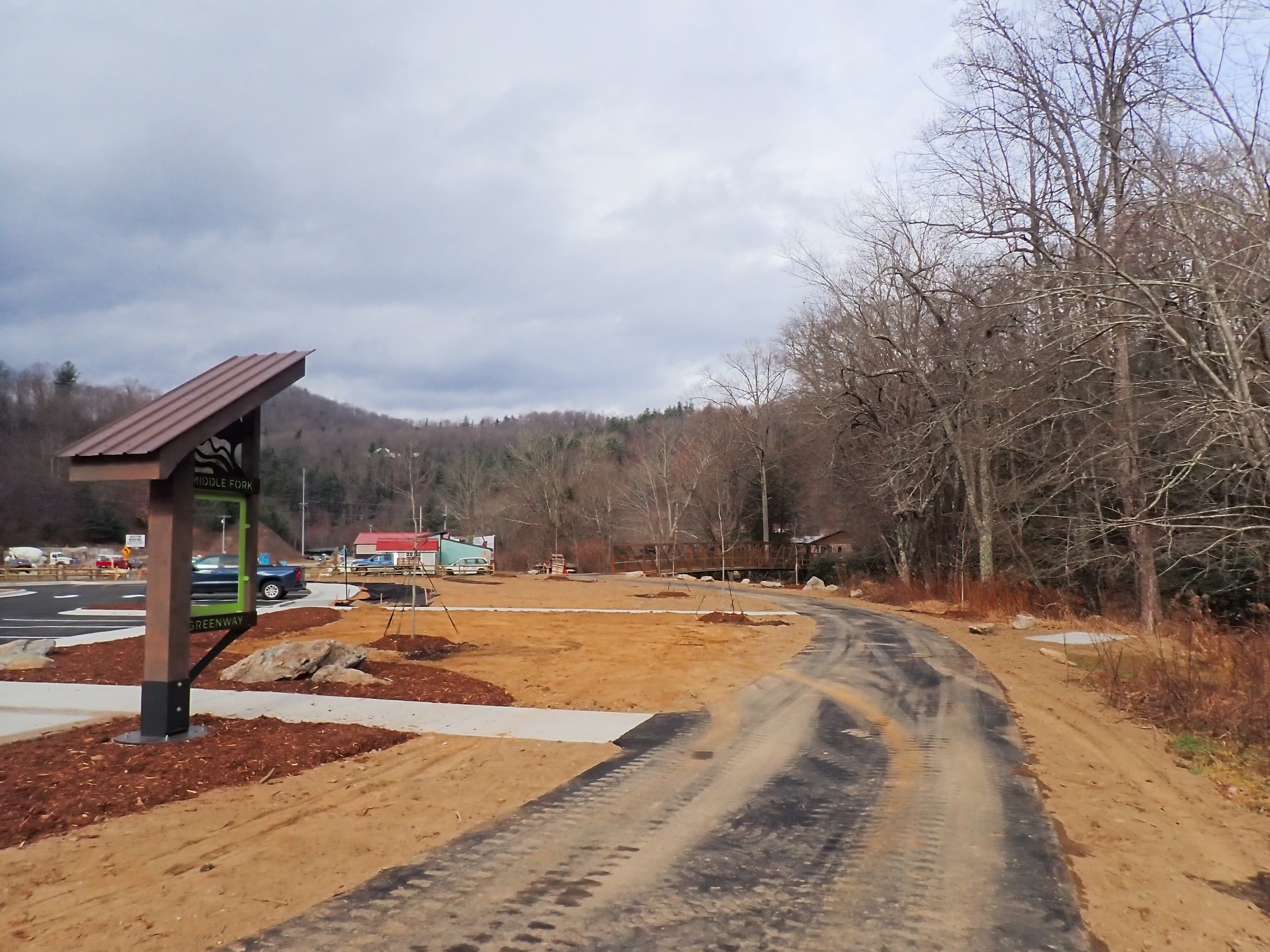
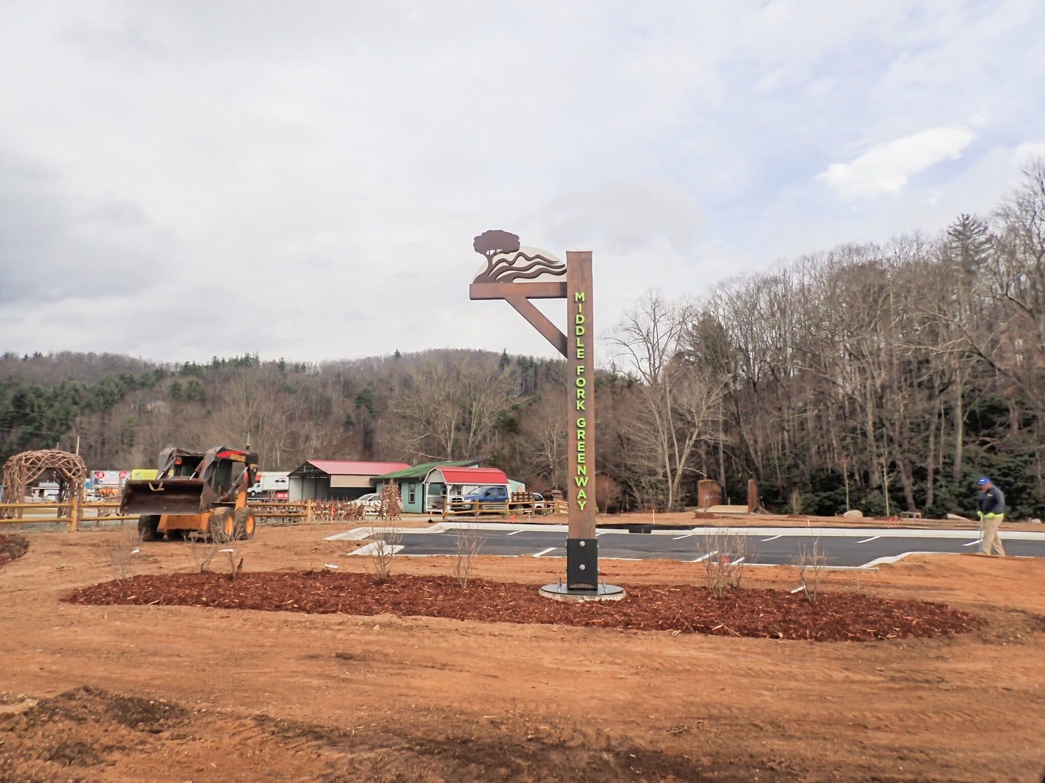
The 321 Trailhead (Section 4, Phase 1) on the Middle Fork Greenway will be opening soon and two more phases of this section are in progress. The trailhead includes 27 parking spaces, benches, a picnic area, bike racks, two bridges, river access, and a large rain garden to capture stormwater runoff. This section has two additional phases to be constructed before connecting to the existing mile-long section at Tweetsie Railroad and Mystery Hill.

From the 321 Trailhead, the greenway goes north over the river toward Boone and stops at another small parking access on Niley Cook Rd. NCDOT is conducting a feasibility study from Niley Cook to Watauga Medical Center in Boone which should be finished by late summer 2022. To the south over the second bridge toward Blowing Rock is a small section that will connect to Section 4, Phase 2, which is currently under construction. Phase 2 will be completed in the Spring/Summer of 2022. This natural surface portion of the trail will eventually be paved when additional funding becomes available.
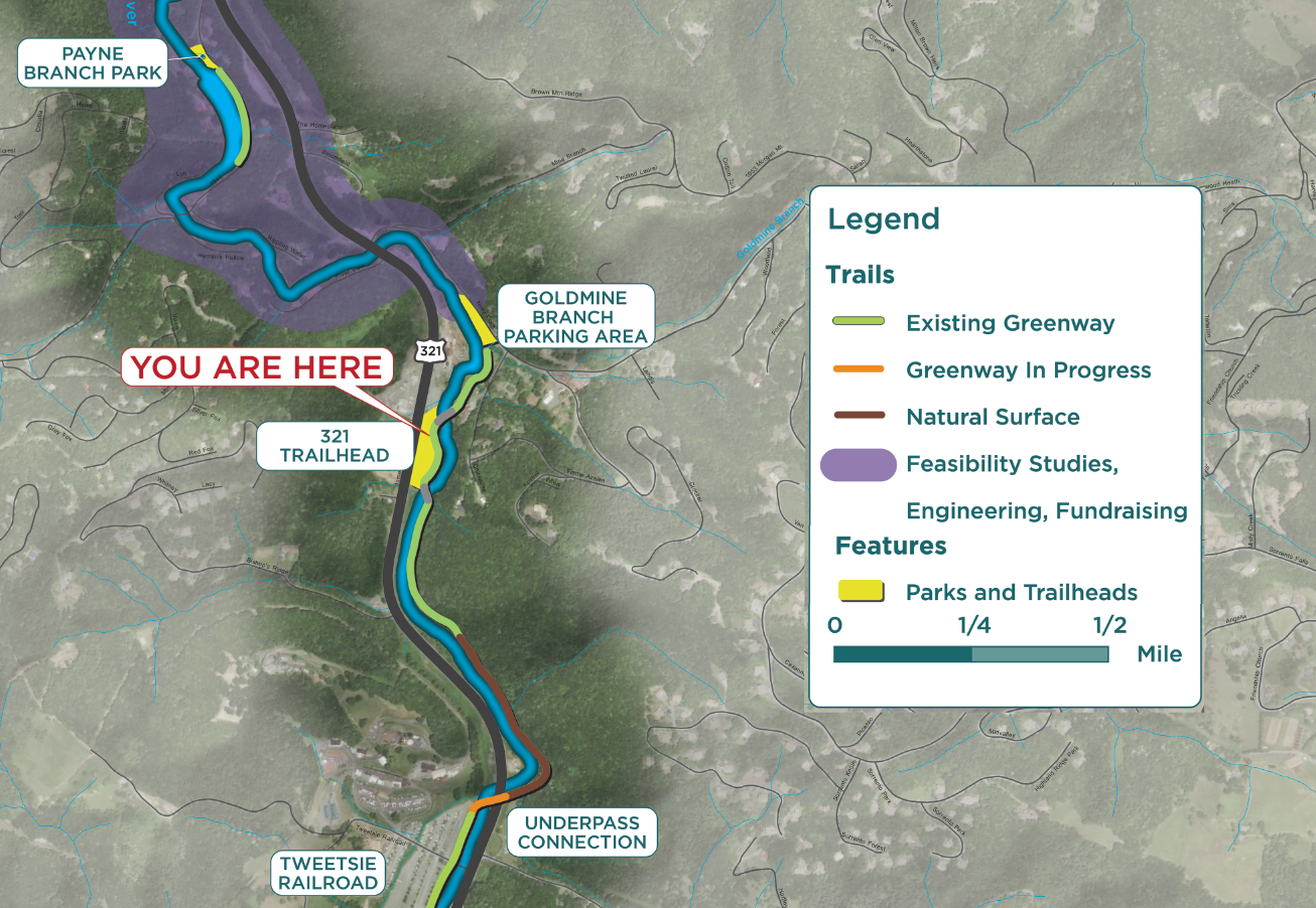
Phase 3, Section 4 includes a Highway 321 underpass and bridge over the Middle Fork of the New River to connect to Tweetsie RR. Phase 3 is currently undergoing design, engineering, and permitting with state and federal agencies. The Watauga Tourism Development Authority (TDA) funded this section of the Middle Fork Greenway, slated for construction in Summer/Fall of 2022.
Wright Tilley, Watauga TDA Director, commented: “The Watauga County TDA is thrilled to see the completion of the new trailhead on Hwy 321. All of these recent phases will connect 2.5 miles of continuous greenway trail which will positively impact the community immediately. When the full 6.5 miles connect Boone and Blowing Rock, it will be a tremendous asset to locals and visitors and an economic driver of our tourism economy.”
MFG Director Wendy Patoprsty explains: “The original plan was to be on the east side of the river the entire length, but after a few permitting issues, we had to change our plans and acquire land along 321 that now includes the bridges and parking area. In the long run, it worked out better to have additional parking and access for the Greenway.”
The right in – right out driveway is the new DOT standard on Highway 321. The NCDOT states this is for safety and will have long-term benefits with growth in the corridor. The NCDOT is funding a feasibility study from Sterling Creek Park to Faithbridge United Methodist Church property, which should be complete by mid-2022.

“Greenways are incredible assets to communities like Watauga County,” according to County Commissioner John Welch. “We have committed to expanding our current greenway system because it highlights the beauty of our area, protects the environment, encourages physical activity, and adds to the quality of life of our citizens. Greenways also strengthen our local economy through expanded tourism and outdoor recreation revenues. I look forward to seeing the completion of the Middle Fork Greenway!”
The Middle Fork Greenway is a project of Blue Ridge Conservancy and funded by Watauga TDA, state grants, NC Land and Water Fund, NC Parks and Recreation Trust Fund, NC Division of Water Resources, NC Recreational Trails Program, numerous foundations including Wells Fargo, Truist, Bank of America, The Cannon Foundation, The Anne Cannon Trust, and numerous private donations from our committed community.