


Last Updated on October 2, 2022 5:39 pm
Snow, rain and freezing rain are all in the forecast starting on Tuesday night and lasting through Thanksgiving morning. There is the chance for travel to be impacted. A Winter Storm Watch is in effect from late Tuesday to late Wednesday.
NWS Video Update Tuesday Nov 26
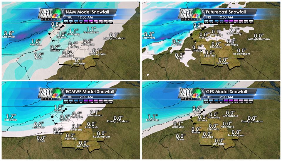
Graphics: Brad Panovich
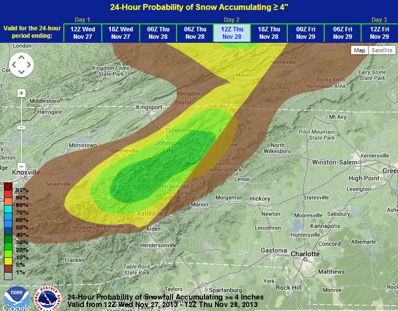
Probability of at least 4 inchs of snow from 7am Wednesday to 7am Thursday Nov 28. Graphics: NWS

Snow probabilities from NWS.
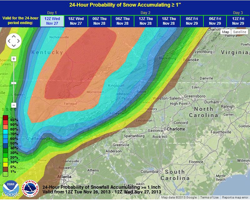
24 Hour Snow Probability of Snow Accumulating at least 1 inch from 7am Tuesday to through 7am Wednesday
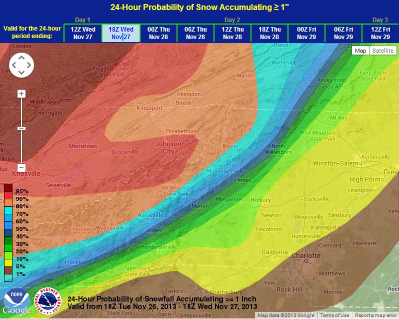
From 1pm Tuesday through 1pm Wednesday
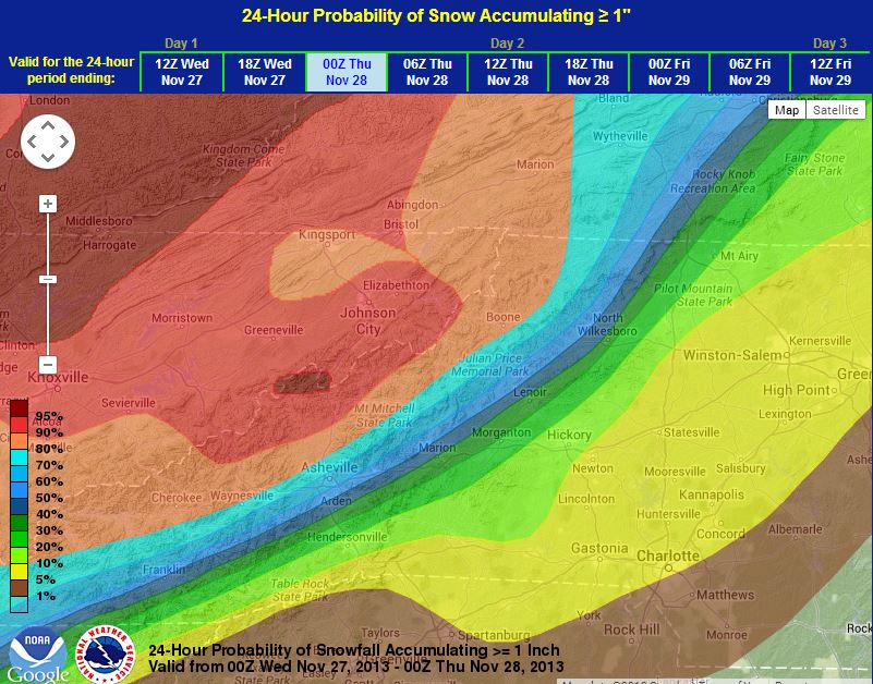
From 7pm Tuesday through 7pm Wednesday
24 Hour Snow Probability of Snow Accumulating at least 2 inches. From 7am Tuesday through 7am Wednesday

From 1pm Tuesday through 1pm Wednesday
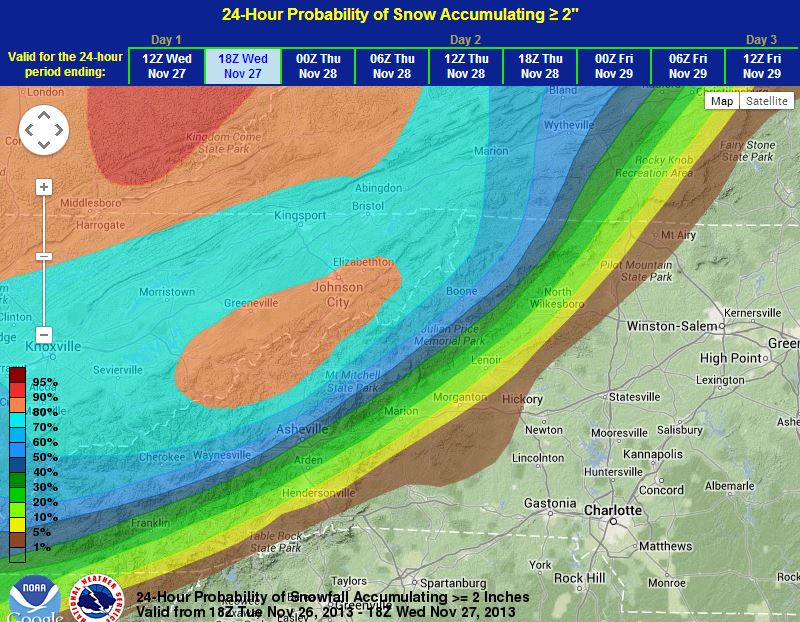
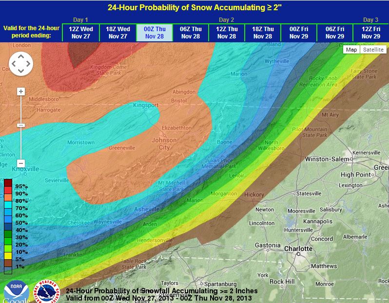
From 7am Wednesday through Through 7am Thursday
24 Hour Snow Probability of Snow Accumulating at least 4 inches. From 7am Wednesday through Through 7am Thursday
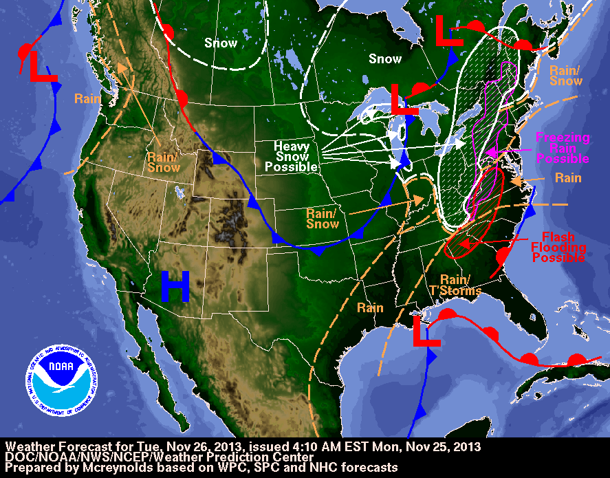
National Outlook for Tuesday
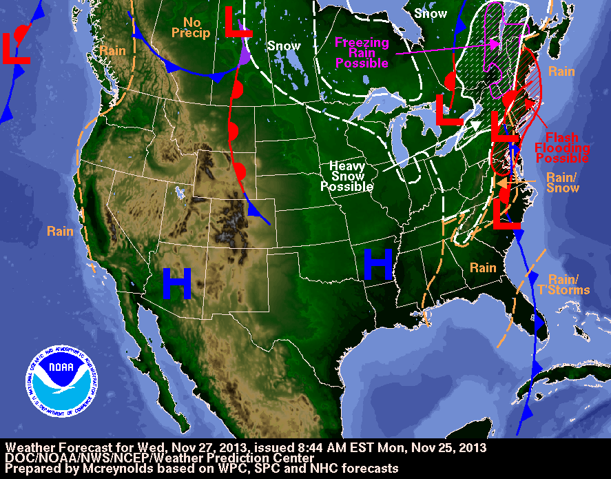
National Outlook for Wednesday


Yes it’s on its way 🙂 i just pray for everyone’s safety
Boone has a nice thump of snow on the way Wednesday, much of the day too. First synoptic scale from the minor system coming from Georgia early on, then wraparound upslope which is loaded with moisture at 850 mb level and great wind setup..should be the best snow event of the season..several inches in town I’d think after all said and done. Cold and windy to boot all day Wed. with gusts to 30 mph, and bone chilling cold Thanksgiving morning. Not to mention significant glazing esp. east of town by tomorrow morning.
Yuk again!!!