Last Updated on June 15, 2022 6:29 pm
NOAA-NWS-ALERTS-NC1263FA9664E4.SpecialWeatherStatement.1263FA968230NC.RNKSPSRNK.58f4ce296d5e86823d4ce23c0c948268
w-nws.webmaster@noaa.gov
2022-06-15T18:25:00-04:00
Actual
Alert
Public
Alert for Ashe (North Carolina) Issued by the National Weather Service
Met
Special Weather Statement
Expected
Minor
Observed
SAME
SPS
2022-06-15T18:01:00-04:00
2022-06-15T19:00:00-04:00
NWS Blacksburg (Southwest Virginia)
Special Weather Statement issued June 15 at 6:25PM EDT by NWS Blacksburg
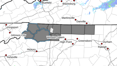
…A strong thunderstorm will impact portions of
north central Ashe, south central Smyth and southwestern Grayson
Counties through 700 PM EDT…
At 625 PM EDT, Doppler radar was tracking a strong thunderstorm over
Grayson Highlands State Park, or near Whitetop, moving northwest at
15 mph.
HAZARD…Wind gusts up to 50 mph and pea size hail.
SOURCE…Radar indicated.
IMPACT…Gusty winds could knock down tree limbs and blow around
unsecured objects. Minor damage to outdoor objects is
possible.
Locations impacted include…
Whitetop…
Sugar Grove…
Troutdale…
Volney…
Nella…
Rugby…
and Mount Rogers Summit.
MAX HAIL SIZE…0.25 IN
MAX WIND GUST…50 MPH
If outdoors, consider seeking shelter inside a building.
Locally heavy rain will quickly reduce visibility and result in
ponding of water on roadways, standing water in low lying areas, and
minor flooding of creeks, streams, and areas of poor drainage.
Drivers are urged to slow down and use extra caution to avoid
hydroplaning.
This storm may intensify, so be certain to monitor local radio
stations and available television stations for additional information
and possible warnings from the National Weather Service.
WMOHEADER
UGC
NCZ001-VAZ009-015
VTEC
TIME…MOT…LOC
2225Z 140DEG 13KT 3663 8152
36.61,-81.65 36.62,-81.62 36.63,-81.6 36.64,-81.61 36.63,-81.62 36.64,-81.62 36.69,-81.65 36.7,-81.65 36.8,-81.44 36.61,-81.33 36.51,-81.54 36.59,-81.68 36.61,-81.65
FIPS6
037009
UGC
NCZ001


