Last Updated on August 2, 2024 12:43 pm
NCZ018-019-021715-
Wilkes NC-Watauga NC-
1240 PM EDT Fri Aug 2 2024
…A STRONG THUNDERSTORM WILL IMPACT
SOUTHWESTERN WILKES AND SOUTHEASTERN WATAUGA COUNTIES THROUGH 115 PM
EDT…
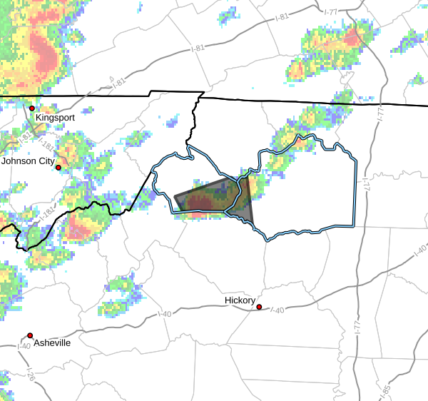
At 1239 PM EDT, Doppler radar was tracking a strong thunderstorm over
Aho, or over Blowing Rock, moving east at 10 mph.
HAZARD…Wind gusts up to 40 mph and pea size hail.
SOURCE…Radar indicated.
IMPACT…Gusty winds could knock down tree limbs and blow around
unsecured objects. Minor hail damage to vegetation is
possible.
Locations impacted include…
Boone…
Blowing Rock…
Deep Gap…
Foscoe…
Blowing Rock In Caldwell County…
Darby…
and Rutherwood.
PRECAUTIONARY/PREPAREDNESS ACTIONS…
If outdoors, consider seeking shelter inside a building.
Torrential rainfall is also occurring with this storm and may lead to
localized flooding. Do not drive your vehicle through flooded
roadways.