


Last Updated on June 26, 2022 6:45 pm
Special Weather Statement
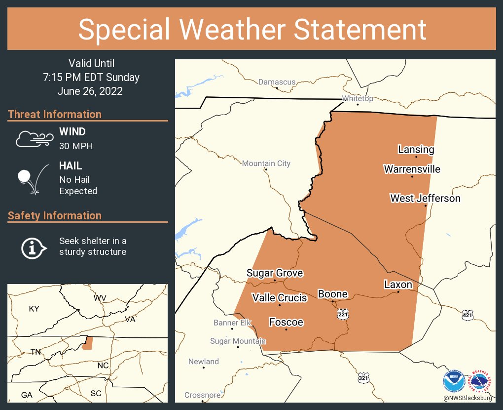
National Weather Service BLACKSBURG VA
639 PM EDT Sun Jun 26 2022
NCZ001-018-262315-
Ashe NC-Watauga NC-
639 PM EDT Sun Jun 26 2022
…A cluster of thunderstorms with heavy rainfall will impact
portions of Watauga and western Ashe Counties through 715 PM EDT…
At 637 PM EDT, Doppler radar was tracking a cluster of strong
thunderstorms across western Ashe county from just south of Whitetop
VA to Shatley Springs, Clifton, and Trout moving south at 30 mph.
HAZARD…Winds in excess of 30 mph.
SOURCE…Radar indicated.
IMPACT…Gusty winds could knock down tree limbs and blow around
unsecured objects.
Locations impacted include…
Boone…
West Jefferson…
Blowing Rock…
Lansing…
Foscoe…
Deep Gap…
and Ashland.
PRECAUTIONARY/PREPAREDNESS ACTIONS…
If outdoors, consider seeking shelter inside a building.
Locally heavy rain will quickly reduce visibility and result in
ponding of water on roadways, standing water in low lying areas, and
minor flooding of creeks, streams, and areas of poor drainage.
Drivers are urged to slow down and use extra caution to avoid
hydroplaning.


