


Last Updated on June 8, 2022 3:49 pm
NCZ001-018-019-082015-
Ashe NC-Wilkes NC-Watauga NC-
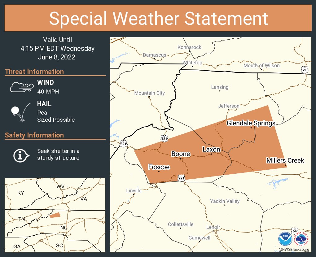
346 PM EDT Wed Jun 8 2022
…Strong thunderstorms will impact portions of northwestern Wilkes,
Watauga and southeastern Ashe Counties through 415 PM EDT…
At 344 PM EDT, Doppler radar was tracking strong thunderstorms
developing over Rutherwood, or near Todd, as well as Beech Mountain,
moving east at 25 mph.
HAZARD…Winds in excess of 40 mph and pea size hail.
SOURCE…Radar indicated.
IMPACT…Gusty winds could knock down tree limbs and blow around
unsecured objects. Minor damage to outdoor objects is
possible.
Locations impacted include…
Boone…
Blowing Rock…
Foscoe…
Glendale Springs…
Deep Gap…
Wilbar…
and Sugar Grove.
PRECAUTIONARY/PREPAREDNESS ACTIONS…
If outdoors, consider seeking shelter inside a building.
Torrential rainfall is also occurring with this storm and may lead to
localized flooding. Do not drive your vehicle through flooded
roadways.


