Last Updated on August 12, 2021 1:48 pm
NCZ001-018-019-121815-
Ashe NC-Wilkes NC-Watauga NC-
145 PM EDT Thu Aug 12 2021
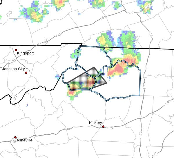
…A strong thunderstorm will impact portions of
west central Wilkes, southern Watauga and south central Ashe Counties
through 215 PM EDT…
At 145 PM EDT, Doppler radar was tracking a strong thunderstorm near
Deep Gap. This storm was nearly stationary.
HAZARD…Winds in excess of 40 mph.
SOURCE…Radar indicated.
IMPACT…Gusty winds could knock down tree limbs and blow around
unsecured objects.
Locations impacted include…
Boone…
Blowing Rock…
Foscoe…
Deep Gap…
Todd…
Blowing Rock In Caldwell County…
and Seven Devils.
PRECAUTIONARY/PREPAREDNESS ACTIONS…
If outdoors, consider seeking shelter inside a building.