


Last Updated on March 20, 2022 8:45 am
NCZ001>006-018>020-VAZ009-012>017-022>024-032>035-043>047-058-059-
201600-
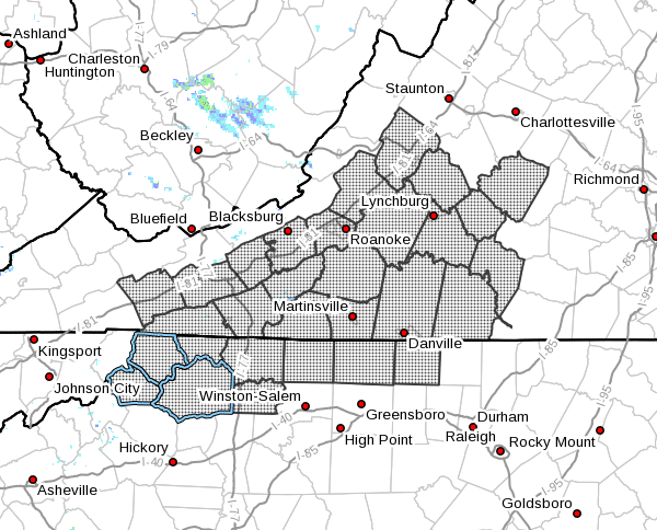
Ashe-Alleghany NC-Surry-Stokes-Rockingham-Caswell-Watauga-Wilkes-
Yadkin-Smyth-Wythe-Pulaski-Montgomery-Grayson-Carroll-Floyd-
Roanoke-Botetourt-Rockbridge-Patrick-Franklin-Bedford-Amherst-
Henry-Pittsylvania-Campbell-Appomattox-Buckingham-Halifax-
Charlotte-
Including the cities of West Jefferson, Sparta, Dobson, Danbury,
Eden, Yanceyville, Boone, Wilkesboro, Yadkinville, Marion,
Wytheville, Radford, Pulaski, Blacksburg, Independence, Whitetop,
Troutdale, Volney, Galax, Floyd, Roanoke, Salem, Fincastle,
Lexington, Buena Vista, Stuart, Rocky Mount, Bedford, Amherst,
Martinsville, Danville, Lynchburg, Appomattox, South Boston,
and Keysville
520 AM EDT Sun Mar 20 2022
…INCREASED FIRE DANGER TODAY FOR SOUTHWEST VIRGINIA AND
NORTHWEST NORTH CAROLINA…
Winds will be gusty from the northwest today, especially this
afternoon with gusts 25 to 35 mph at times. This afternoon
humidity levels drop below 35 percent in the mountains and below
25 percent in the foothills and piedmont. These winds and low
relative humidity values will create an increased fire danger from
mid afternoon through early evening. Wind speeds will decrease
around sunset.
Outdoor burning is discouraged. Please refer to your local burn
permitting authorities on whether you can burn. Use caution with
any potential ignition sources such as campfires and cigarettes.


