Last Updated on October 27, 2012 10:41 am
2pm Sunday Oct 28 audio update –
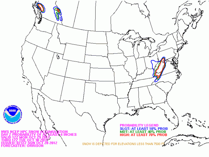
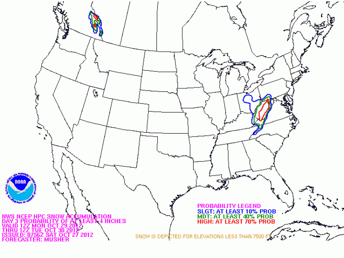
1:10pm – Snow accumulation probability of at least 4 inches Monday-Tuesday from NOAA
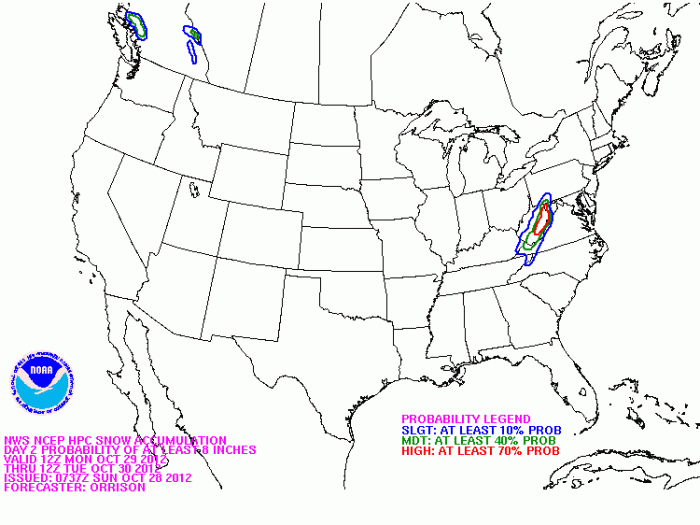
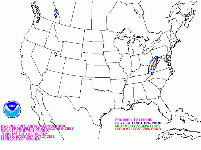
Snow accumulation probability of at least 8 inches Monday-Tuesday from NOAA
1pm – Video update from Brad Panovich
10am – WataugaRoads.com audio update
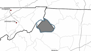
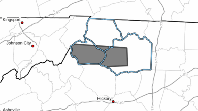
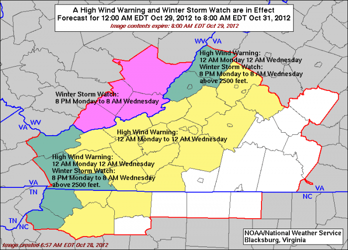
9:39am Sunday – Numerous watches and warnings are out for the High Country, including Winter Storm Watches and High Wind Warnings. Wind gust of up to 55mph are possible, which could cause power outages. Area residents are strongly encouraged to prepare for the coming storm.
Graphic from NOAA/National Weather Service Blacksburg.
———————————————————————————————————
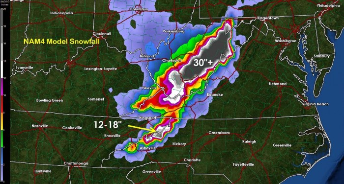
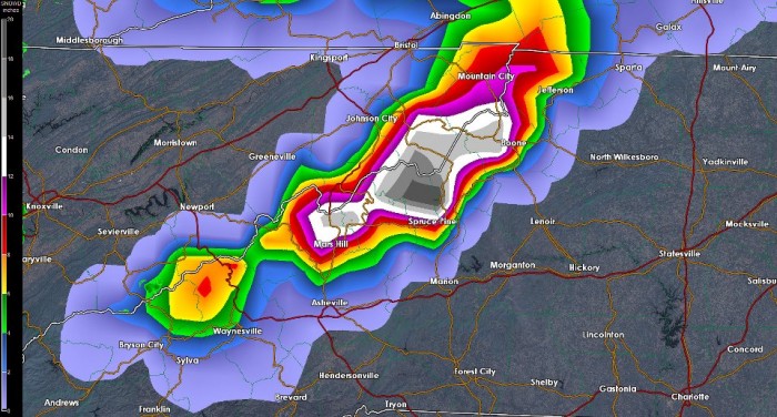
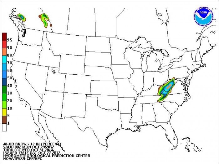
4:22pm -From NOAA – “Here's an update on the snowfall potential across the Appalachians from the interaction of Hurricane Sandy with a polar air mass behind a cold front across the Eastern U.S. Portions of the Central Appalachians are forecast to receive very heavy snowfall beginning Sunday night. This image shows the probability of receiving 12 inches of snow from 8 PM EDT Sunday through 8 PM EDT Tuesday.”
Click on map for a larger view, it will open in a new window
4:05pm – getting some facebook questions regarding could this storm break snowfall records. Here's some historical weather data from the State Climate Office.
The top 5 greatest one day snowfall totals of all time are:
24 inches in Blowing Rock March 13 1993, followed by:
19 inches in Boone Jan 27,1998
17 inches in Boone March 2,1942
16 inches in Boone Dec 26,1969
and 15 inches in Boone Feb 10, 1983. Keep in mind that these numbers are from reporting stations in the county to the climate office.
As far the month of October goes the top 5 greatest one day snowfalls reported to their office are:
2.5 inches in Blowing Rock Oct 17, 1977
2.5 inches in Boone Oct 23, 1937
2 inches in Boone Oct 17, 1977
2 inches in Boone Oct 20, 1961
2 inches in Boone Oct 21, 1989
For more historical data about Watauga, Ashe, Avery and statewide you find it on the Historical Weather Data page.
3:56PM – Snow accumulation probability of at least 4 inches Monday-Tuesday from NOAA
3:45pm National Weather Service update for our forecast area
3:24pm – via Brad Panovich
“Almost a guarantee we see accumulating snows in the NC mountains. Start preparing now for heavy wet snow, brutal cold and possible power outages. Make sure you have food and water for at least 3 days. Make sure you have a safe & reliable heat source as well. I'm thinking 4-7″ with localize 1′ amounts with near blizzard conditions at times & this is conservative.”
11:03am – Courtsey of John L'Heureux of L'Heureux's Weather – http://www.facebook.com/LHeureuxs.Weather, http://www4.ncsu.edu/~jmlheure/index2.html
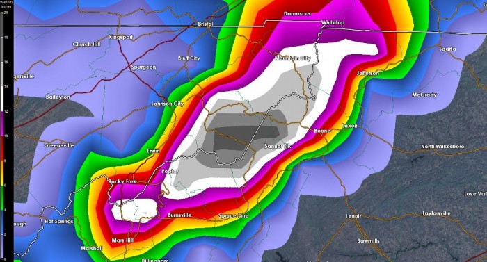
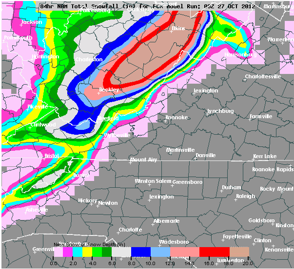
“A longer persistence of a northwest flow has ramped up snow projections in this mornings model run. There is still considerable spread as to how much snow will fall and stick for the High Country. The longevity (Monday – Wednesday) will provide ample opportunity for snowfall; the slight shift in the post-tropical storm Sandy will determine how far south moisture from the Great Lakes will travel. This has the potential to be one of the largest October snowstorms for the High Country. High winds (gusts to 55mph) through Monday – Wednesday may create low visibility conditions. Here is an image of the NAM snow prediction, which has been chosen for my update for its better resolution with resolving snowfall for the topography of the mountains. With low confidence of course, we seem to be gunning for a 2-10″ snowfall projection (2″ for the Blue Ridge, increasing to 10″ towards the NC/TN line and highest peaks).”
10:39am – Here are forecast temps from NWS – 40s on Sunday, 30s Sunday night, 40s Monday, 20s Monday night. Wind speeds of 10-30mph with gust of 40mph possible Sunday-Tuesday night at least.
9:21am Saturday – Snow accumulation probability of at least 8 inches Monday-Tuesday from NOAA
Snow accumulation probability of at least 4 inches Monday-Tuesday from NOAA
8:45am Saturday. From Brad Panovich “Model guidance continues to show a favorable set-up for major snow along the TN/NC border starting late Sunday night. This model shows almost 19″ at Mount Mitchell. This will be very elevation dependent. The worry is this wet heavy snow will combined with strong winds to bring trees & power lines down. Be ready for cold & snow and possibly no power starting Sunday night through Tuesday.”
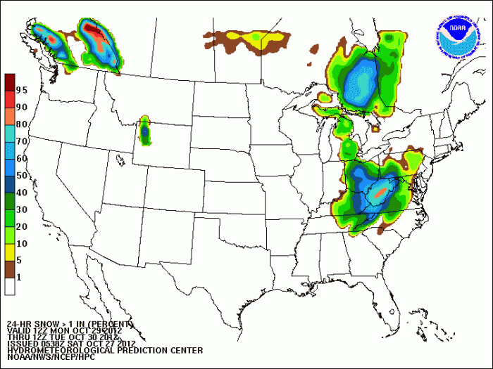
Also via Brad – “If you like probabilities check out the chances of seeing 1″ of snow Mon-Tue”
