Last Updated on September 22, 2024 3:41 pm
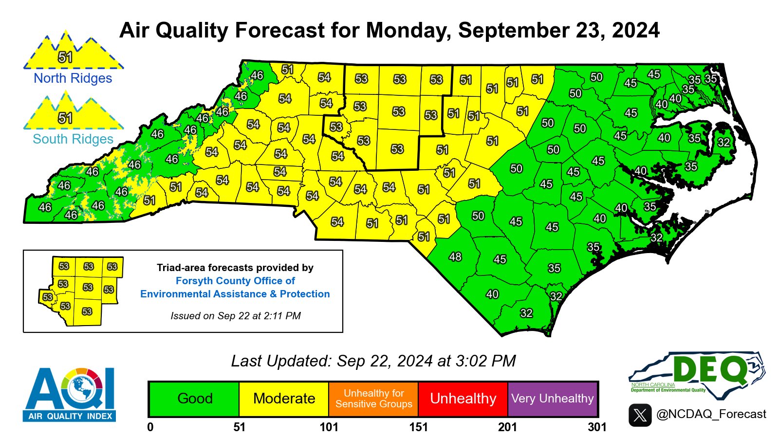
Portions of the High Country have been placed in the Moderate air quality index for Monday. Those areas are primarily for the northern ridges and southern ridges. Five counties boarding the High Country are completely in the Moderate quality.
The North Carolina Air Quality Forecast Center states in the report:
An upper-level ridge will continue to be over the state Monday, but a deepening trough will be taking shape to our west across the Central U.S. At the surface, yesterday's weak backdoor front will still be lingering across the western portion of the state where a plume of higher moisture will be concentrated. This should lead to a little more cloud cover across the state, slightly lower temperatures, as well as isolated showers and thunderstorms, especially in the mountains. Thus, ground-level ozone formation should be slightly diminished compared to yesterday. However, some upstream transport may keep the Ridgetops in Code Yellow. As for fine particulates, easterly to southeasterly flow should push pollutants into the western half of the state where some pooling can occur, so Code Yellow averages are expected in this area. Meanwhile, cleaner onshore flow will help lower concentrations closer to the coast.
Outlook
Moisture should increase across the state on Tuesday and Wednesday as onshore strengthens ahead of an approaching trough to our west and a possible tropical system moving north in the Gulf of Mexico. Expect cloudier conditions along with the threat for isolated showers and thunderstorms each day. This should favor improving air quality into the middle of the week, although daily average fine particulates may hold in the Code Yellow range once again on Tuesday across the western Piedmont due to pooling.