Last Updated on June 16, 2015 7:21 pm
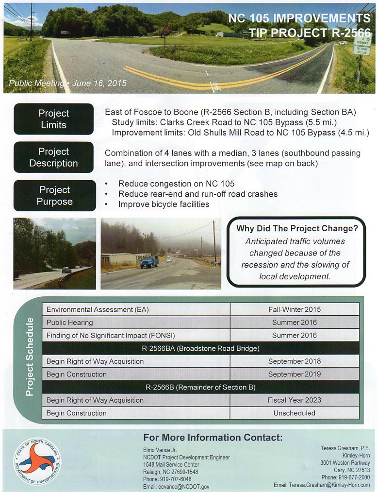
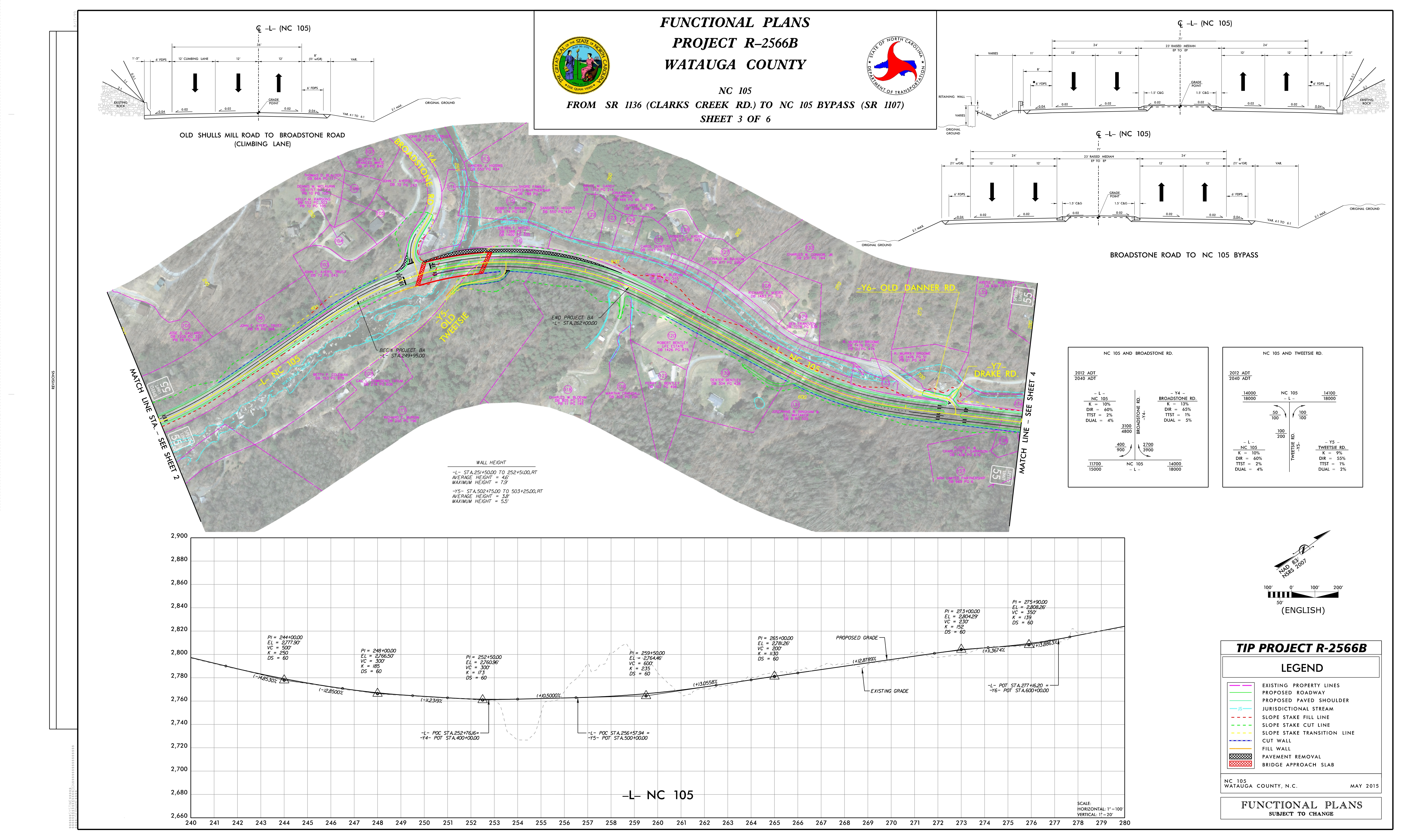
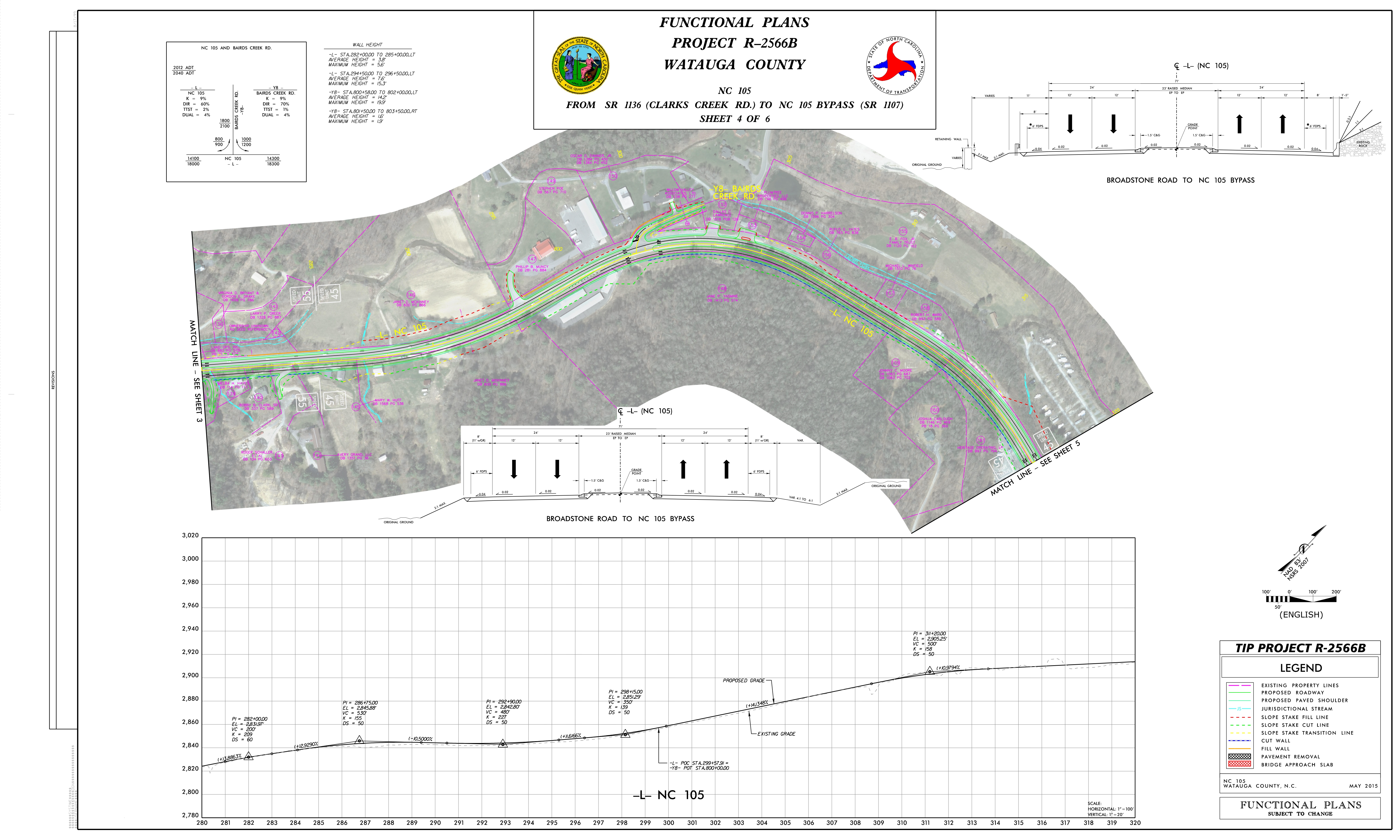
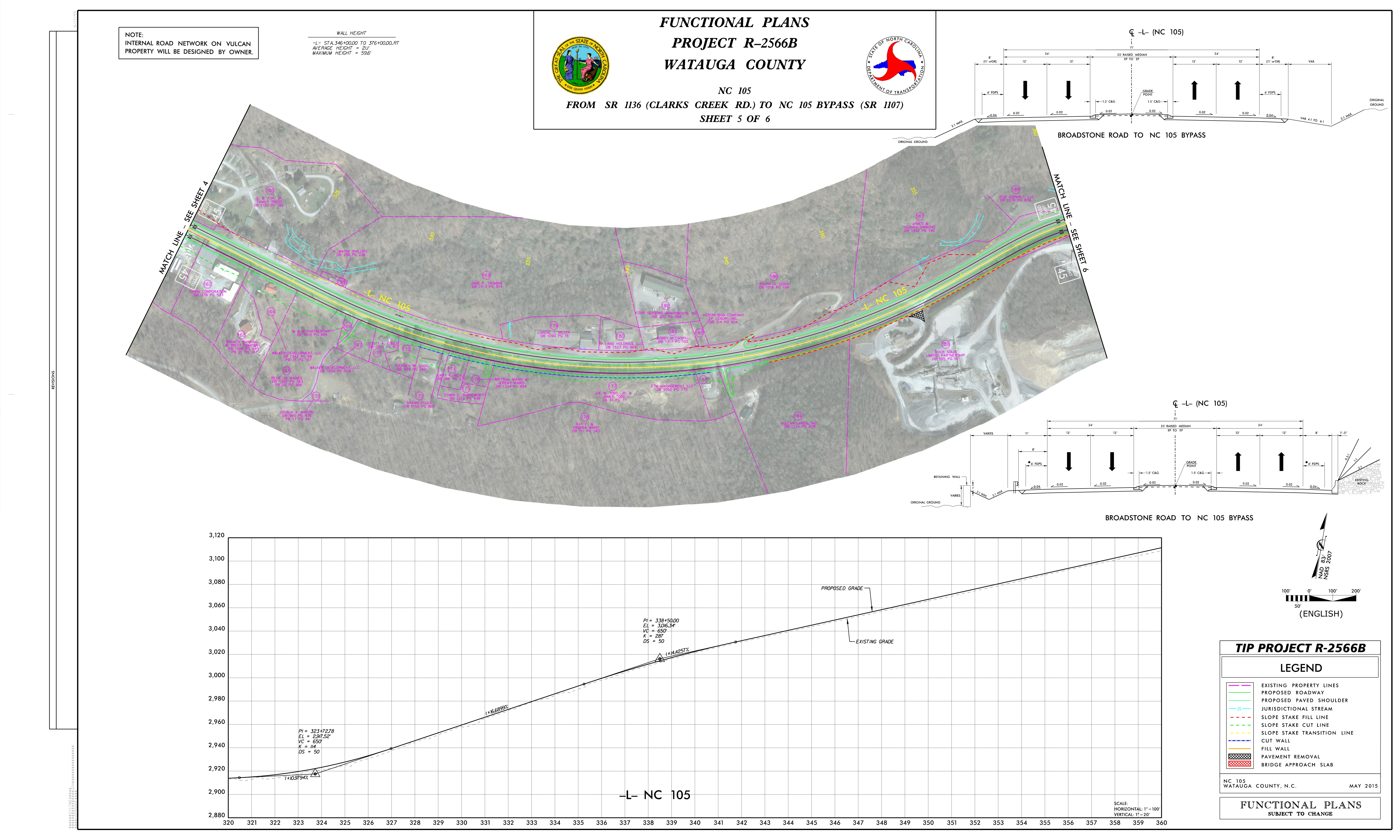
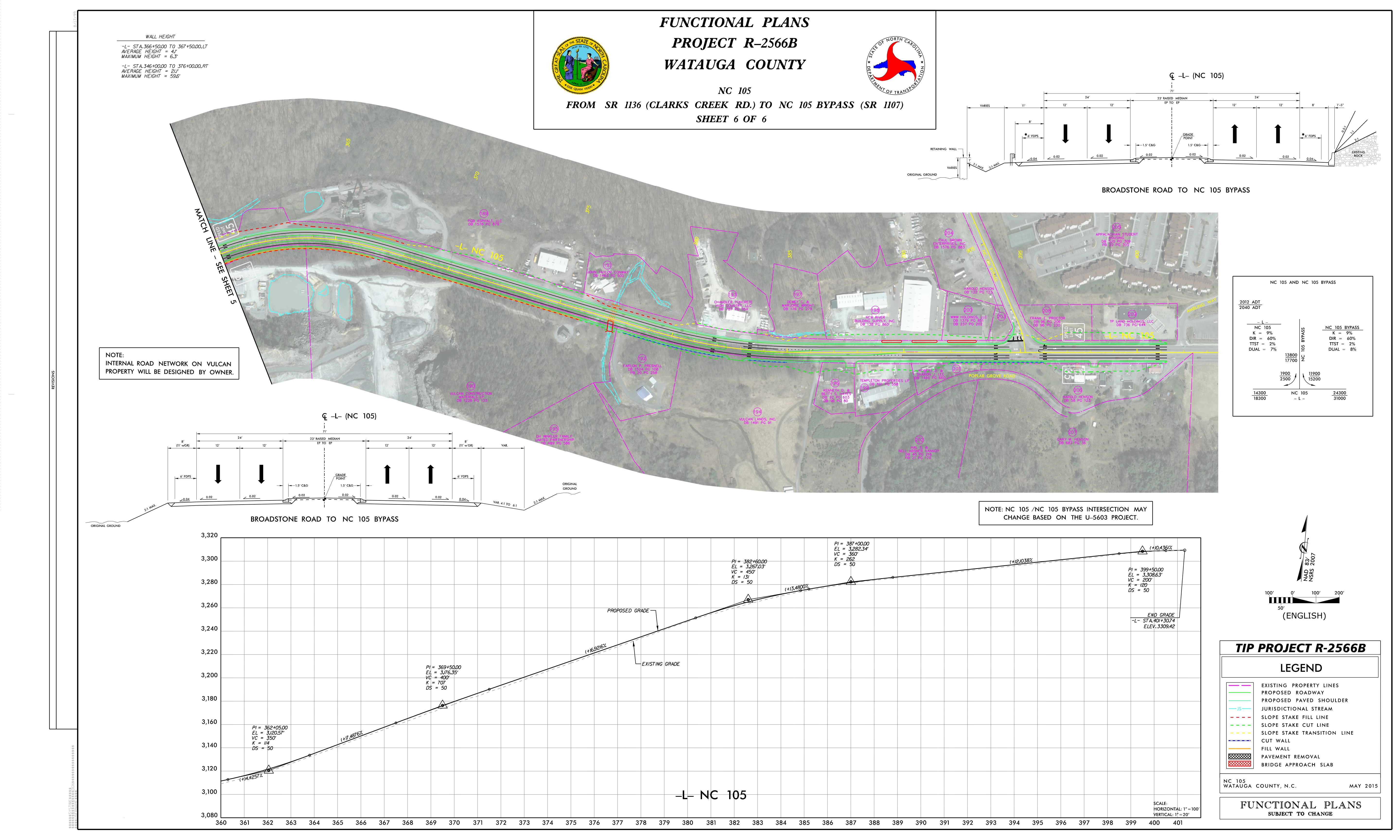
On Tuesday, June 16, officials with NCDOT held an informal meeting to allow motorists, residents and citizens to get more information about the proposed highway 105 widening project. Originally slated to include all of 105 from Linville to Boone, the project is now planned from Clarks Creek Road to 105 bypass in Boone.
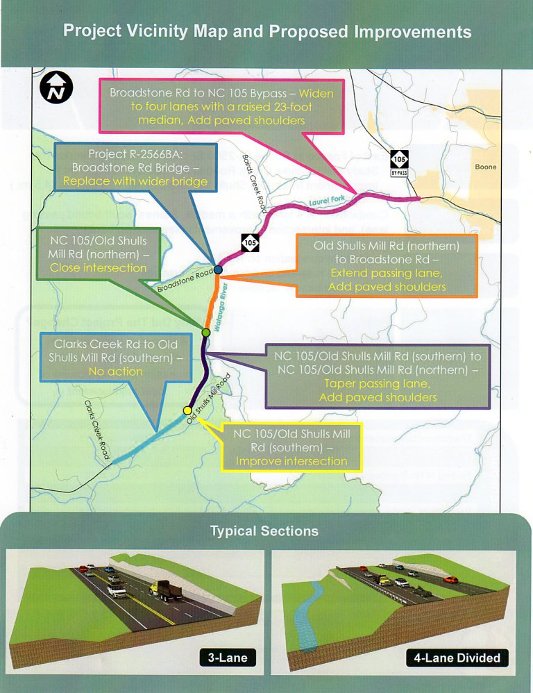
Among the projects notable items would be replacing the bridge at the traffic light to Broadstone Road/Valle Crucis. Believed to have been built in the 1950s, the bridge is also thought to be the tallest bridge in the county.
Michael PettyJohn, Division Engineer with NCDOT, tells WataugaRoads.com that a section of a new bridge would be built beside the existing one, then as traffic is turned onto the new structure the old bridge would be tore down and 2 more lanes added to the new bridge for a total of 4 lanes. There's still several years before that part of the project would get underway, as right of way acquisition is not scheduled until September 2018.
Another aspect of the project would be the closing to one of two entrances to Old Shull's Mill Road. The entrance on the northern side of 105, more commonly known to long time residents as the entrance near the old railroad cabooses, would be closed completely. Improvements to the southern entrance intersection would make it the primary entrance.
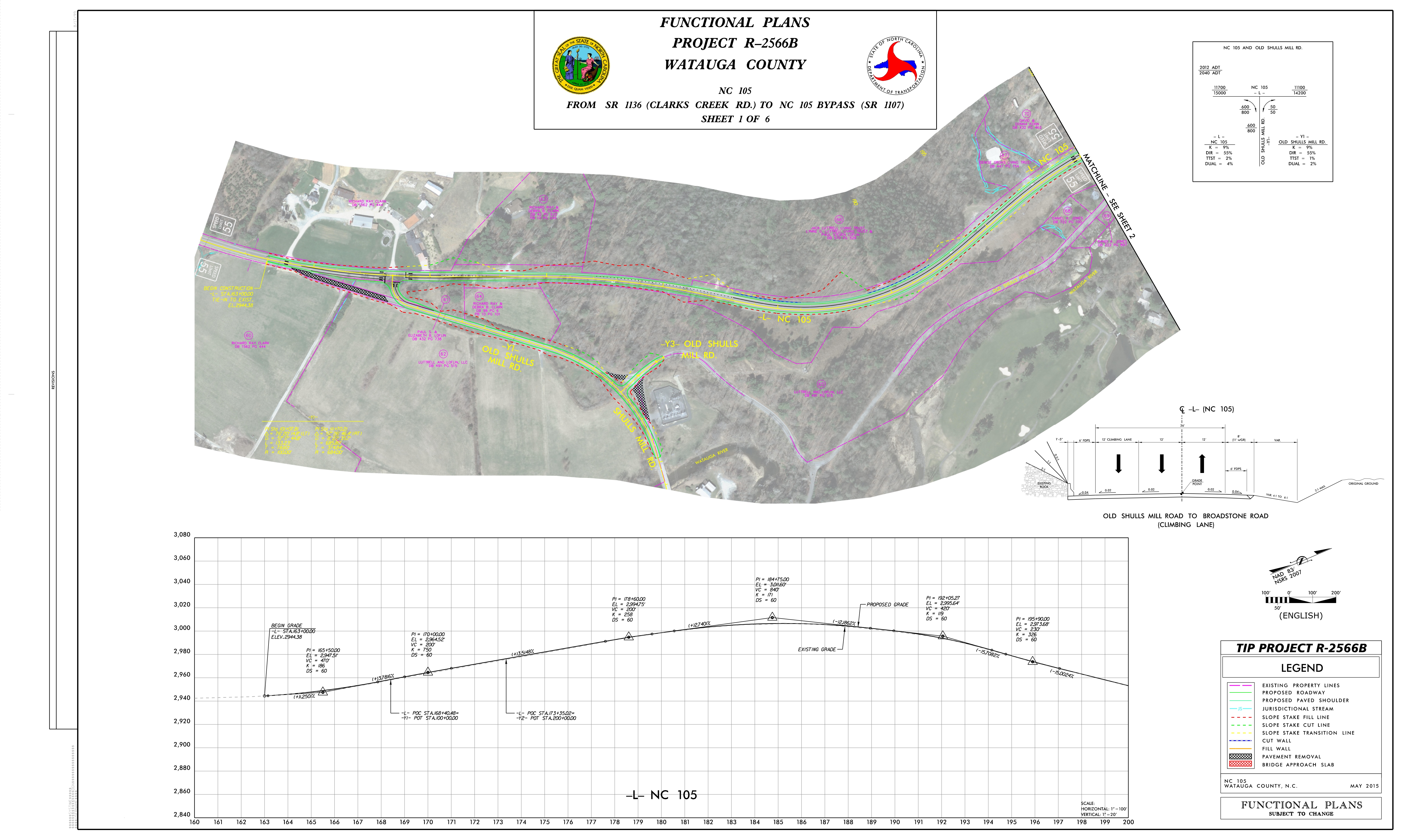
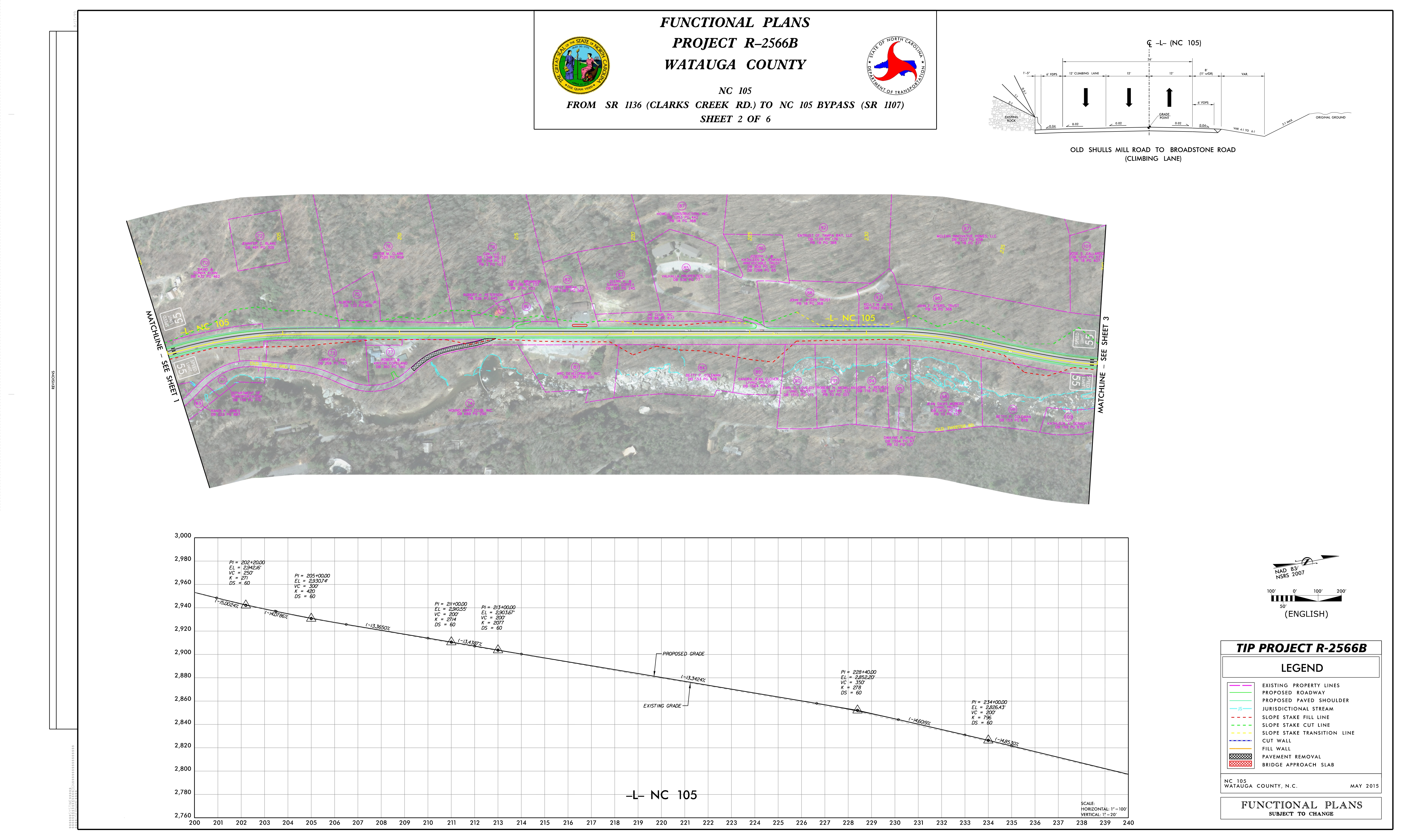
The section of road from Old Shull's Mill southern entrance to the Broadstone bridge would be widening to 3 lanes, while the section from the bridge to Boone would be 4 lanes.
Elmo Vance Jr., NCDOT Project Development Engineer, shared with WataugaRoads.com that the reason for the project being scaled back to not include Foscoe to Linville was due to traffic volumes had changed during studies. Vance says that DOT found the recession and the slowing of building in the area had lead to decreased traffic through those areas. He adds that though that section of Watauga and Avery had seen a decrease, it was also felt statewide too according to their studies.
The project schedule and more information below. Click on any image for a larger view that will open in a new window.
Information Guide & Maps: NCDOT. Click on any map for a larger view, map will open in a new window.