


Last Updated on February 5, 2020 7:27 am
GAZ010-017-NCZ033-048>053-058-059-062>065-501-503-505-507-509-
052100-
/O.NEW.KGSP.FF.A.0001.200205T2300Z-200207T0500Z/
/00000.0.ER.000000T0000Z.000000T0000Z.000000T0000Z.OO/
Rabun-Habersham-Avery-Madison-Yancey-Mitchell-Swain-Haywood-
Buncombe-Graham-Northern Jackson-Macon-Southern Jackson-
Transylvania-Henderson-Caldwell Mountains-Burke Mountains-
McDowell Mountains-Rutherford Mountains-Polk Mountains-
Including the cities of Clayton, Pine Mountain, Mountain City,
Cornelia, Baldwin, Demorest, Clarkesville, Hollywood, Ingalls,
Banner Elk, Newland, Faust, Mars Hill, Marshall, Walnut,
Allenstand, Hot Springs, Luck, Swiss, Burnsville, Celo,
Micaville, Ramseytown, Busick, Spruce Pine, Poplar, Alarka,
Almond, Bryson City, Luada, Wesser, Waynesville, Waterville,
Canton, Cruso, Cove Creek, Asheville, Robbinsville, Stecoah,
Cullowhee, Tuckasegee, Sylva, Franklin, Rainbow Springs, Kyle,
Highlands, Wolf Mountain, Cashiers, Brevard, Cedar Mountain,
Little River, Hendersonville, Fletcher, Dana, East Flat Rock,
Tuxedo, Etowah, Patterson, Jonas Ridge, Ashford, Sugar Hill,
Woodlawn, Old Fort, Chimney Rock State Park, and Saluda
420 AM EST Wed Feb 5 2020
…FLASH FLOOD WATCH IN EFFECT FROM THIS EVENING THROUGH THURSDAY
EVENING…
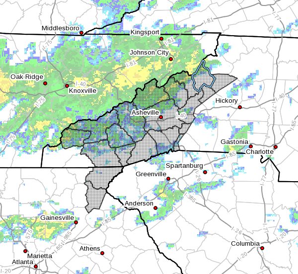
The National Weather Service in Greenville-Spartanburg has issued
a
- Flash Flood Watch for portions of northeast Georgia and
western North Carolina, including the following areas, in
northeast Georgia, Habersham and Rabun. In western North
Carolina, Avery, Buncombe, Burke Mountains, Caldwell
Mountains, Graham, Haywood, Henderson, Macon, Madison,
McDowell Mountains, Mitchell, Northern Jackson, Polk
Mountains, Rutherford Mountains, Southern Jackson, Swain,
Transylvania, and Yancey. - from this evening through Thursday evening
- The threat for heavy and/or excessive rainfall will be on the
increase tonight through Thursday. - Rapid rises on streams and creeks are likely to occur along with
the threat of flooded roads. Flooding is also likely to occur on
larger rivers which would linger through Friday. Storm total
rainfall through Thursday evening may be as much as 5 or 6
inches in favored locales across the Northeast Georgia and
Southern North Carolina Mountains.
PRECAUTIONARY/PREPAREDNESS ACTIONS…
Rainfall of more than five inches in similar storms has been
associated with an increased risk of landslides and rockslides. If
you live on a mountainside or in a cove at the base of a mountain,
especially near a stream, be ready to leave in advance of the
storm or as quickly as possible should rising water, moving earth,
or rocks threaten. Consider postponing travel along mountain roads
during the period of heavy rainfall.
A Flash Flood Watch means that conditions may develop that lead
to flash flooding. Flash flooding is a very dangerous situation.
You should monitor later forecasts and be prepared to take action
should Flash Flood Warnings be issued.


