Last Updated on January 9, 2024 11:44 am
NCC189-101200-
/O.NEW.KRNK.FA.W.0001.240109T1640Z-240110T1200Z/
/00000.0.ER.000000T0000Z.000000T0000Z.000000T0000Z.OO/
Watauga NC-
1140 AM EST Tue Jan 9 2024
…FLOOD WARNING IN EFFECT UNTIL 7 AM EST WEDNESDAY…
- WHAT…Flooding caused by excessive rainfall is expected.
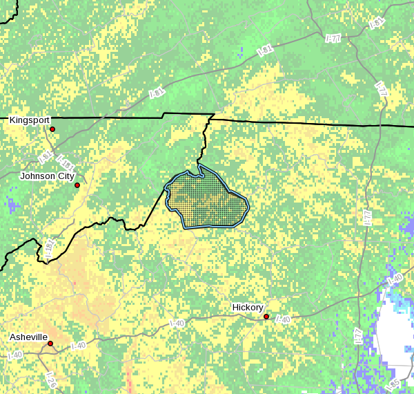
- WHERE…A portion of northwest North Carolina, including the
following county, Watauga. - WHEN…Until 700 AM EST Wednesday.
- IMPACTS…Flooding of rivers, creeks, streams, and other low-lying
and flood-prone locations is imminent or occurring. - ADDITIONAL DETAILS…
- At 1139 AM EST, Doppler radar and automated rain gauges
indicated heavy rain. Flooding is ongoing or expected to
begin shortly in the warned area. Between 1.5 and 2 inches of
rain have fallen. - Additional rainfall amounts of 1.5 to 2 inches are possible
in the warned area, with localized higher amounts. - Some locations that will experience flooding include…
Boone, Blowing Rock, Beech Mountain, Sugar Grove, Foscoe,
Todd and Deep Gap. - http://www.weather.gov/safety/flood
PRECAUTIONARY/PREPAREDNESS ACTIONS…
Turn around, don't drown when encountering flooded roads. Most flood
deaths occur in vehicles.
In hilly terrain there are hundreds of low water crossings which are
potentially dangerous in heavy rain. Do not attempt to cross flooded
roads. Find an alternate route.


