Last Updated on July 16, 2024 6:32 pm
Flood Advisory
National Weather Service Blacksburg VA
625 PM EDT Tue Jul 16 2024
…Flood Advisory In Effect for Watauga County until 930 PM EDT This
Evening…
NCC189-170130-
/O.NEW.KRNK.FA.Y.0050.240716T2225Z-240717T0130Z/
/00000.N.ER.000000T0000Z.000000T0000Z.000000T0000Z.OO/
Watauga NC-
625 PM EDT Tue Jul 16 2024
…FLOOD ADVISORY IN EFFECT UNTIL 930 PM EDT THIS EVENING…
- WHAT…Minor flooding caused by excessive rainfall associated with
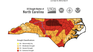
thunderstorms is expected. - WHERE…Watauga County in northwest North Carolina.
- WHEN…Until 930 PM EDT.
- IMPACTS…Overflowing poor drainage areas. Ponding of water in
urban or other areas is occurring or is imminent. - ADDITIONAL DETAILS…
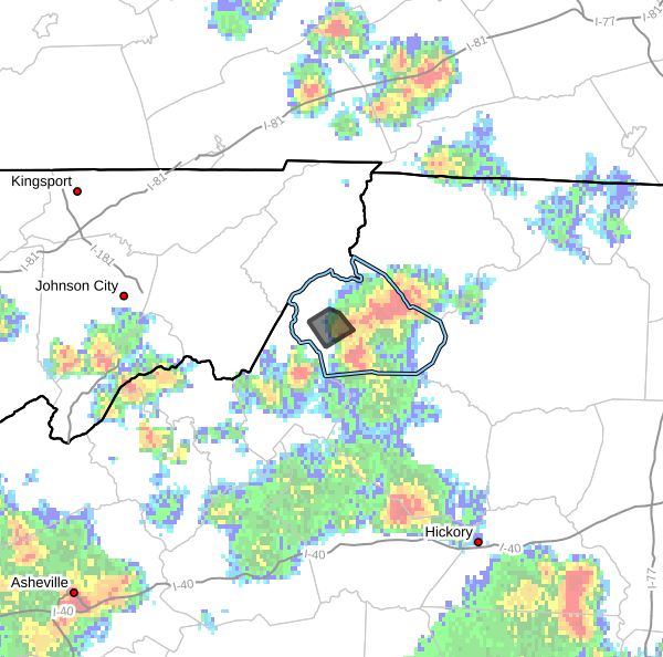
- At 625 PM EDT, Doppler radar indicated heavy rain due to
thunderstorms in central Watauga county between Rominger,
Sugar Grove, Boone, and VAlle Crucis. Minor flooding may
result in areas of overflowing poor drainage. Between 1.5
and 2.5 inches of rain have fallen during the past hour or so
and an additional 1.5 to 2.5 inches of rain is possible
during the next 30 minutes to an hour. - Flooding is most likely in the Rominger, Valle Crucis, and
Sugar Grove areas.
This includes the following streams and drainages… Laurel Fork, Cove Creek, Watauga River, Brushy Fork,
Craborchard Creek, George Gap Branch, Dutch Creek and Laurel
Creek. Additional rainfall amounts of 1.5 to 2 inches are expected
over the area. This additional rain will continue the threat
for minor to possibly moderate flooding in normally flood
prone and low-lying areas. - Some locations that will experience flooding include…
Sugar Grove… Valle Crucis…
Rominger… Lovill… - For additional information please go to our web site located
at http://www.weather.gov/safety/flood
PRECAUTIONARY/PREPAREDNESS ACTIONS…
Precuation and Preparedness Statements: In hilly terrain there are
hundreds of low water crossings which are potentially dangerous in
heavy rain. Do not attempt to cross flooded roads. Find an alternate
route.
When it is safe to do so, please send your reports of flooding,
including mudslides or flooded roads, to the National Weather
Service by calling toll free at 1…8 6 6…2 1 5…4 3 2 4. Reports
and pictures can also be shared on the National Weather Service
Blacksburg Facebook page and on Twitter.