Last Updated on January 1, 2022 1:01 pm
Lost Cove Fire Update January 1, 2022 from US Forest Service
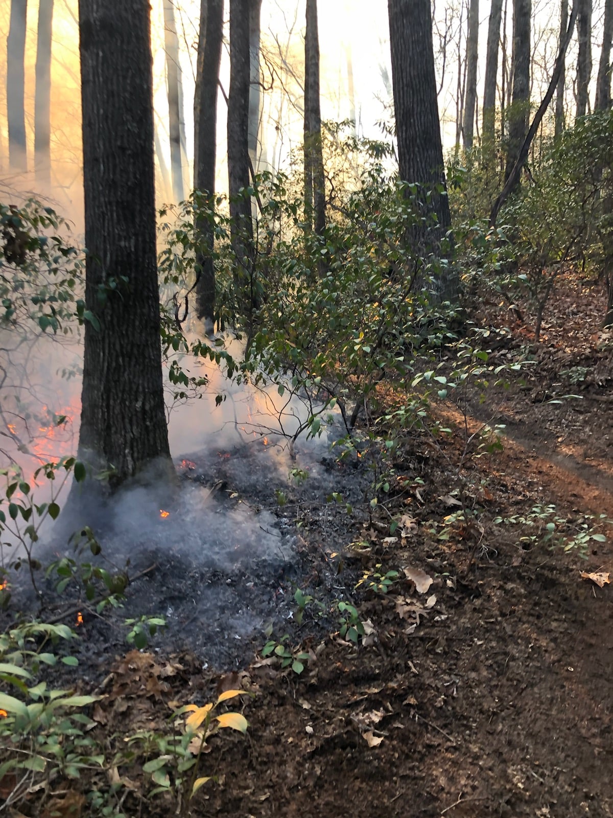
Light rain and humid conditions over the last two days allowed firefighters to continue progress containing the Lost Cove fire, which remains at an estimated 1,000 acres and is now 80% contained. The fire has burned to the containment lines throughout much of the fire area, and only minimal interior hot spots remain where large, downed trees continue to burn.
Firefighters are continuing to monitor the fire throughout the weekend. The public can expect to see a small amount of smoke interior to the fire area, especially in the afternoons as warm temperatures dry the fuels. At this time, there are no concerns for the fire escaping the containment area. This will be the last operational update for the Lost Cove Fire.
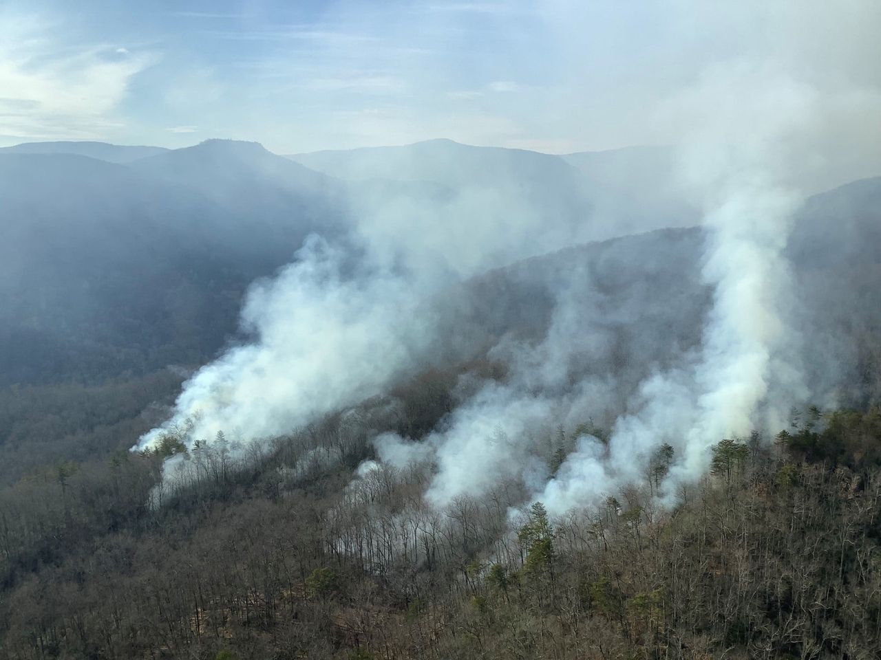
The fire, which started on Christmas Eve, is burning in the Wilson Creek watershed on the US Forest Service Grandfather Ranger District in Avery County, NC. The fire began in a remote part of the Lost Cove Wilderness Study Area near Bee Mountain. Firefighters responded quickly on Christmas Eve, building firelines on the northwest side of the fire to protect 6 homes in the community of Roseboro. Much of the initial firefighting efforts focused on ensuring this fireline held to protect private property. No structures were damaged or lost. On the south and east sides, the fire slowly backed down Timber Ridge to Lost Cove and Gragg Prong Creeks, where the wet creek valleys provided natural containment lines. Much of the 1,000-acre fire area burned with low intensity, removing leaf litter and fuels and minimizing loss of overstory trees.
Emergency closures remain in place for the Huntfish Falls Trail (TR #263), Darkside Cliffs Trail (TR #272), Lost Cove Loop Trail (TR #262) and the Timber Ridge Trail (TR #261), including the sections of the Mountains to Sea Trail that follow Gragg Prong between Roseboro and Pineola Roads. Closures will remain in place at least through the weekend, and an additional update will be provided when fire managers lift the closure.
12 firefighters from the US Forest Service remain on scene this weekend. The response effort is supported by local fire departments from Collettsville and Linville, as well as the North Carolina Forest Service. We would like to extend gratitude to all the firefighters who responded over Christmas, New Years, and throughout the holidays, as well as their families and friends who sacrificed time with loved ones.
The cause of the Lost Cove Fire remains under investigation.
Lost Cove Fire Update December 30, 2021 from US Forest Service
Much needed rain was received on the Lost Cove Fire overnight, which remains at an estimated 1,000 acres and 60% contained. The fire, which started on Christmas Eve, is burning in the Wilson Creek watershed on the US Forest Service Grandfather Ranger District in Avery County, NC.
Approximately 0.2 inches of rain was received over the fire area in the last 24 hours. While not enough to fully extinguish the flames, this significant rainfall allowed the firefighters to shift focus to monitoring and “mopping up” hot spots along the firelines. The Lost Cove Fire has burned much of the area between Lost Cove Creek and Gragg Prong to the south and east and the fireline protecting the Roseboro community to the north and west. Some pockets of fuels remain in the fires interior, where the low intensity fire left a mosaic of burned and unburned areas in the most remote parts of the Lost Cove Wilderness Study Area.
In addition to on-the-ground firefighters, fire managers are using an unmanned aircraft system (UAS, or drone) to assist with reconnaissance and monitoring of the fire area. This firefighting tool has been particularly helpful in the remote terrain and can fly even in rainy conditions where manned air operations are not feasible. Today, the UAS will provide infrared video to allow fire managers to map hot spots within the fire area. This information will help focus operations going into the drier weather predicted over the next two days.
Emergency closures remain in place for the Huntfish Falls Trail (TR #263), Darkside Cliffs Trail (TR #272), Lost Cove Loop Trail (TR #262) and the Timber Ridge Trail (TR #261), including the sections of the Mountains to Sea Trail that follow Gragg Prong between Roseboro and Pineola Roads. The public is asked to avoid recreating in the Lost Cove Wilderness Study Area until the fire is fully contained.
13 firefighters from the US Forest Service are responding. The response effort is supported by local fire departments from Collettsville and Linville, as well as the North Carolina Forest Service. The cause of the Lost Cove Fire remains under investigation.
Update 11:41 am Wednesday, December 29 – Below is an update from the U.S Forest Service.
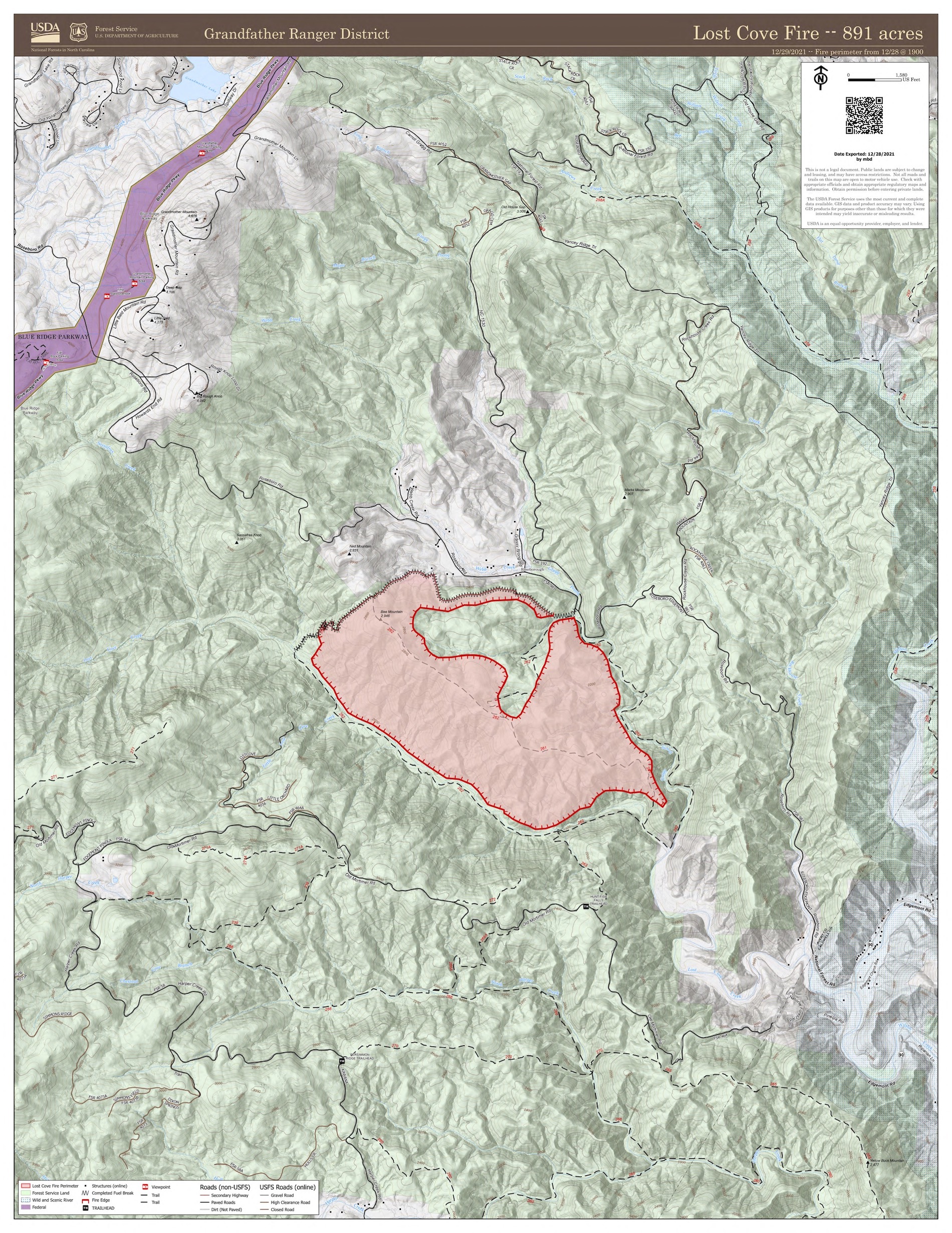
Firefighters increased containment of the Lost Cove Fire, which is now estimated at 1,000 acres and 60% contained.
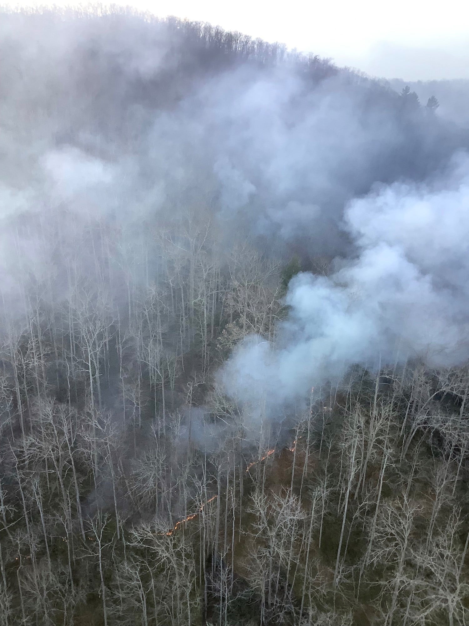
The Lost Cove Fire has now backed down to Lost Cove Creek and Gragg Prong within the Lost Cove Wilderness Study Area. These creeks provide containment lines on the south and east side of the fire. The fire continues to burn through the leaf litter within the containment area with low intensity. In using the creeks as containment lines, fire managers are working to minimize impacts of fire suppression within the Lost Cove Wilderness Study Area. This indirect method of firefighting keeps firefighters out of direct danger from the fire front, as well as reduces the need for construction of new firelines within the sensitive Wilson Creek watershed.
Yesterday, firefighters continued to improve the fireline on the northwest side of the fire to protect private property near the Roseboro community. This included limited burn out operations to remove any remaining fuel between the active fire and the fireline. Fire managers monitored the fire as it backed into the drainages for Lost Cove Creek and Gragg Prong.
Today, firefighters are patrolling and monitoring the fire perimeter. Some light rain fell on the fire area overnight, and additional rainfall may occur later in the day. The outlook of firefighting operations beyond today will depend on if enough rainfall occurs to fully extinguish the flames.
14 firefighters from the US Forest Service are responding. The response effort is supported by local fire departments from Collettsville and Linville, as well as the North Carolina Forest Service. The cause of the Lost Cove Fire remains under investigation.
Emergency trail closures remain in place for the Huntfish Falls Trail (TR #263), Darkside Cliffs Trail (TR #272), Lost Cove Loop Trail (TR #262) and the Timber Ridge Trail (TR #261), including the sections of the Mountains to Sea Trail that follow Gragg Prong between Roseboro and Pineola Roads. The public is asked to avoid recreating in the Lost Cove Wilderness Study Area until the fire is fully contained.
Map of fire area:
Update 10:22 am Tuesday, December 28 – Below is an update from the U.S Forest Service.
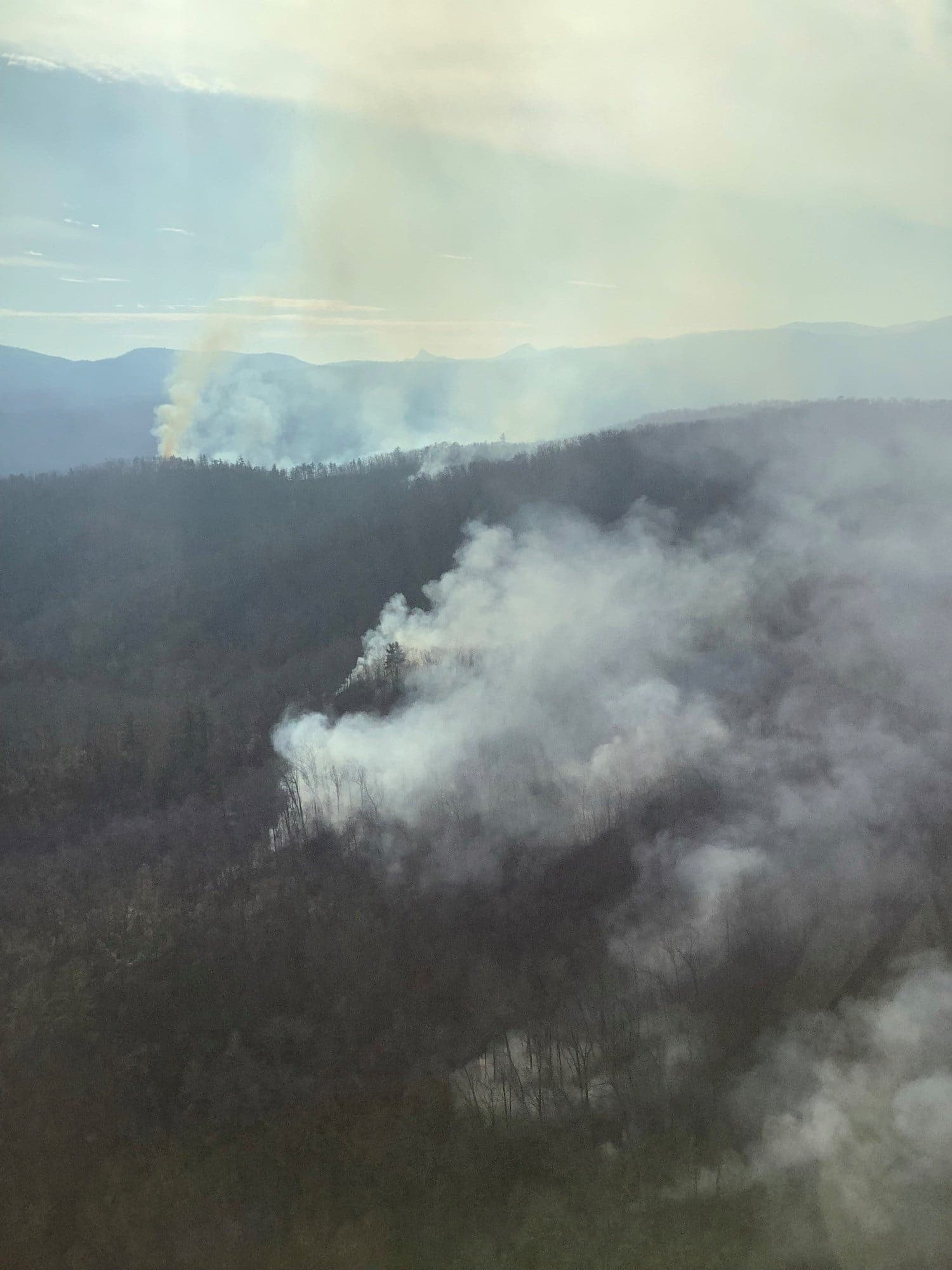
The Lost Cove fire grew to an estimated 700 acres as the fire spread with low intensity within the Lost Cove Wilderness Study area. The fire is burning in the Wilson Creek watershed on the US Forest Service Grandfather Ranger District in Avery County, NC. Containment remains at 20%.
The Lost Cove fire began near Bee Mountain in a remote part of the Lost Cove Wilderness Study Area, 10 miles southeast of the town of Linville, NC. The fire, which was reported on Christmas Eve, is now backing downhill from Timber Ridge to the south and east.
Firefighting efforts thus far have focused on securing the fireline on the northwest side of the fire to protect private property near the Roseboro community. As the fire spreads within the Wilderness Study Area, firefighters are continuing to monitor and improve that fireline. Fire managers are monitoring the fire as it backs down to Lost Cove Creek and Gragg Prong, which will provide containment lines to the south and east.
Higher humidity conditions have moderated fire behavior, and the fire is primarily burning through leaf litter at low to moderate intensities. Increases in acreage as of this update are due to not only to this fire spread, but improved mapping of the fire perimeter. The fire is expected to continue to grow within the Lost Cove Wilderness Study Area until significant rain is received. No homes or structures are threatened.
Emergency closures remain in place for the Huntfish Falls Trail (TR #263), Darkside Cliffs Trail (TR #272), Lost Cove Loop Trail (TR #262) and the Timber Ridge Trail (TR #261), including the sections of the Mountains to Sea Trail that follow Gragg Prong between Roseboro and Pineola Roads. The public is asked to avoid recreating in the Lost Cove Wilderness Study Area until the fire is fully contained.
18 firefighters from the US Forest Service are responding. The response effort is supported by local fire departments from Collettsville and Linville, as well as the North Carolina Forest Service. The cause of the Lost Cove Fire remains under investigation.
Photos courtesy of Kenny Frick, USFS
Update 11:43 am Monday, December 27 – Below is an update from the U.S Forest Service.
FIRE UPDATE! Firefighters worked throughout the weekend to secure firelines on the Lost Cove Fire burning in the Wilson Creek area on the US Forest Service Grandfather Ranger District in Avery County, NC. Containment of the fire is now at 20%.
The fire is located near Bee Mountain in a remote part of the Lost Cove Wilderness Study Area, 10 miles southeast of the town of Linville, NC. The fire, which was reported on Christmas Eve, remains at approximately 350 acres.
Firefighting efforts were helped yesterday by a brief period of light rainfall as well as higher humidity. These moderating conditions allowed firefighters to complete fireline construction to protect private property near the Roseboro community. Minimal fire growth occurred Sunday. The fire is expected to continue to burn at low intensities to the south and east along Timber Ridge in the Lost Cove Wilderness Study Area until significant rain is received.
The following trails remain closed:
Timber Ridge Trail (TR #261)
Lost Cove Loop Trail (TR #262)
Huntfish Falls Trail (TR #263)
Darkside Cliffs Trail (TR #272)
The Mountains to Sea Trail along Gragg Prong between Roseboro and Pineola Roads.
20 firefighters from the US Forest Service are responding. The public is asked to avoid recreating in the Lost Cove Wilderness Study Area until the fire is fully contained.
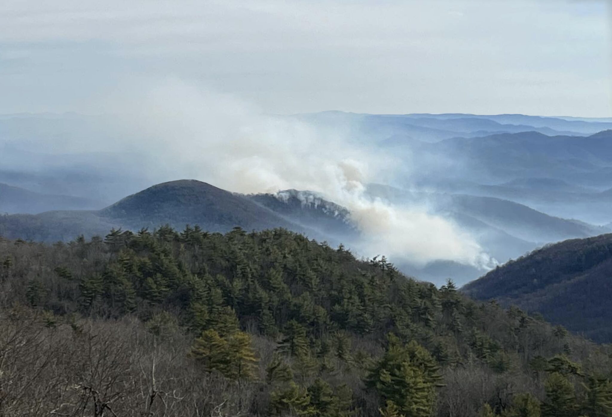
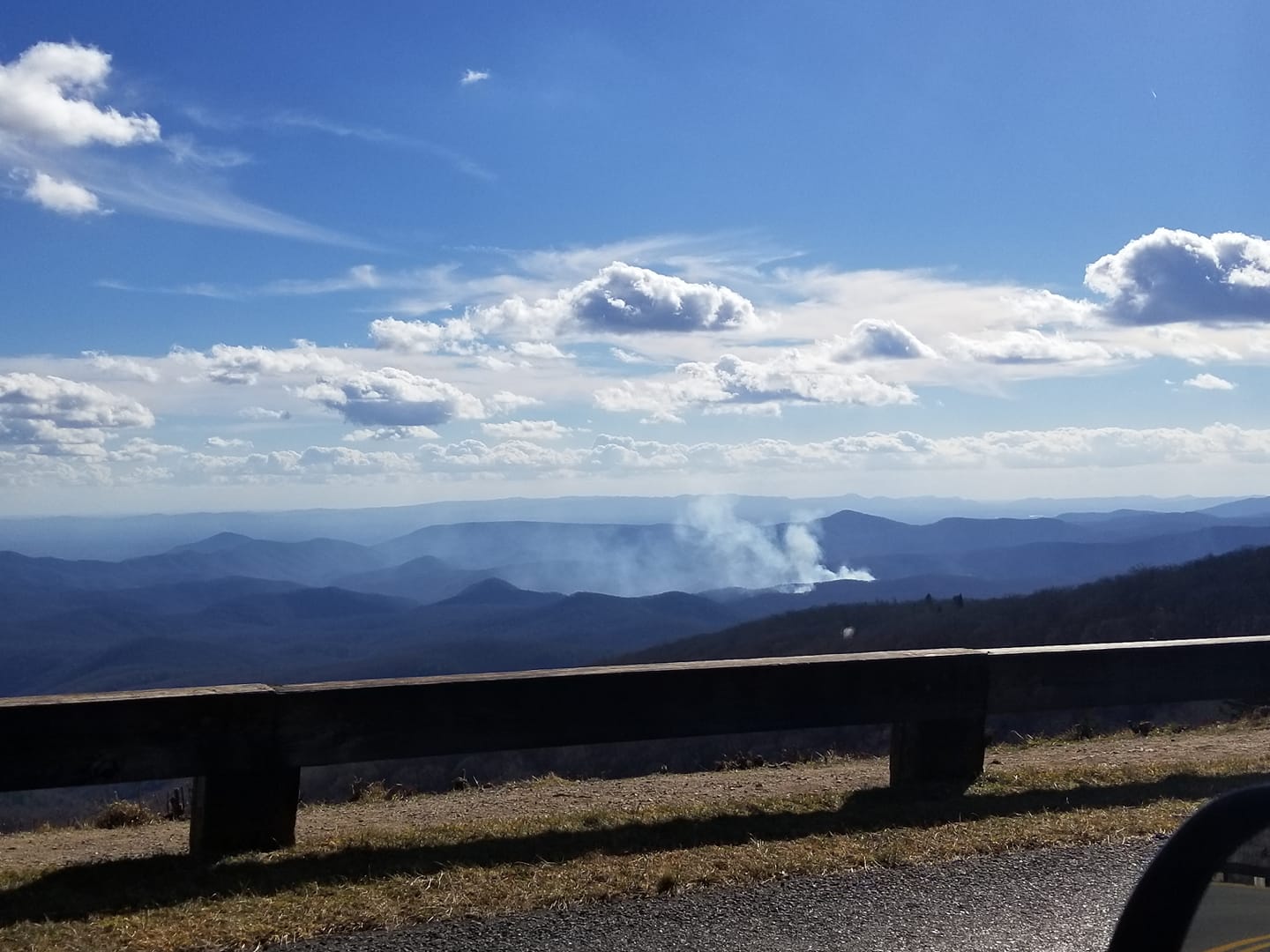
A look at the smoke from the Roseboro area (Avery County) fire from the Blue Ridge Parkway. Photo: Doug Davis.
Update 10:53 am Sunday, December 26 – The fire is estimated at 350 acres and 10% contained, according to the U.S Forest Service.
“As firefighters focus on protecting resources on the northwest end of the fire, the fire is expected to continue to burn to the south and east into the Lost Cove Wilderness Study Area along Timber Ridge. 20 firefighters from the US Forest Service and North Carolina Forest Service are responding. The response effort is supported by local fire departments from Collettsville and Linville.”, the agency said on Sunday morning.
The cause of the Lost Cove Fire is under investigation but is suspected to be human caused, the agency also said.
The following trails are closed:
Timber Ridge Trail (TR #261)
Lost Cove Loop Trail (TR #262)
Huntfish Falls Trail (TR #263)
Darkside Cliffs Trail (TR #272)
The Mountains to Sea Trail along Gragg Prong between Roseboro and Pineola Roads.
Photo by Chris Brubaker, US Forest Service
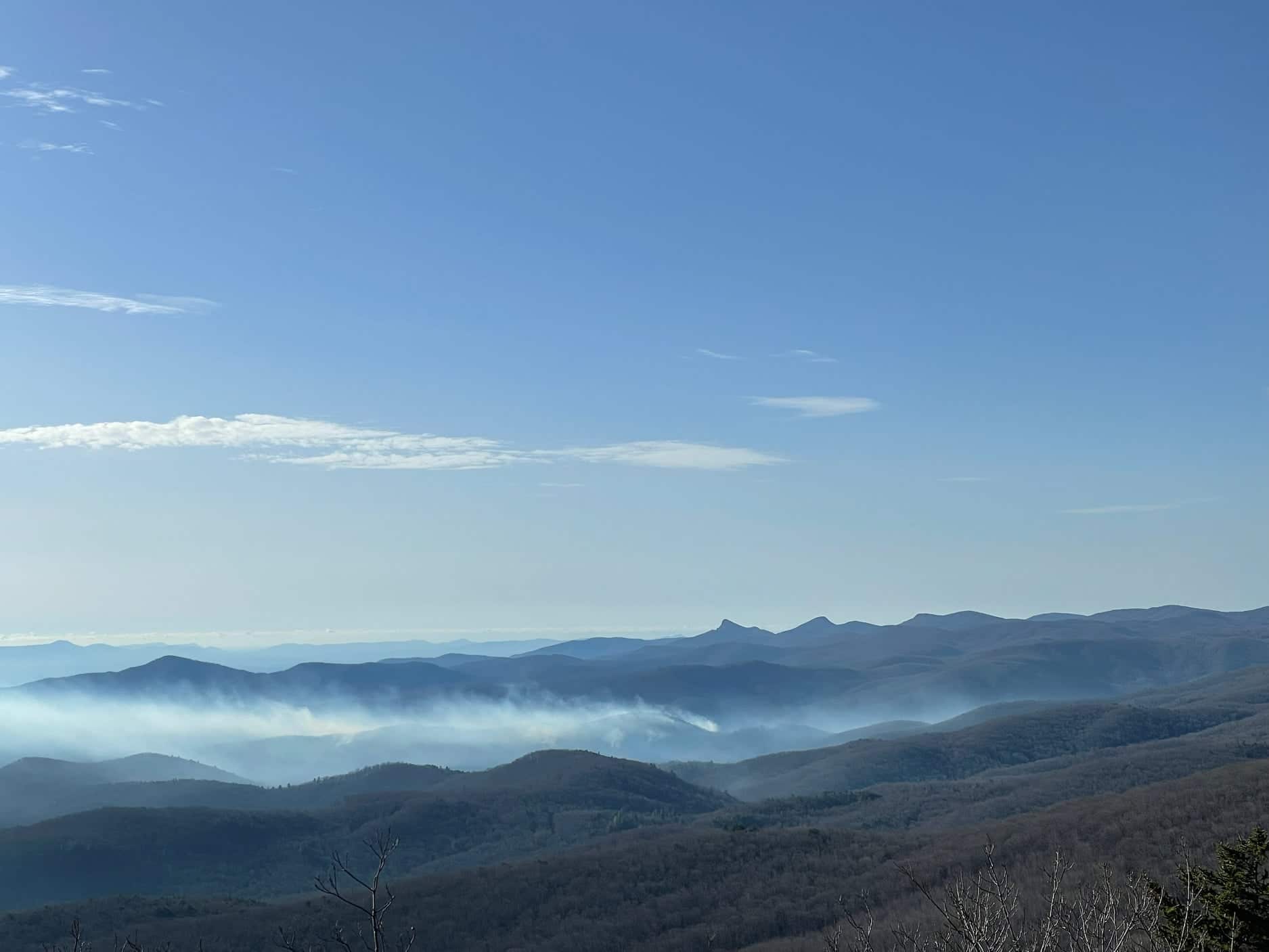
Photo by Nick Massey
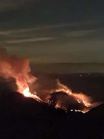
Photo by Greg Philipp, US Forest Service
Update 7:50 pm Saturday, December 25, 2021 – The fire has grown to over 300 acres and it is not known how much of the fire is contained as of this update.
WataugaOnline.com will continue to update as more information becomes available.
Update 11:38 am Saturday December 25, 2021 from Linville Fire Department:
Linville fire units monitored the fire overnight and had equipment on scene to protect residents and their homes. US Forest Service units returned to the scene this morning. The fire has spread overnight, but as of this morning it was not immediately threatening any homes, which is our primary concern. We are continuing to monitor the increasing winds and the fire’s condition.
Friday December 23, 2021 – Fire crews from several departments have been on the scene today of a large woods fire in Avery County.
The fire is on the Parkway side of Grandfather Mountain in the Roseboro area, according to Linville Fire Department. The department said to expect smoke in the area, in a Facebook post at 1:27 pm.
Fire crews from Watauga, Caldwell, Avery and Burke attempted to find the location of the fire this morning, before finally being able to pinpoint the location due to the heavy smoke.
Avery County 911 Communications posted on Facebook at 3:11 pm, “Please know that there is going to be large air craft in the area of Linville. Pulling water out of large ponds and lakes to help with putting out a large brush fire in the Pisgah National Forest. There will also could be a lot of smoke in the county due to this fire.”
The fire is roughly 40 acres in size and is mostly, if not all, on U.S Forest Service land as of this evening.
Fire crews will remain on the scene overnight.
WataugaOnline.com will update as more information becomes available.
Photo: Linville Fire Department