


Last Updated on August 15, 2013 8:46 pm
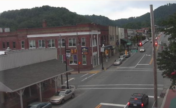
On August 13, 2013 the Watauga Roads facebook shared a picture of the 1940s flood in downtown Boone. Below are two comparisons of how that same area looks 73 years and two days apart.
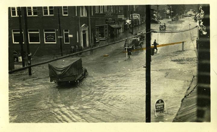
Information and picture courtesy of James Lewis “Seventy-three years ago today, the rain soaked mountains slumped under a deluge of rain and 16 souls in Watauga County perished. A few days ago, the late photographer Paul Weston's niece brought by a collection of photos her uncle took that memorialize those dark days. This is one showing King Street in downtown Boone.”
Aug 13, 1940
Aug 15, 2013 via http://wataugaroads.com/cams/


RT @RadioMediaGuy: Downtown Boone Aug 1940, Downtown Boone Aug 2013: http://t.co/gpX0N8V38E
As I was told, the water was in the fork of that huge tree that used to sit between Blairmont and the Moose Lodge. That’s a good 10-20 feet above current road level.
RT @WataugaRoads: Downtown Boone Aug 1940, Downtown Boone Aug 2013: http://t.co/44VQwX4Ndk
This does not accurately show the horrible traffic there today!!