
Maps
[mappress mapid=”68″]
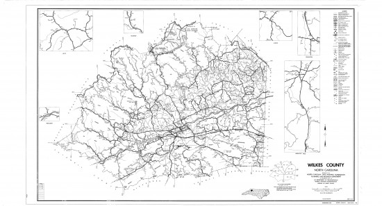
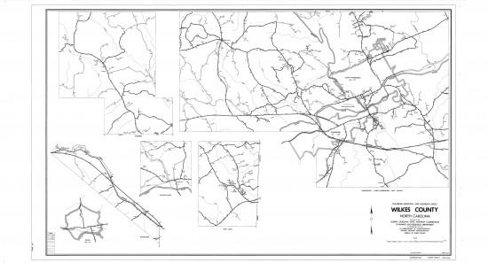
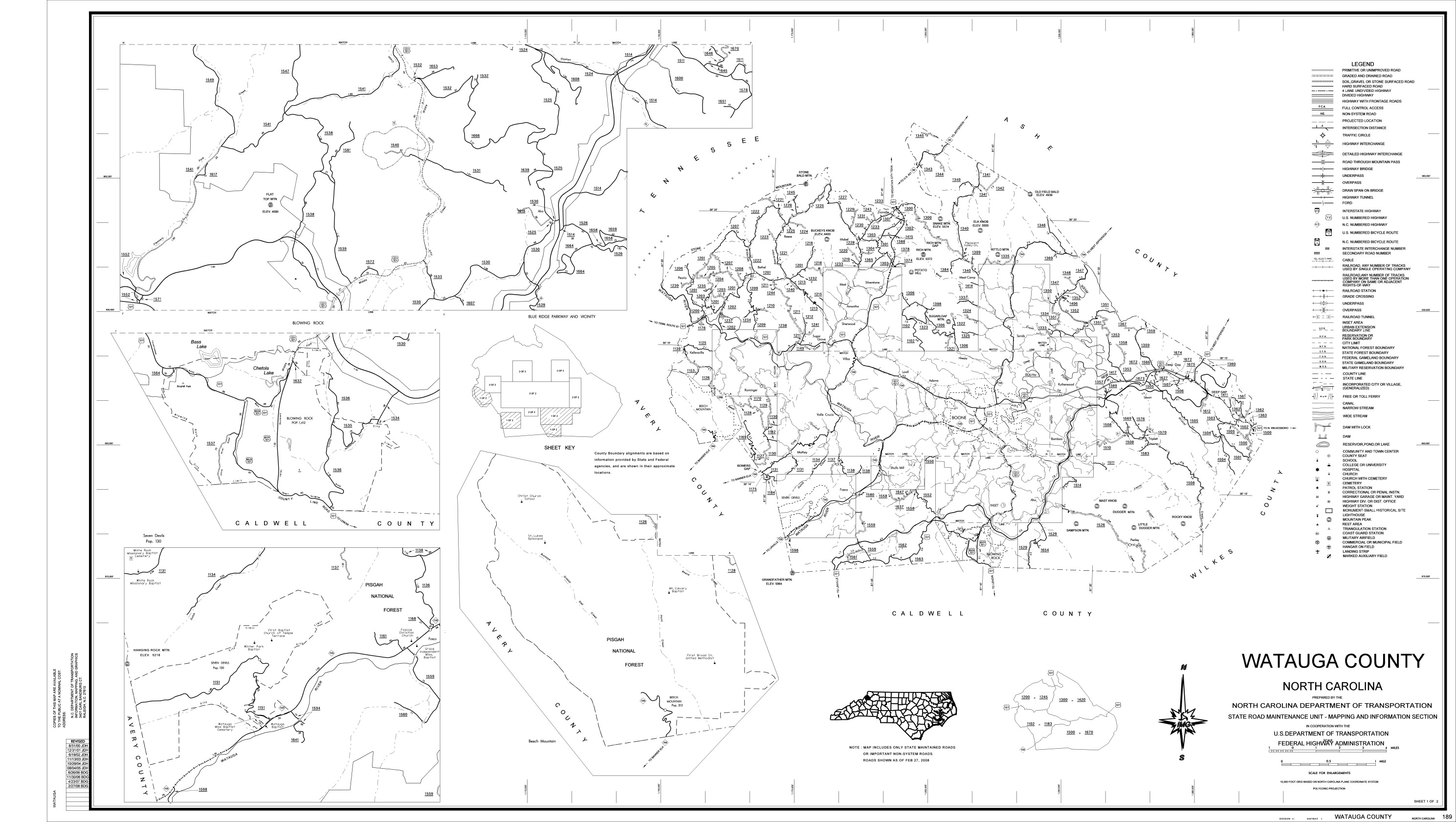
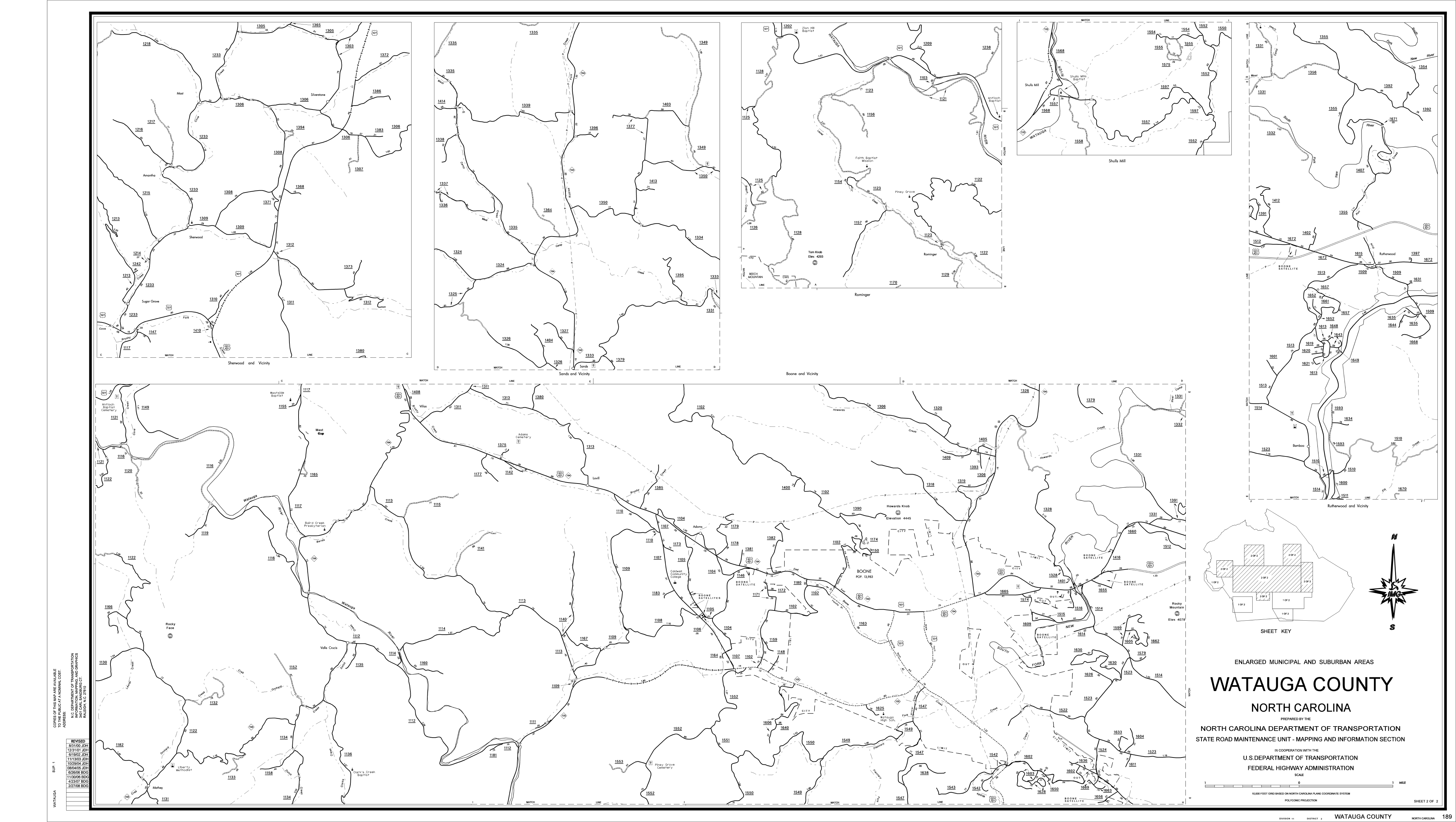
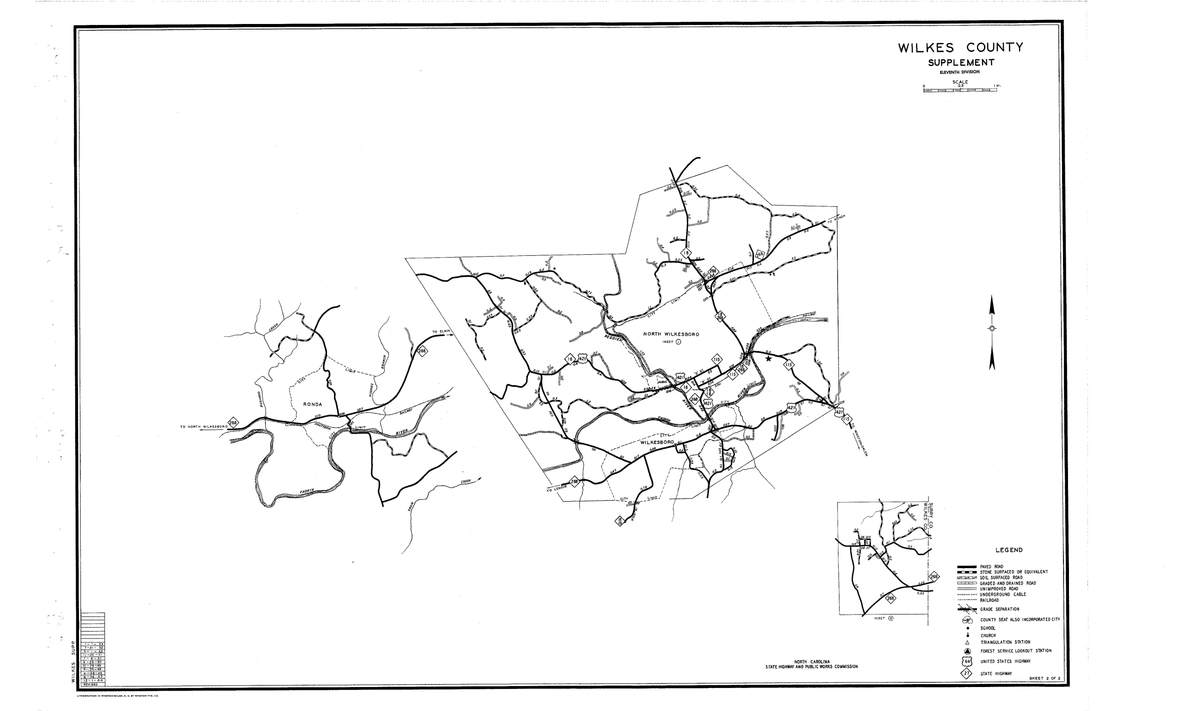
The current official NCDOT County Maintenance Maps *as of April 8, 2013*. Map 1 shows the entire county. Each supplemental sheet shows area insets, usually congested areas.
Watauga Bridge Locations
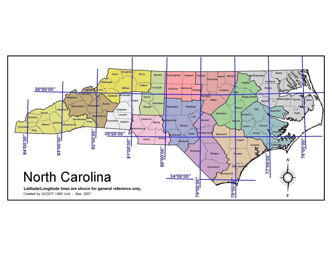
NC Latitude & Longitude
Blue Ridge Parkway

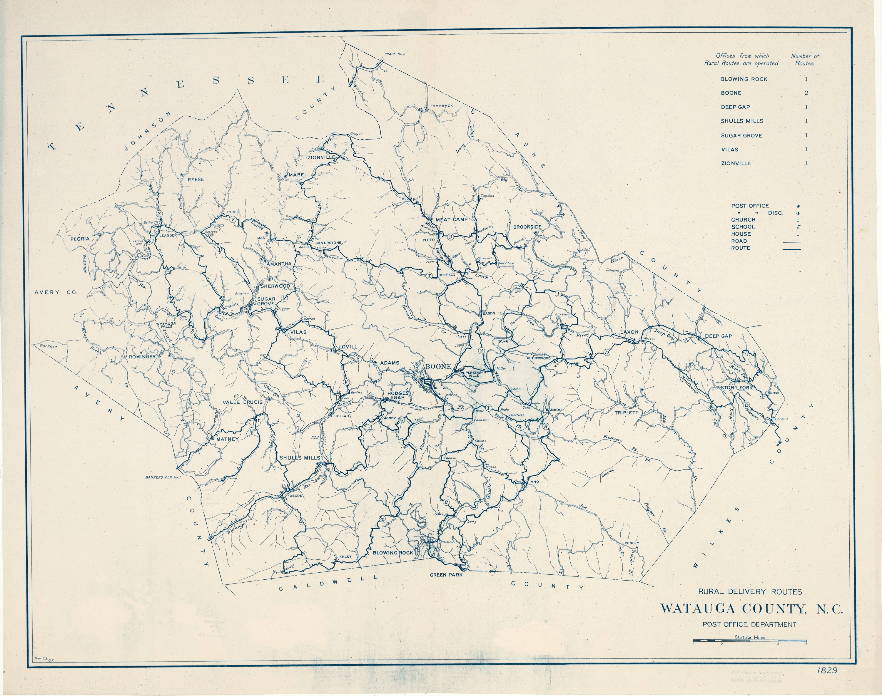
Rural Delivery Route Map circa 1920s from http://dc.lib.unc.edu/cdm/ref/collection/ncmaps/id/1759
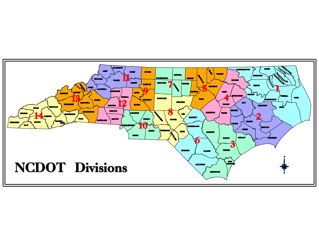
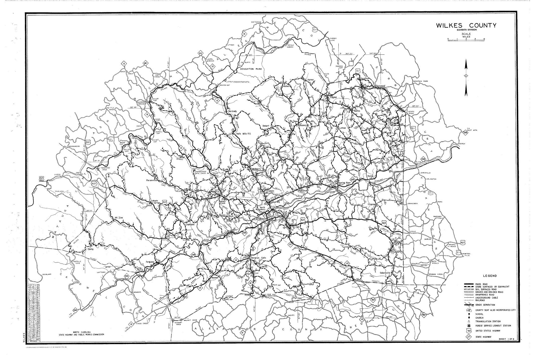
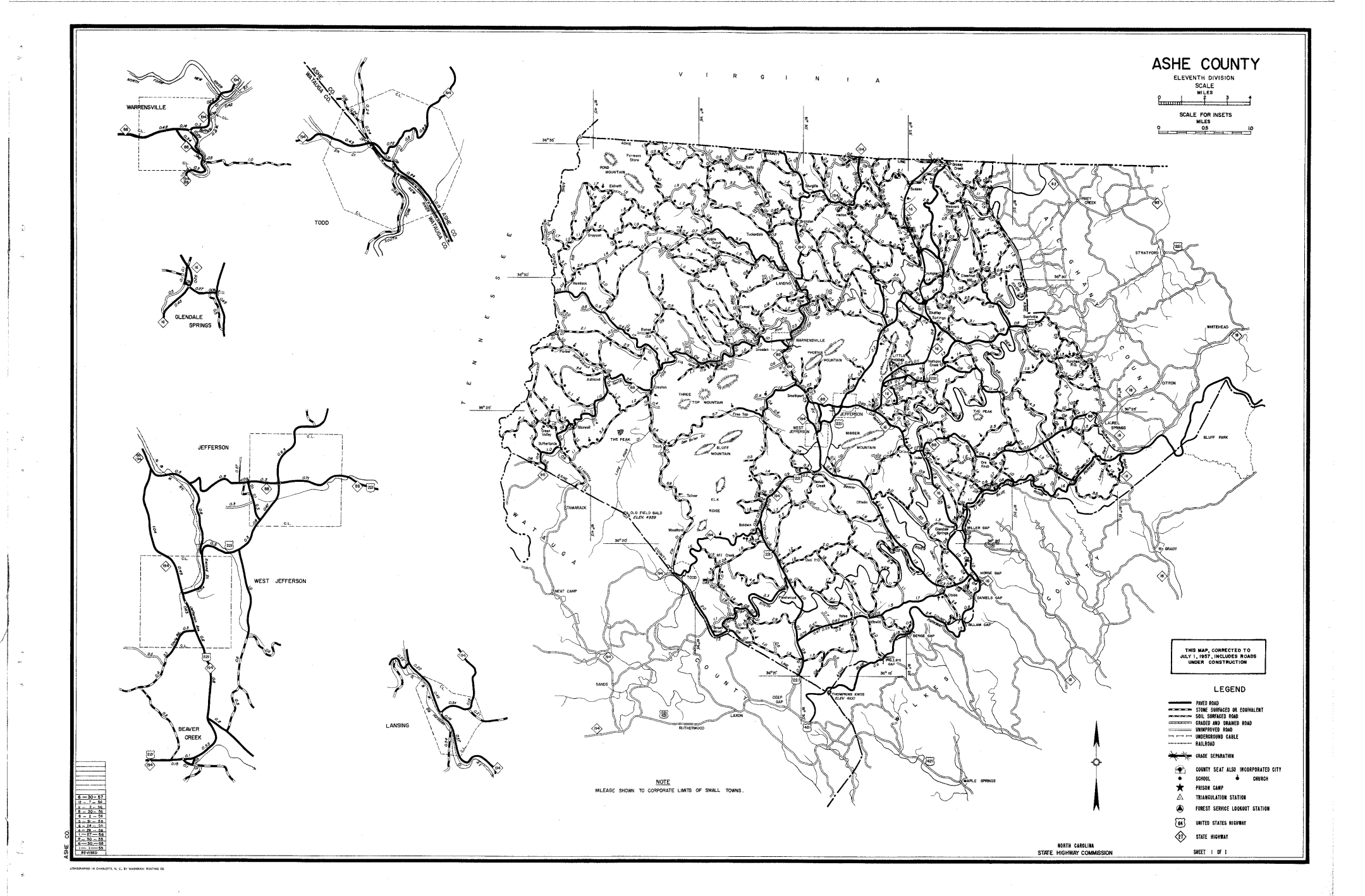
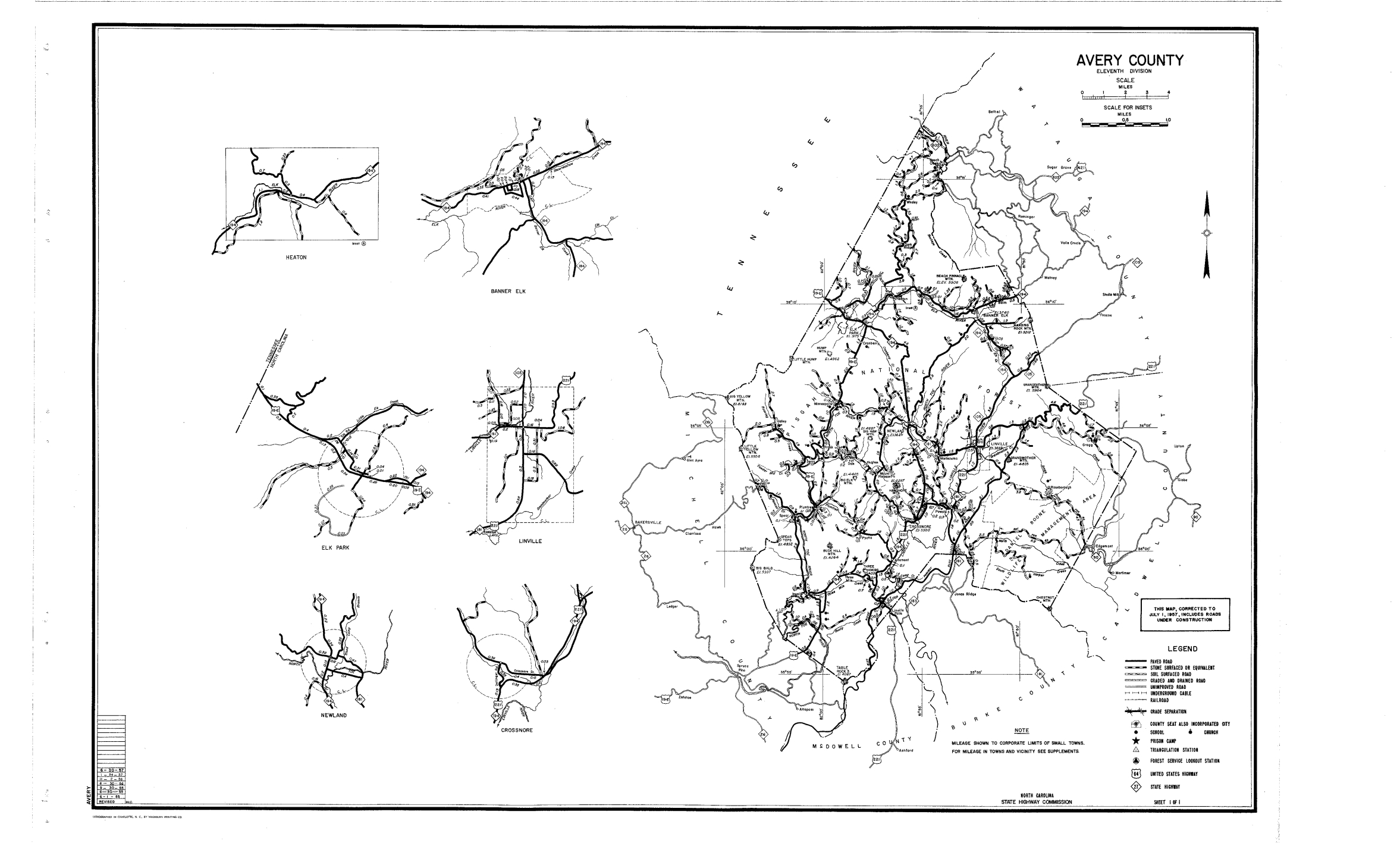
Maps from NCDOT:
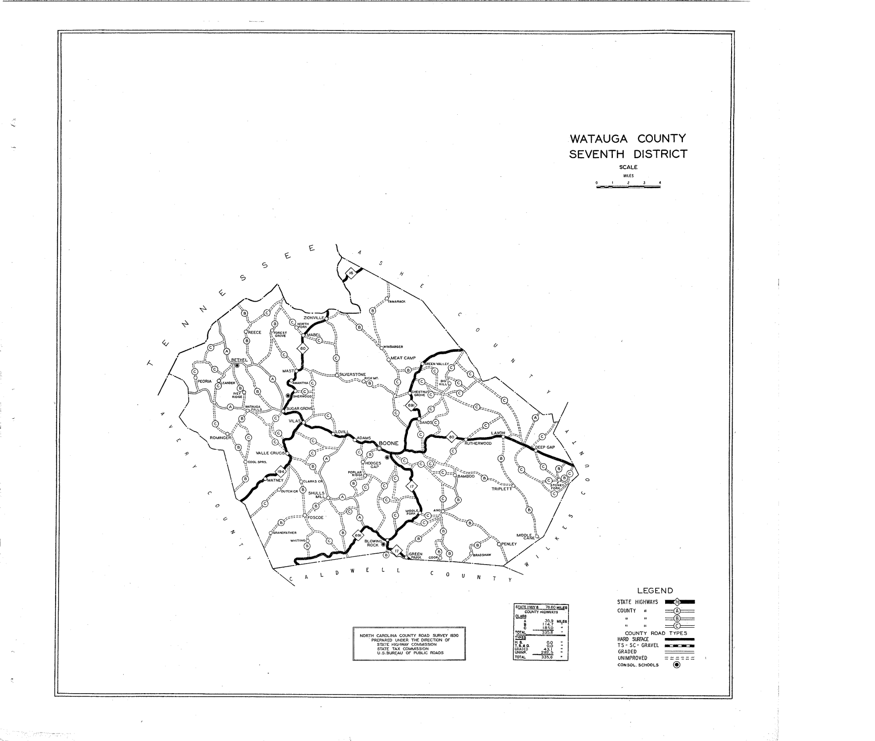
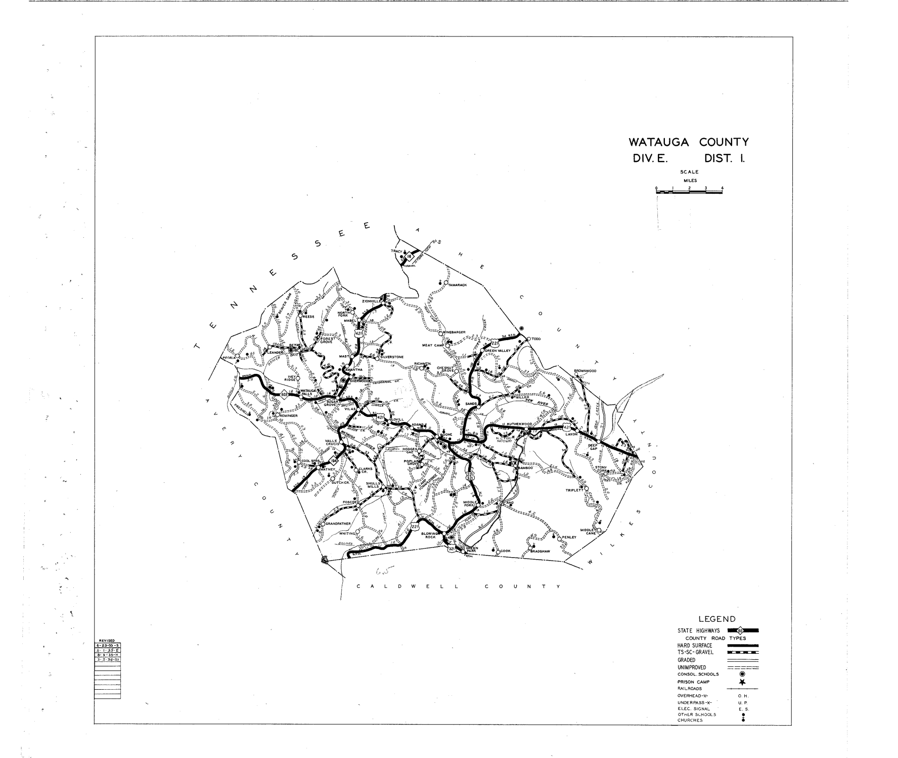
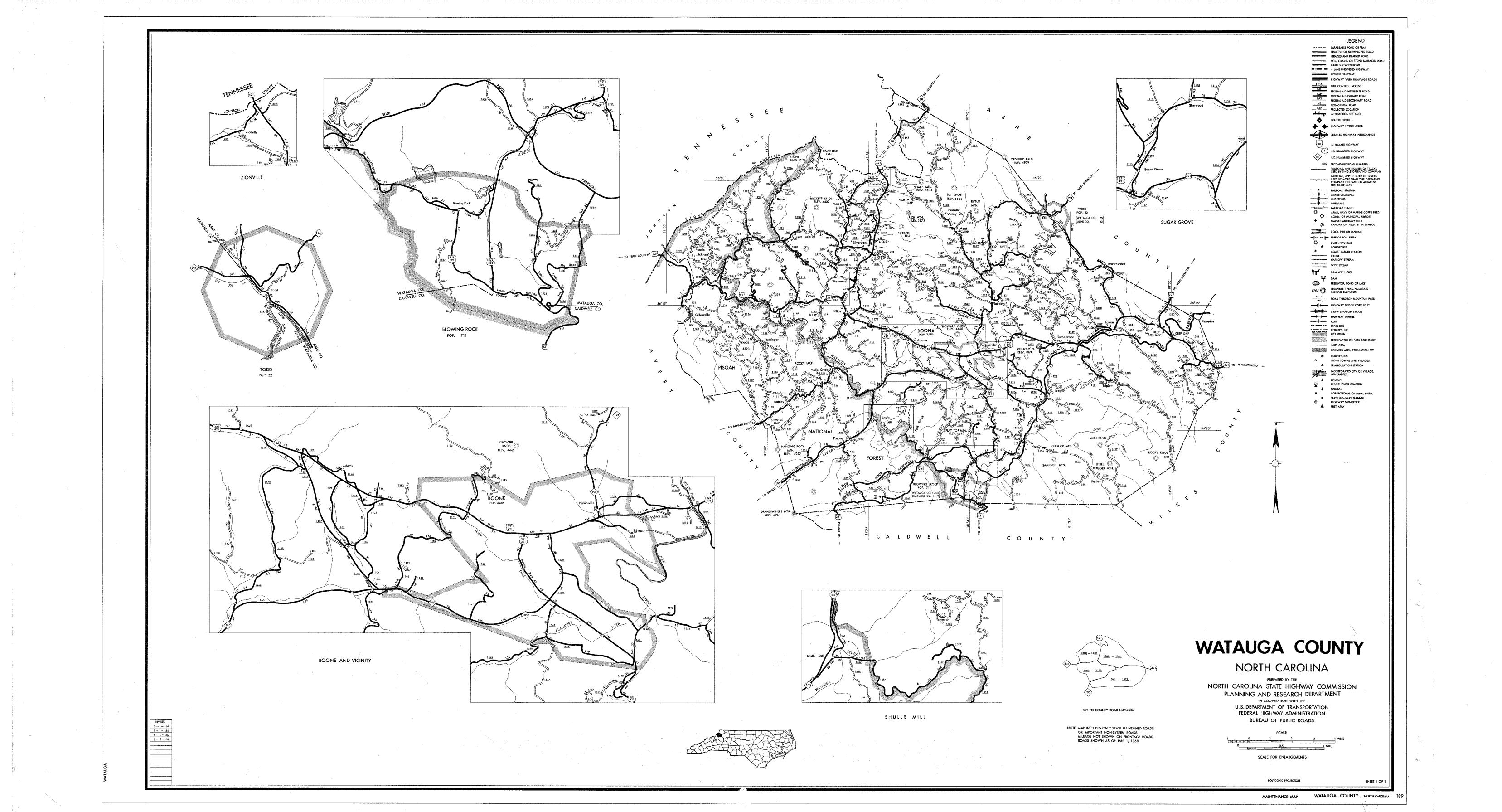
1930 Watauga
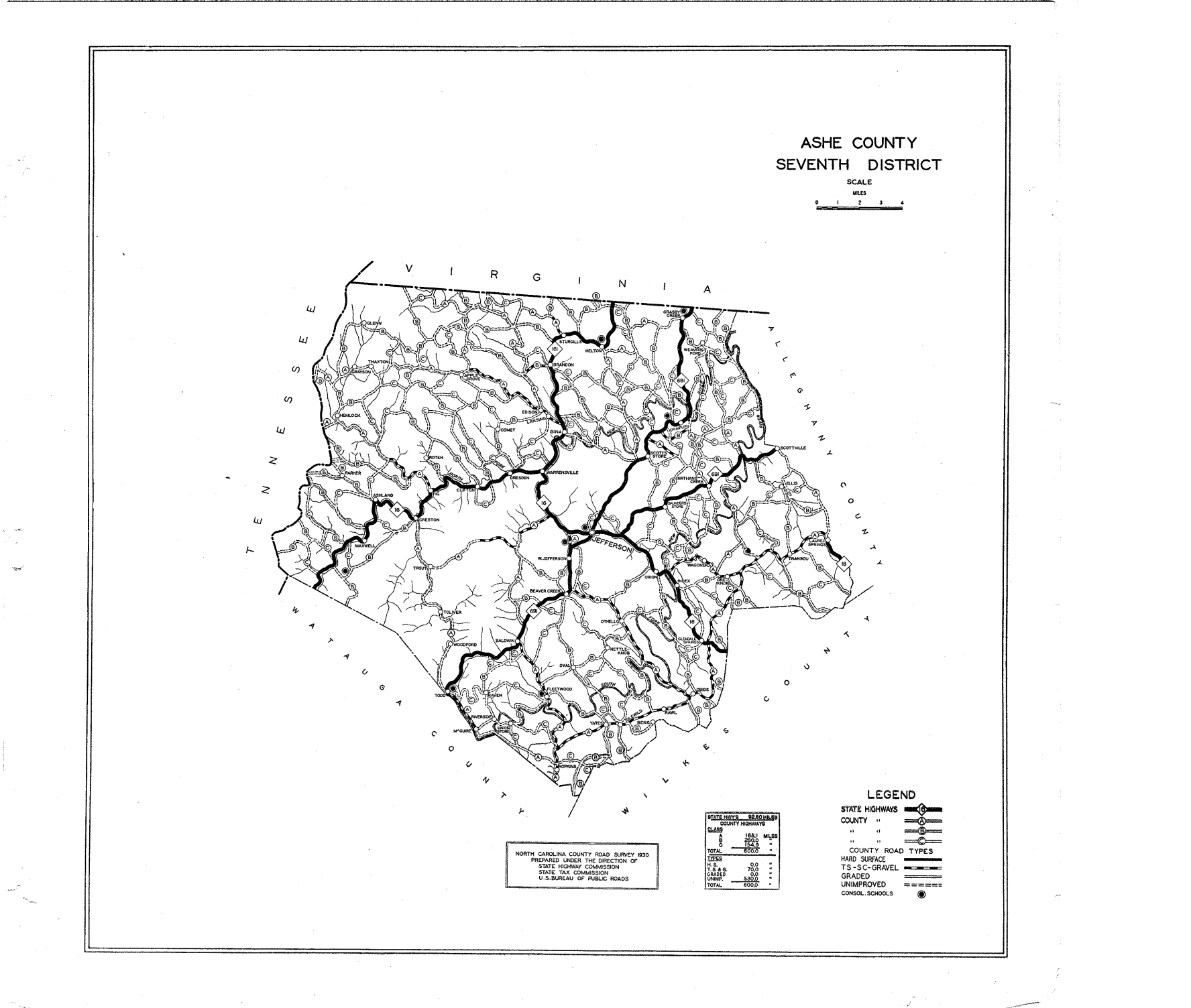
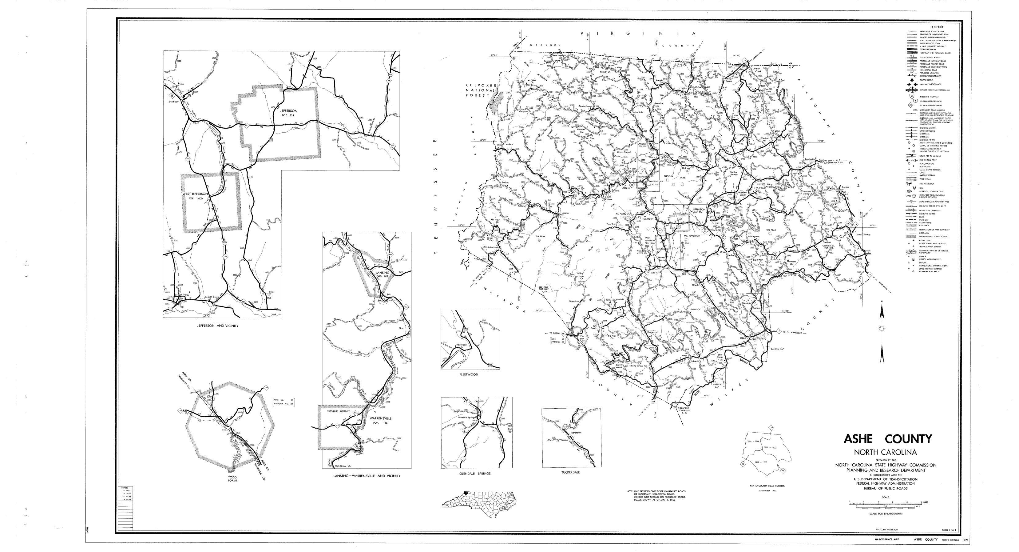
1930 Ashe
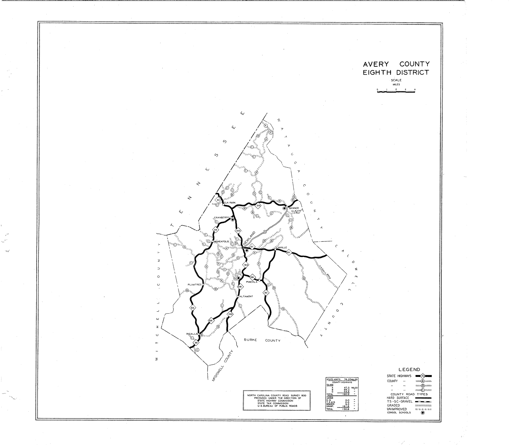
1930 Avery
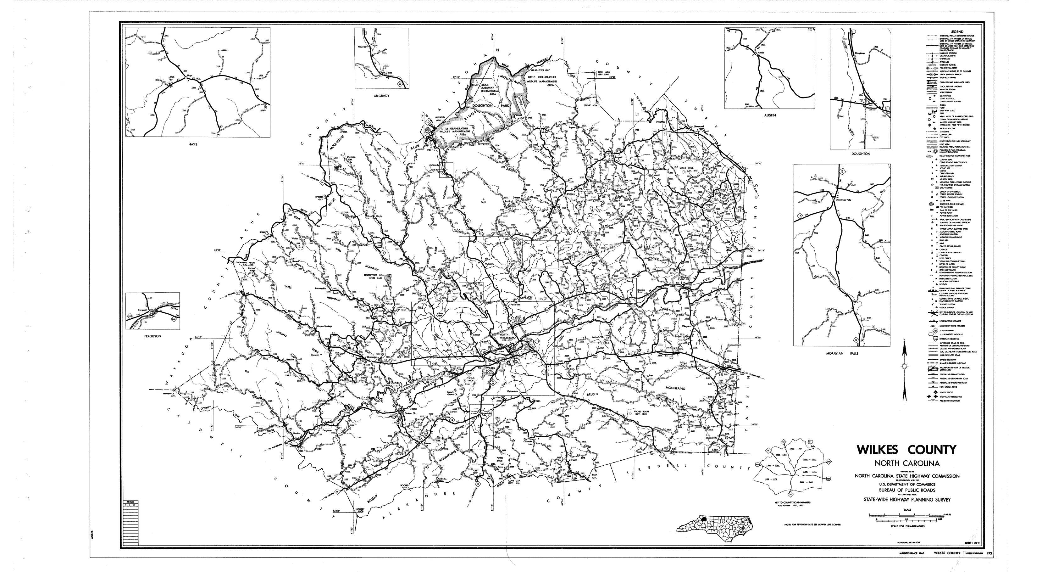
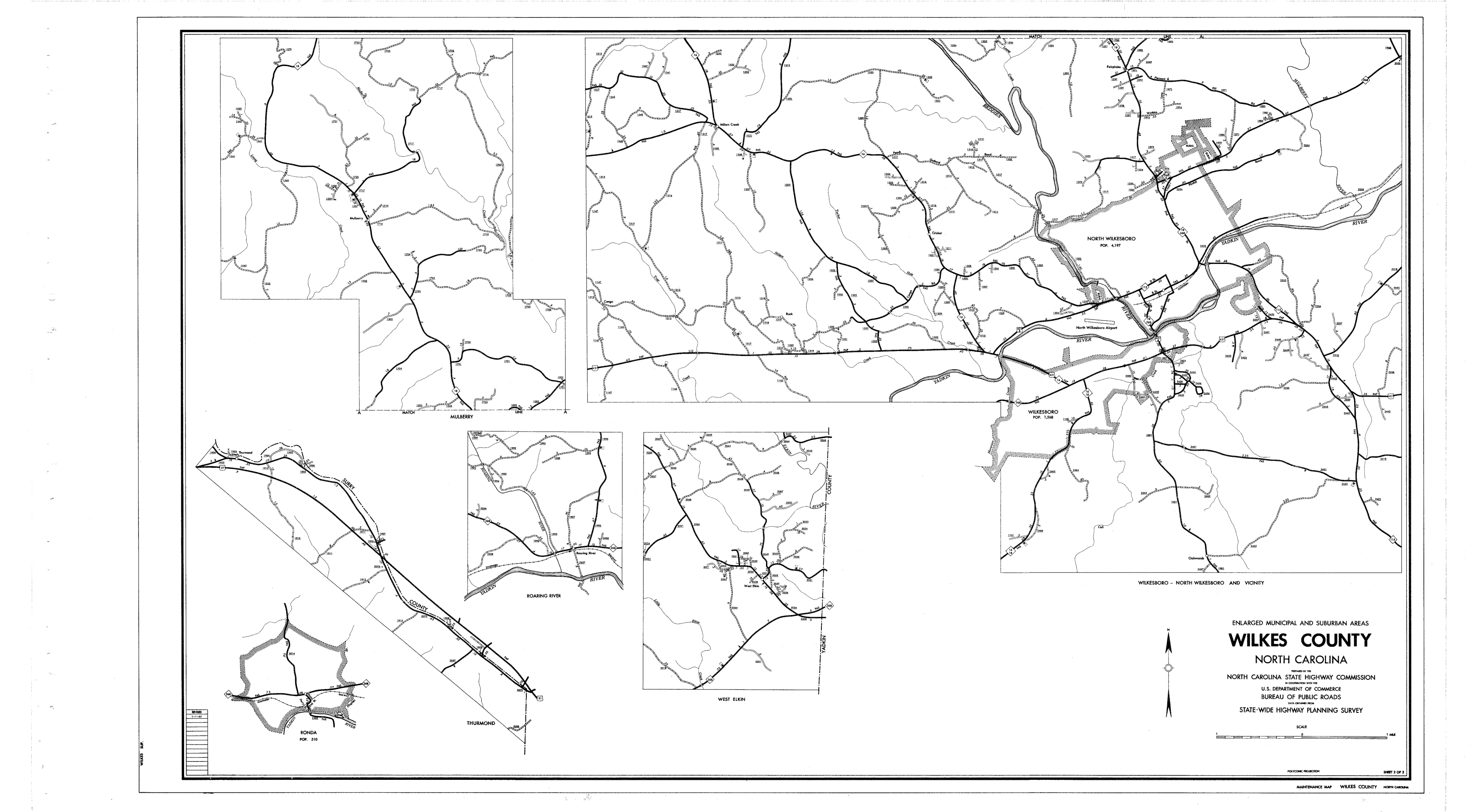
1930 Wilkes

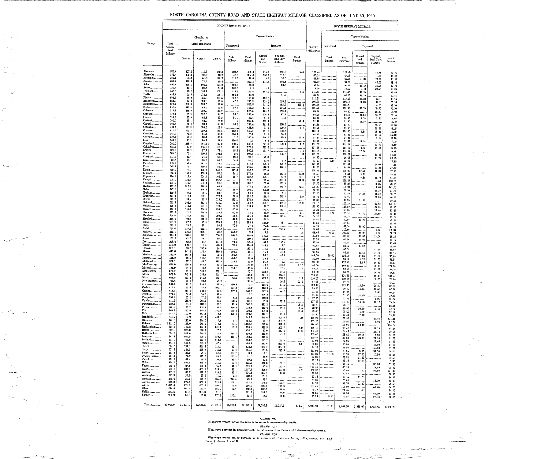
1930 NC State Mileage
1936 Watauga
1936 Ashe

1936 Avery

1936 Wilkes

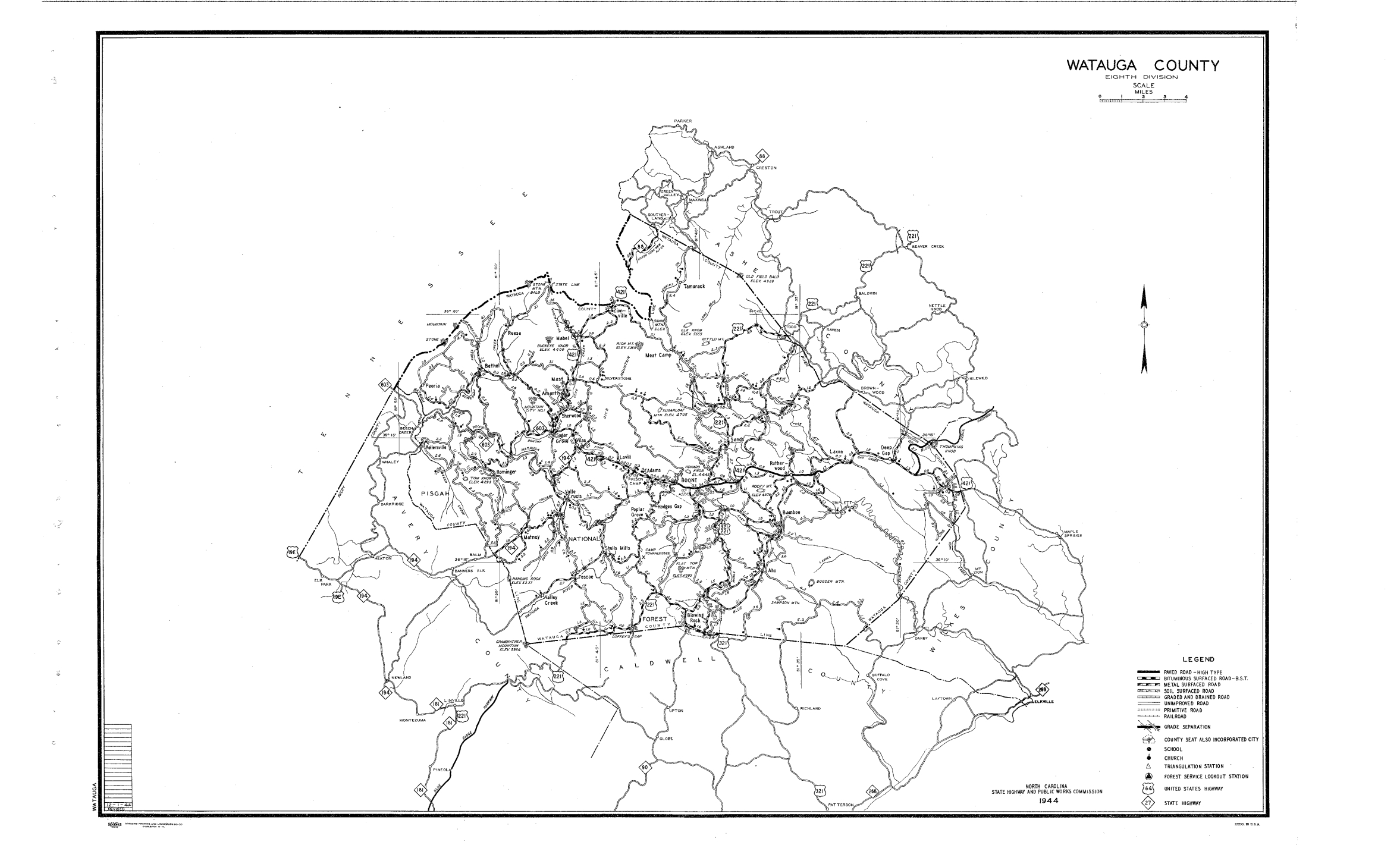
1944 Watauga

1944 Ashe
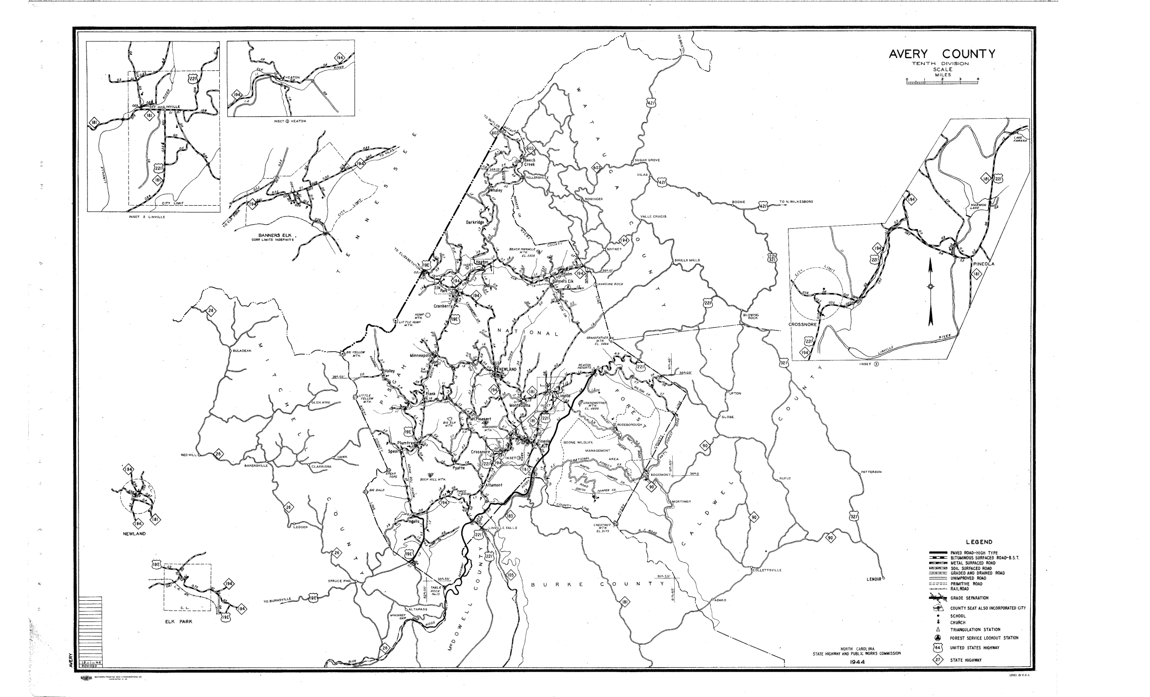
1944 Avery
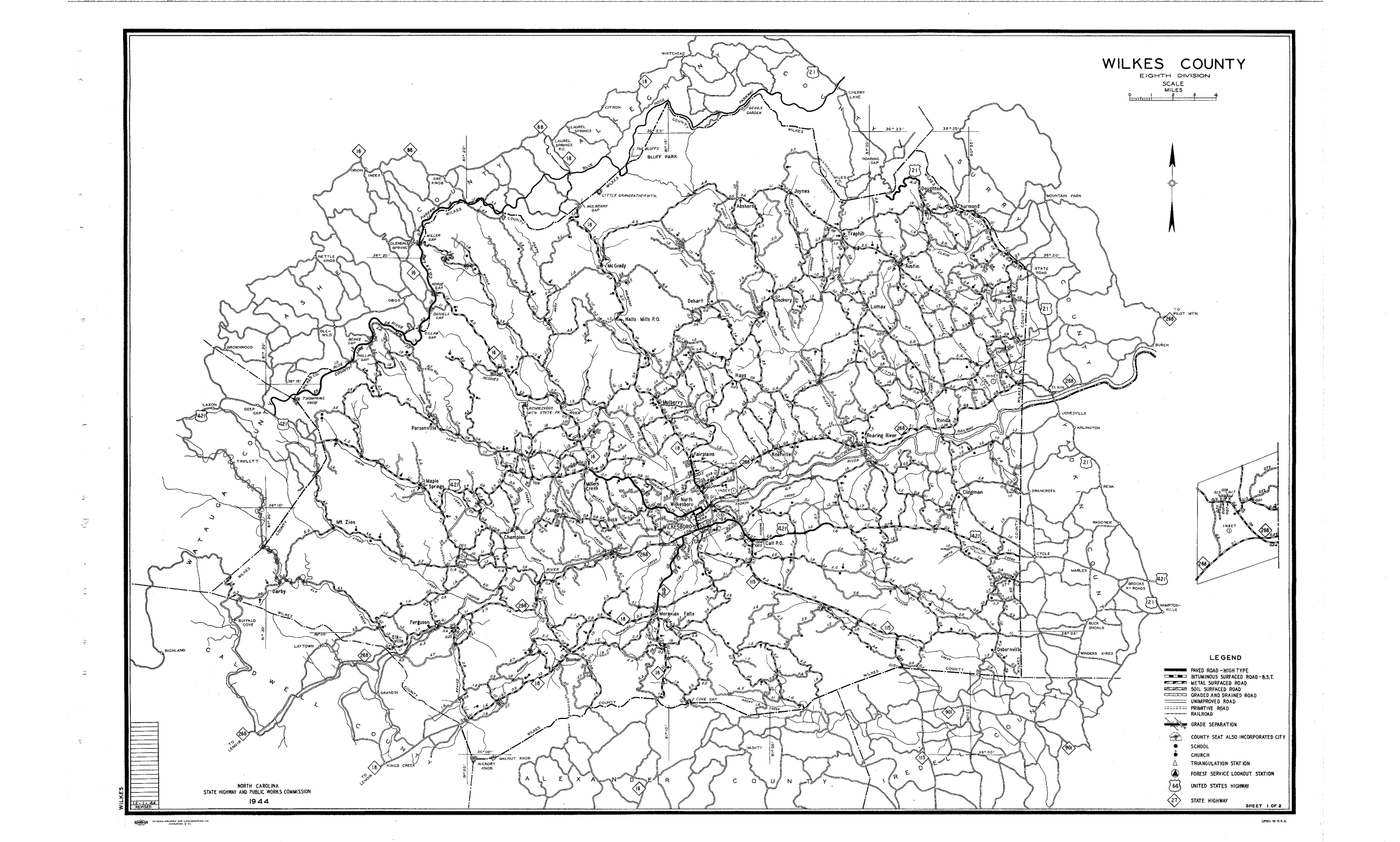
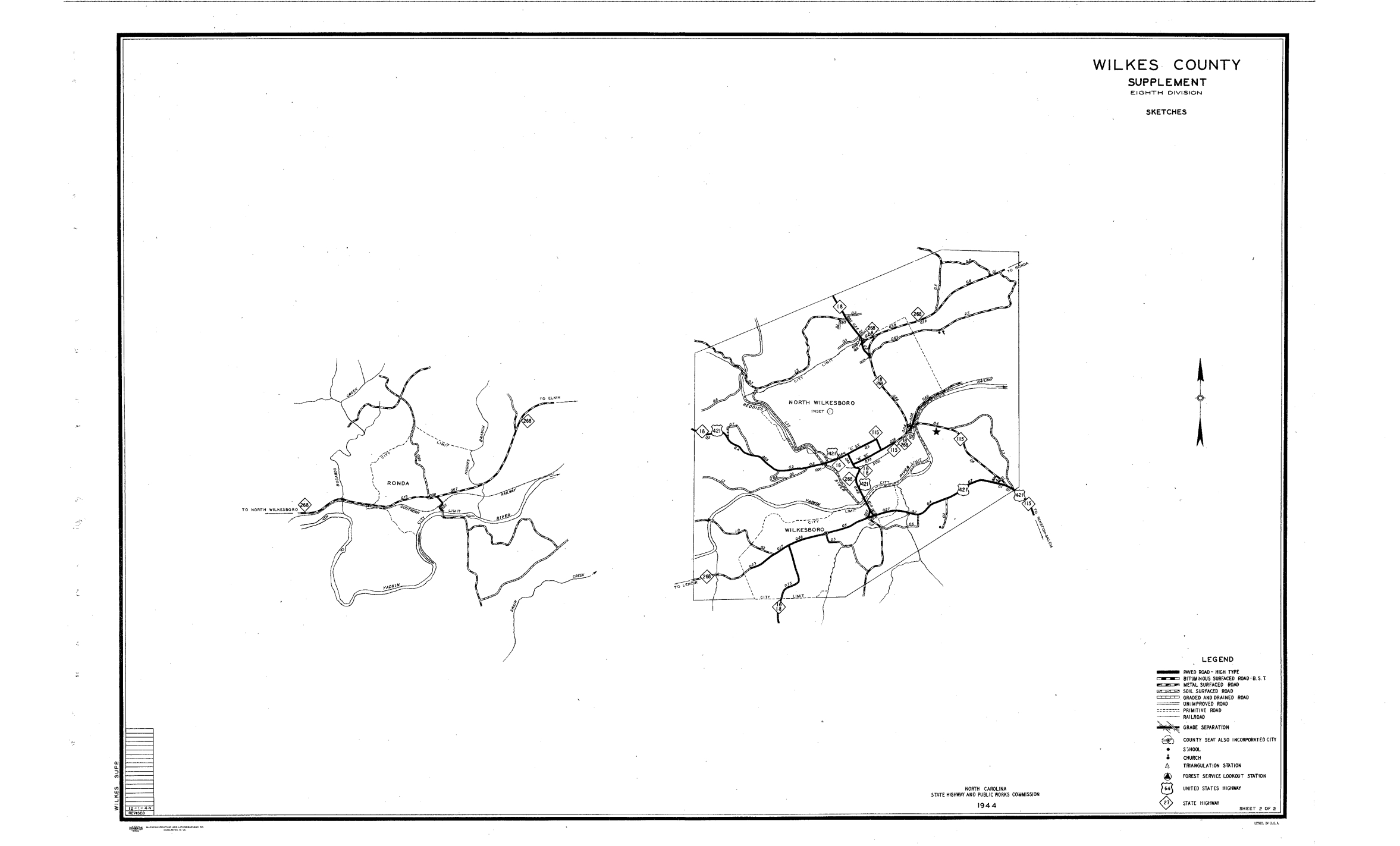
1944 Wilkes
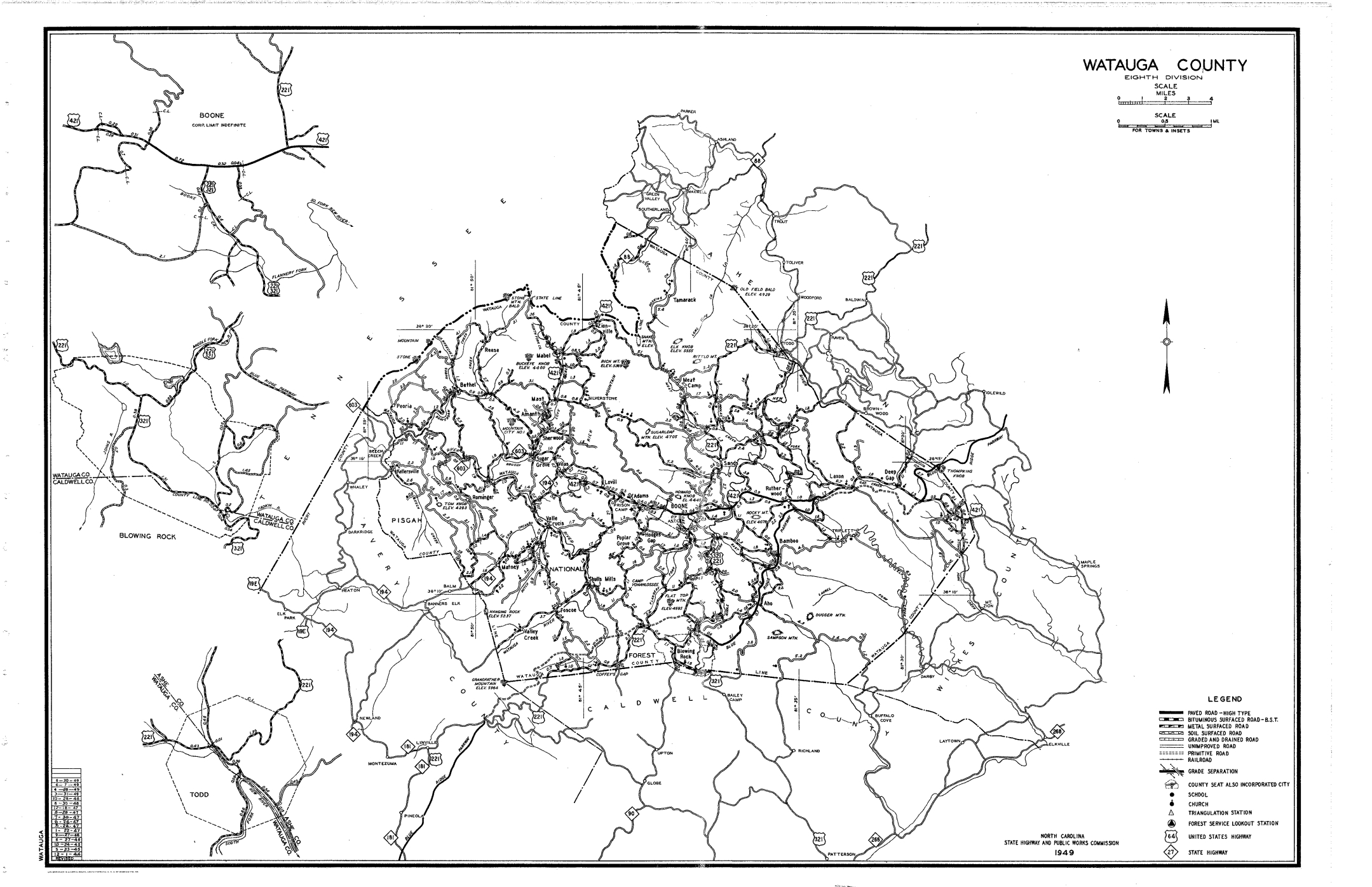
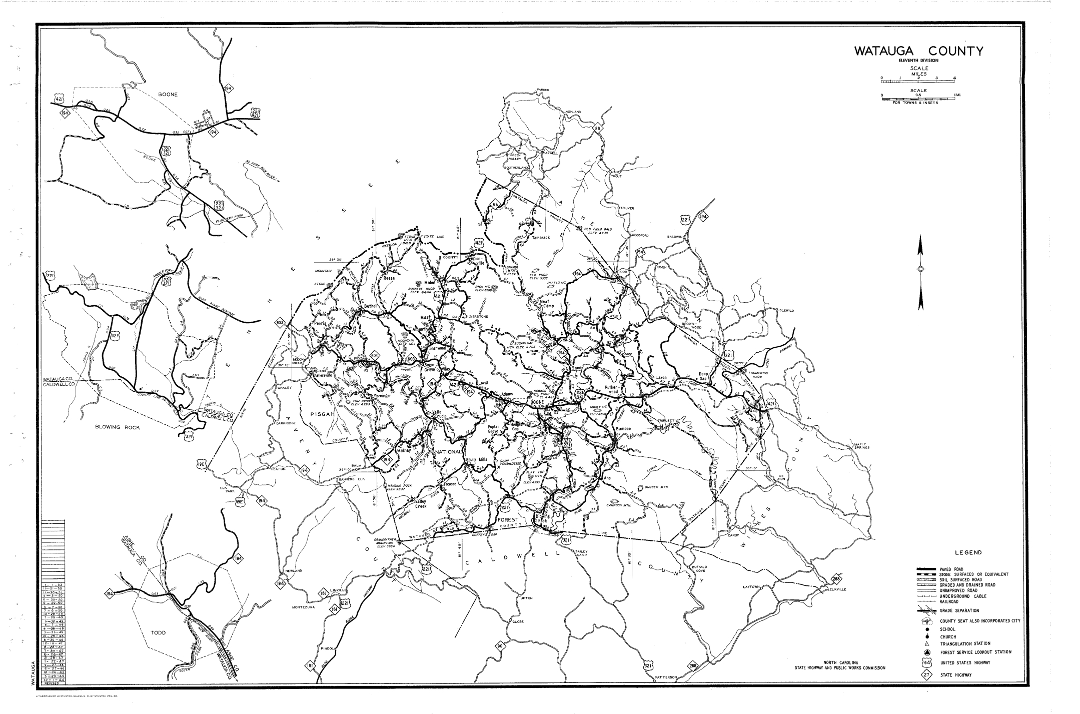
1949 Watauga
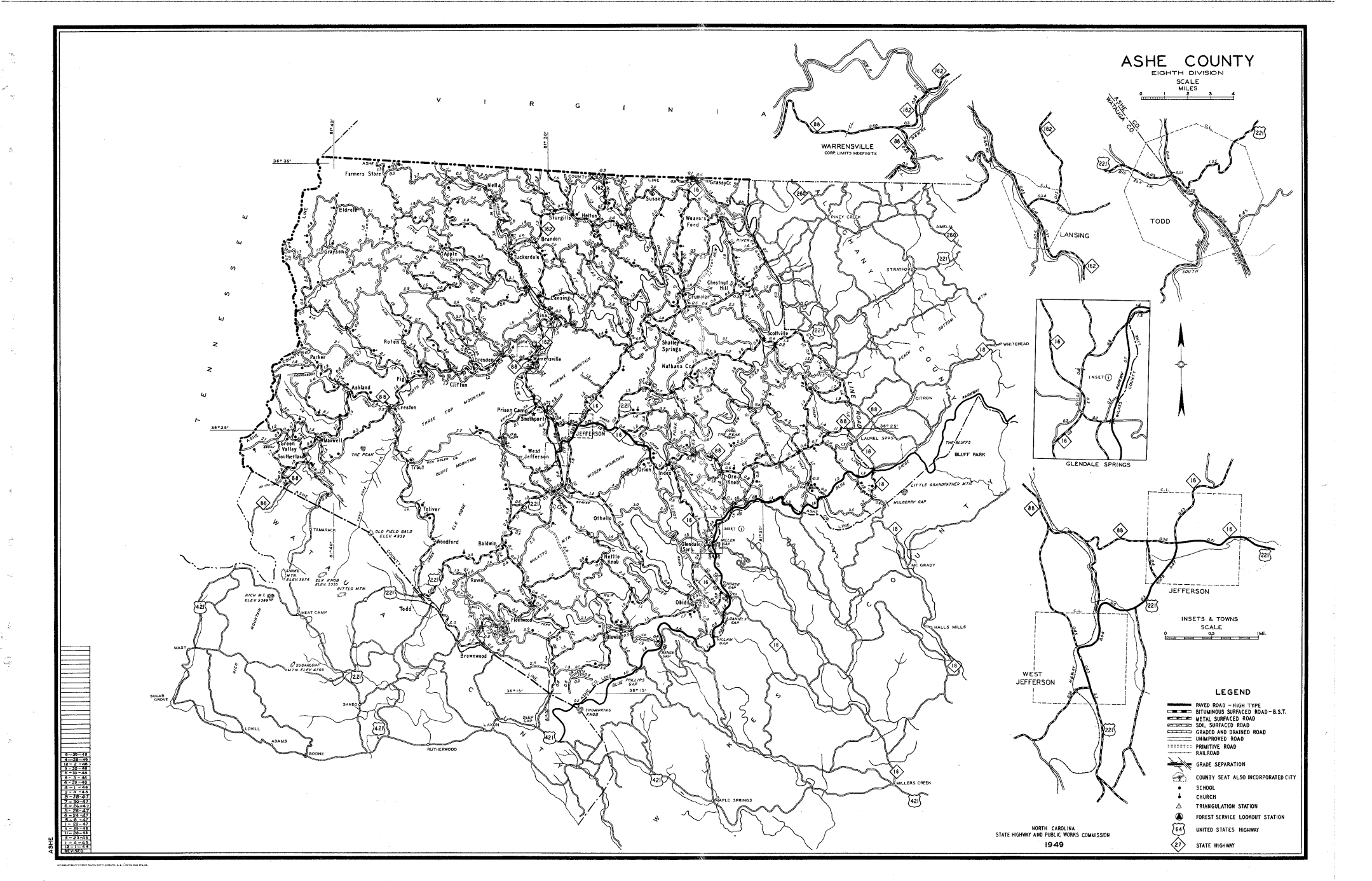
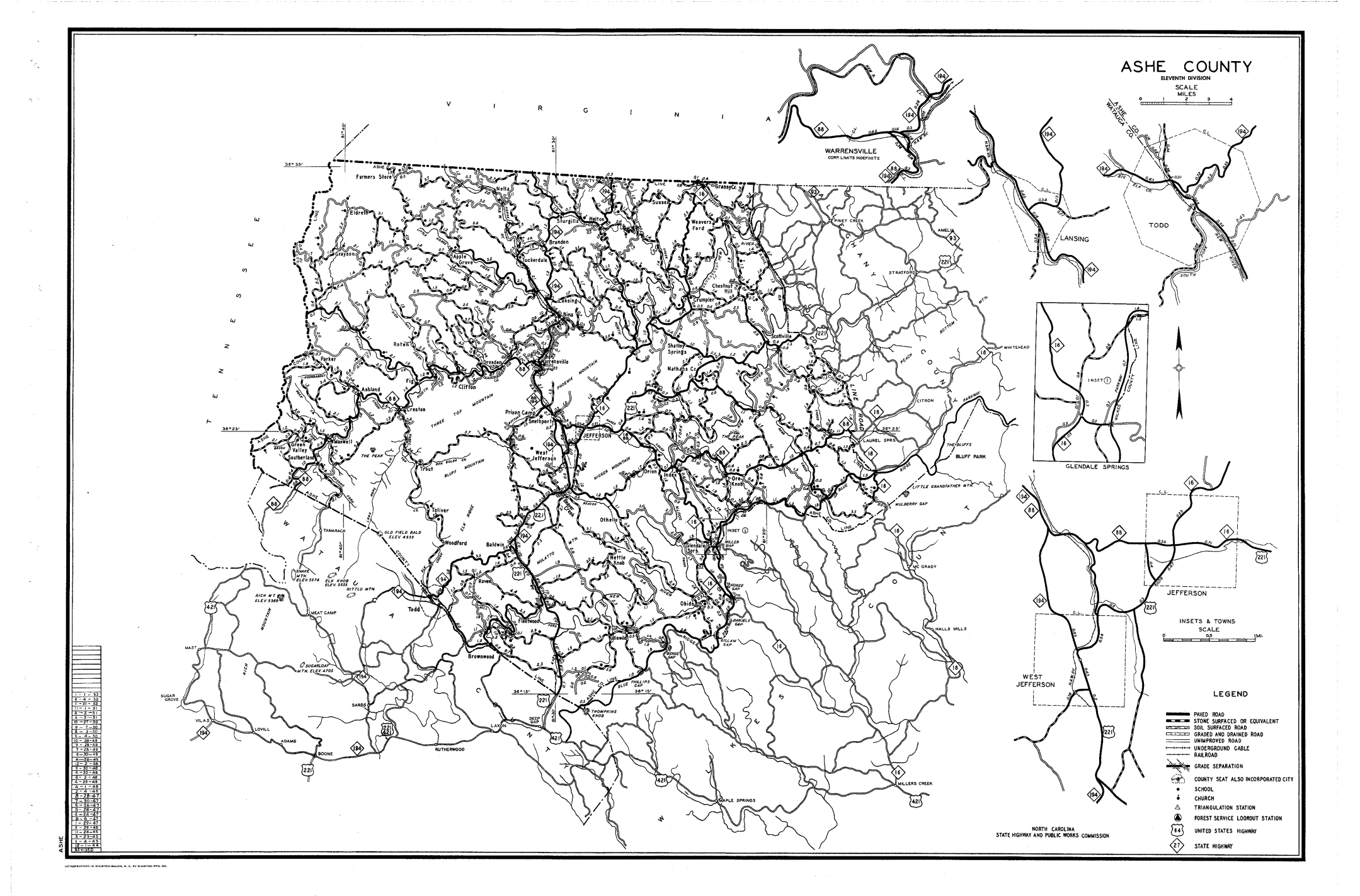
1949 Ashe
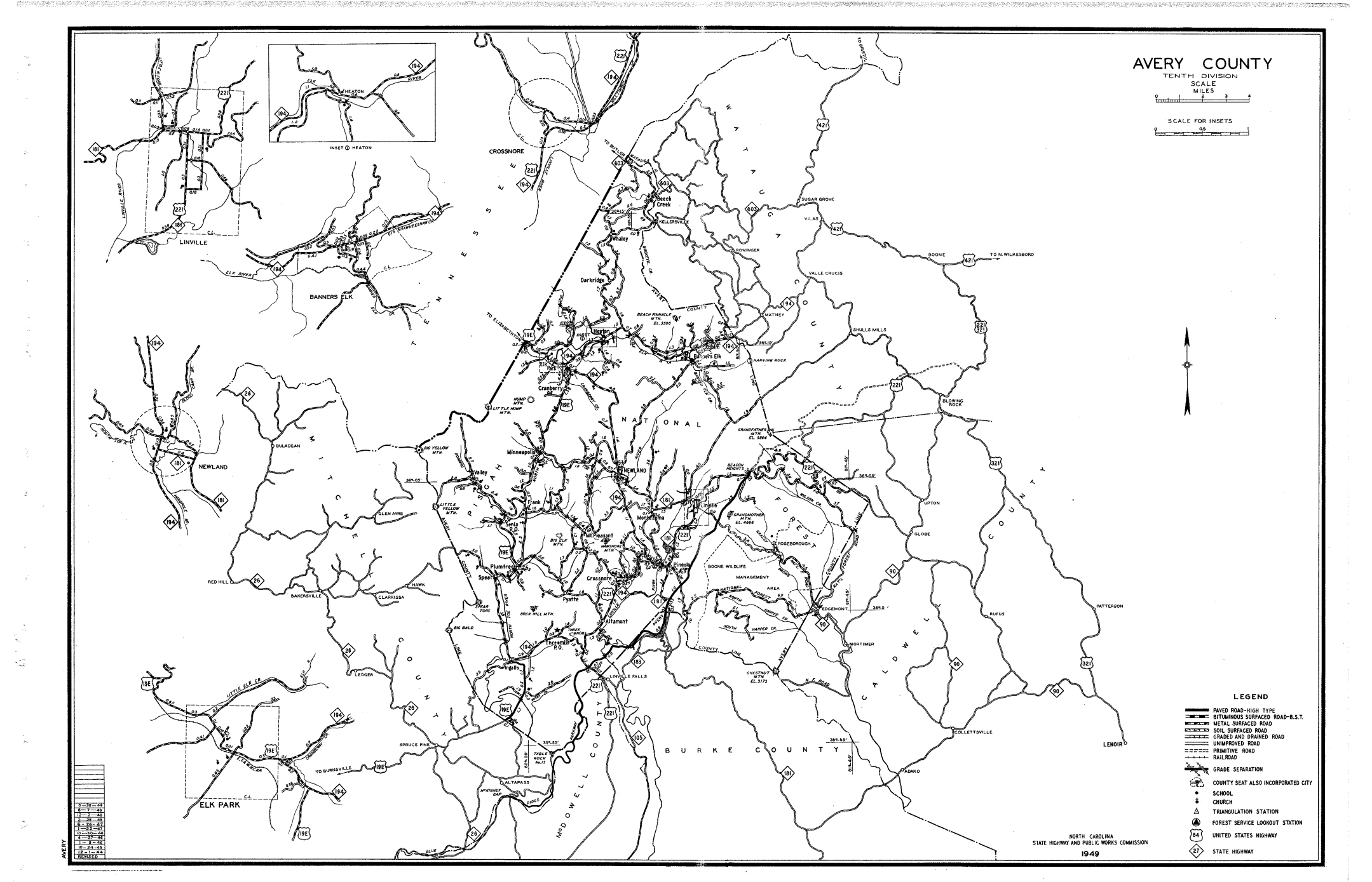
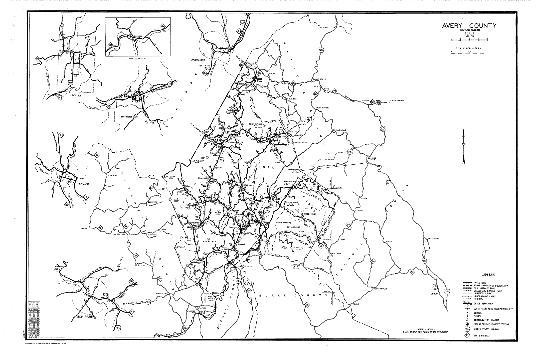
1949 Avery
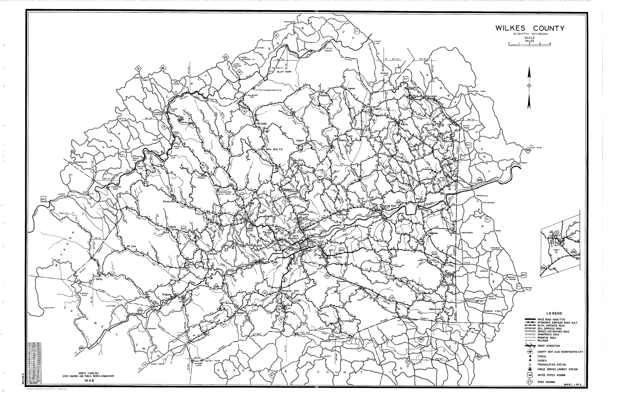
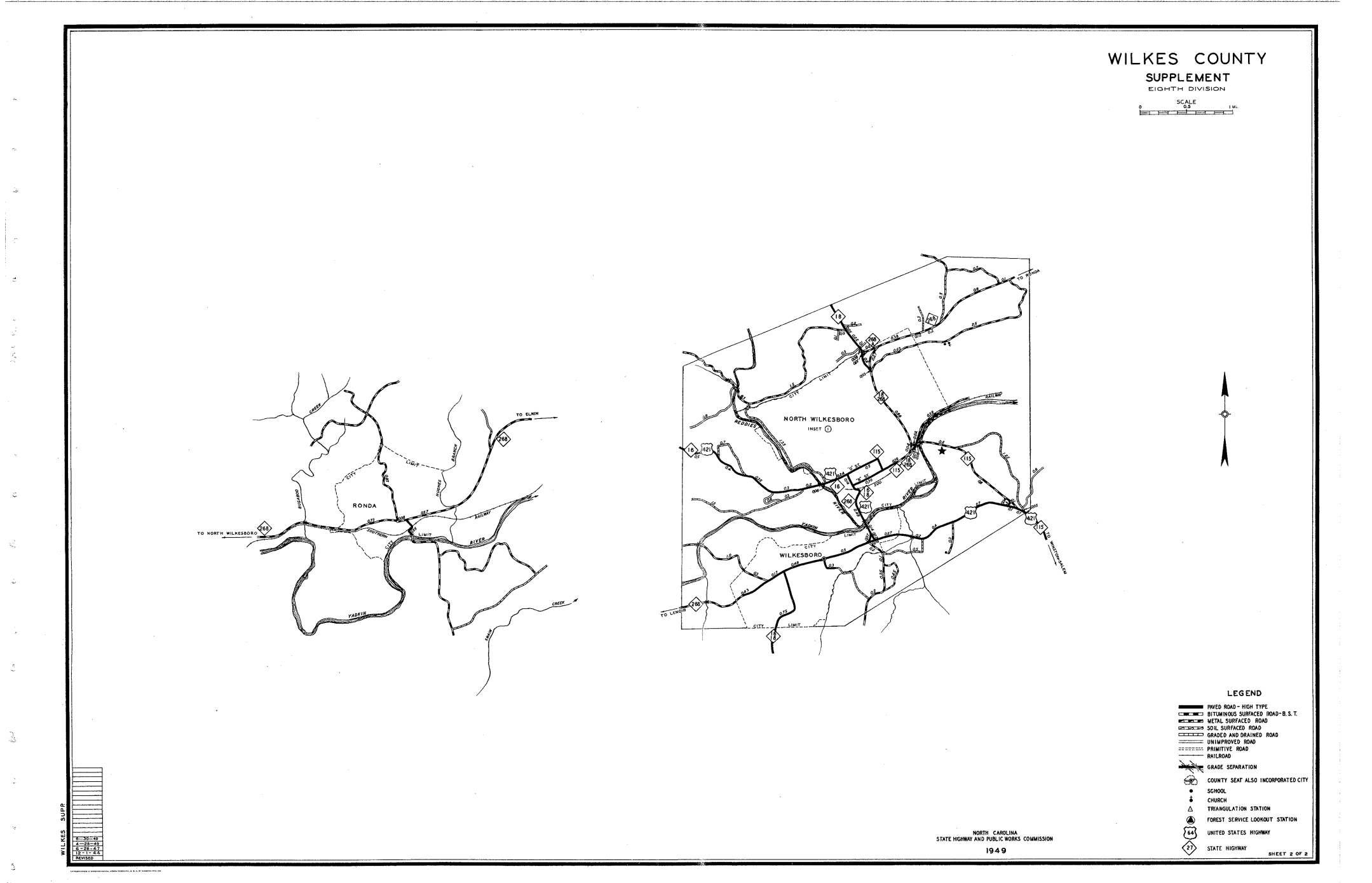
1949 Wilkes
1953 Watauga
1953 Ashe
1953 Avery
1953 Wilkes

1957 Watauga
1957 Ashe
1957 Avery
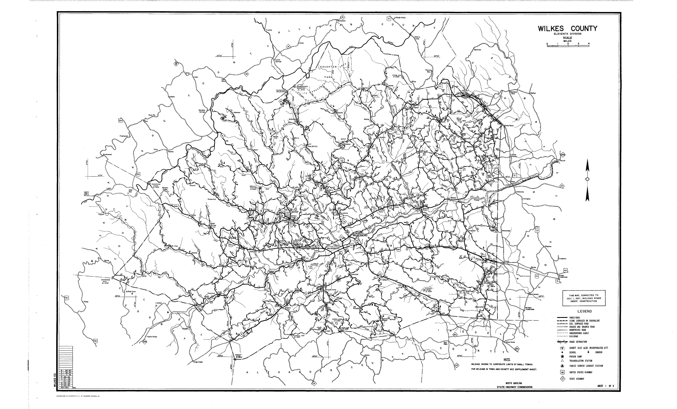
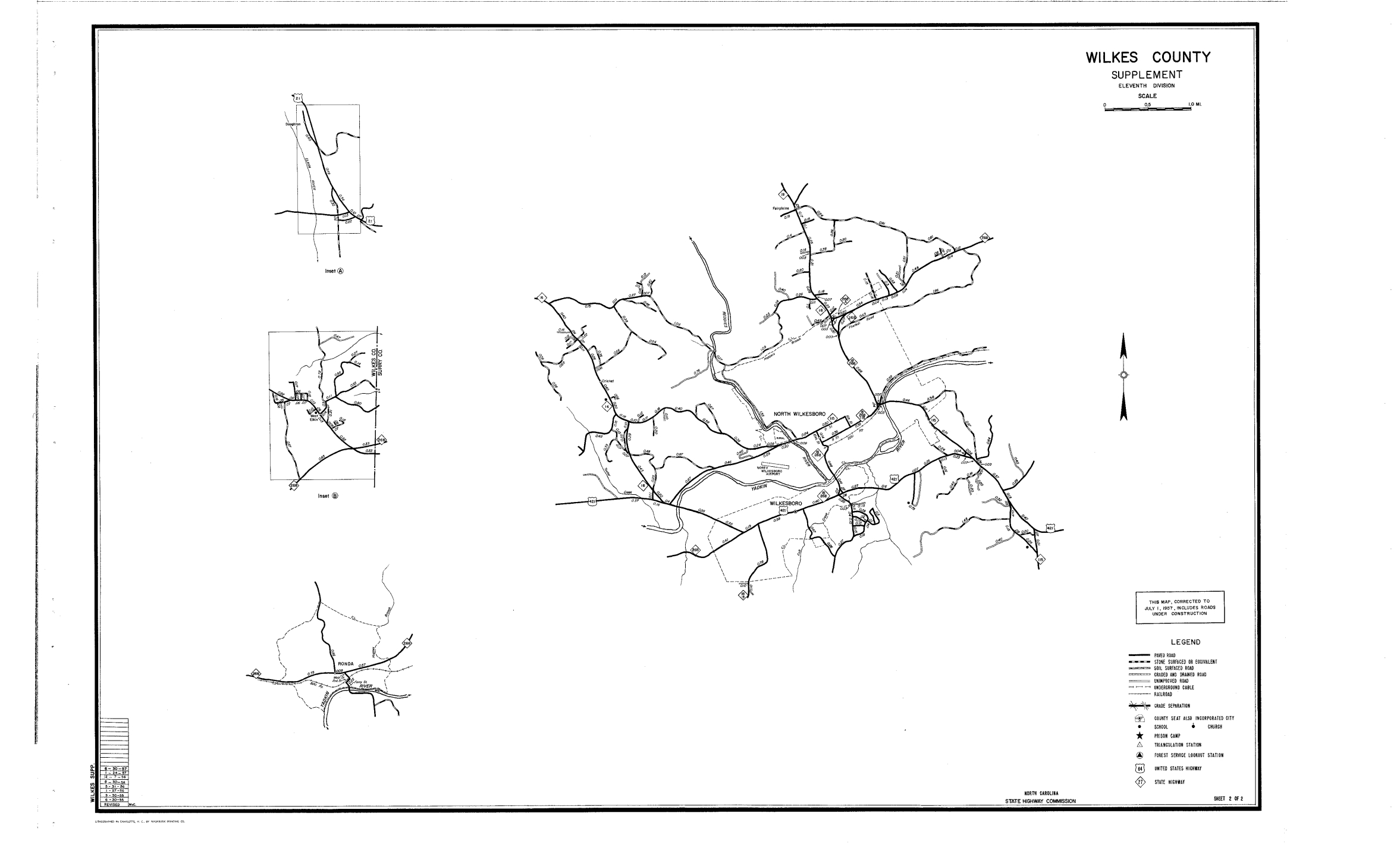
1957 Wilkes
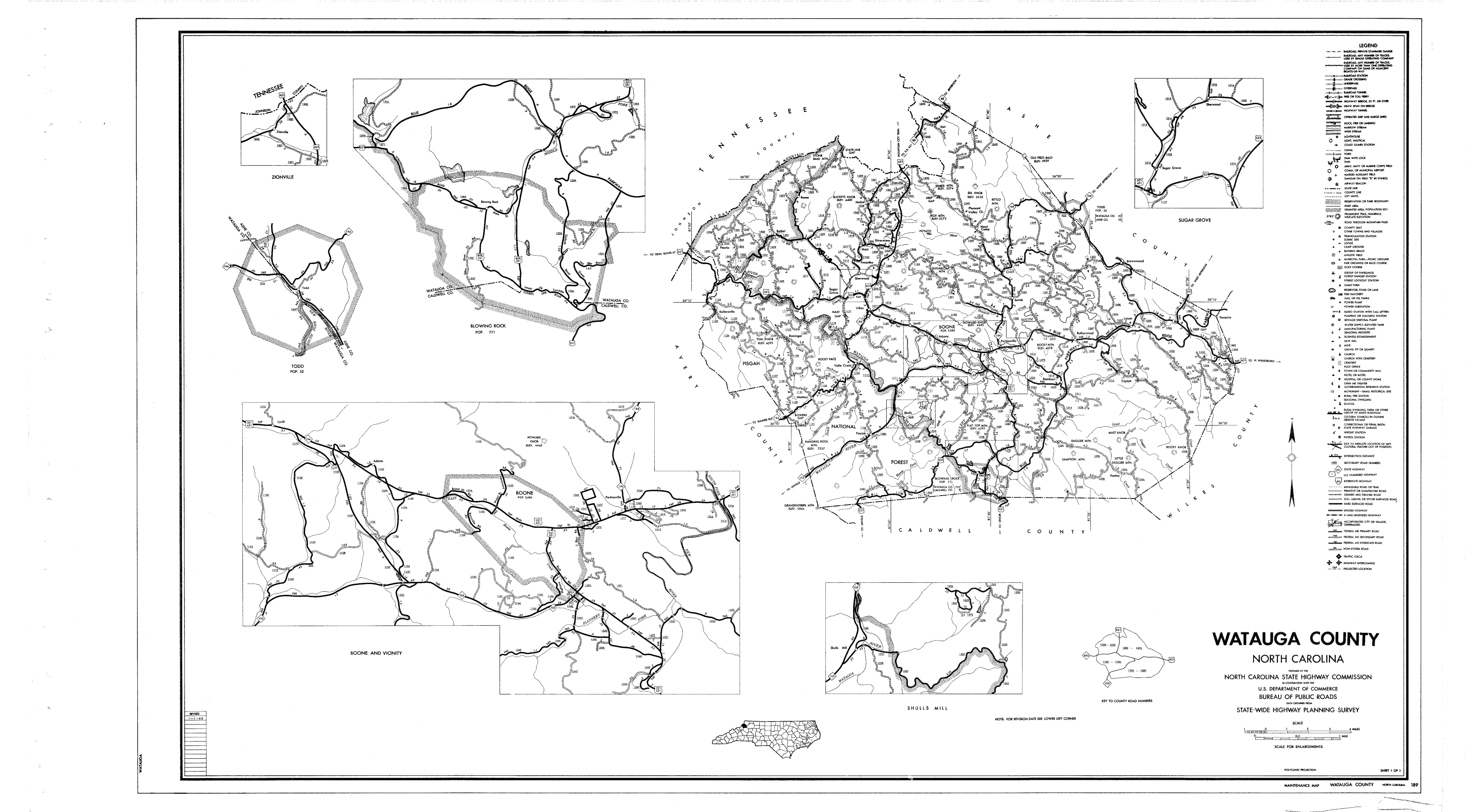
1962 Watauga

1962 Ashe
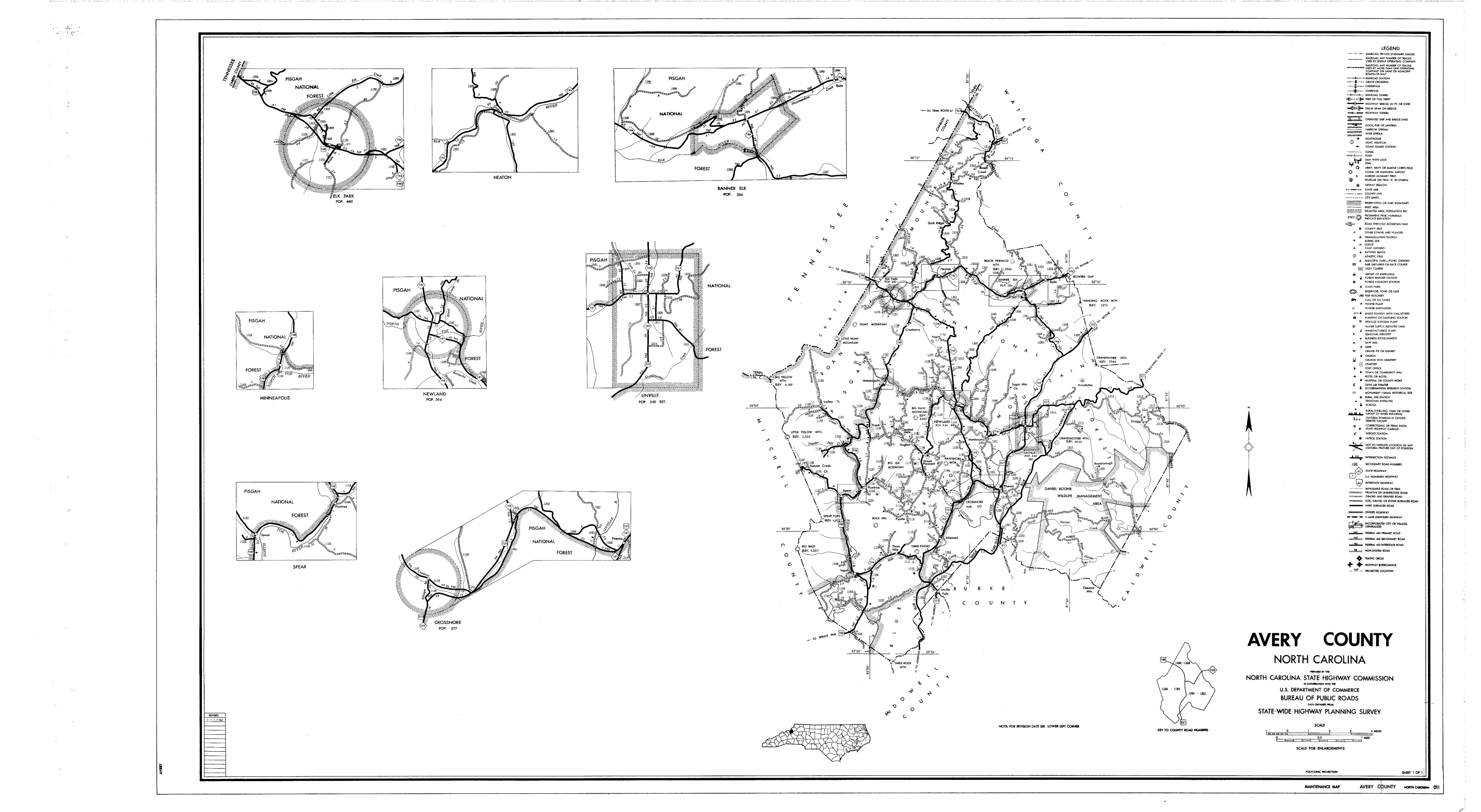
1962 Avery
1962 Wilkes
1968 Watauga
1968 Ashe
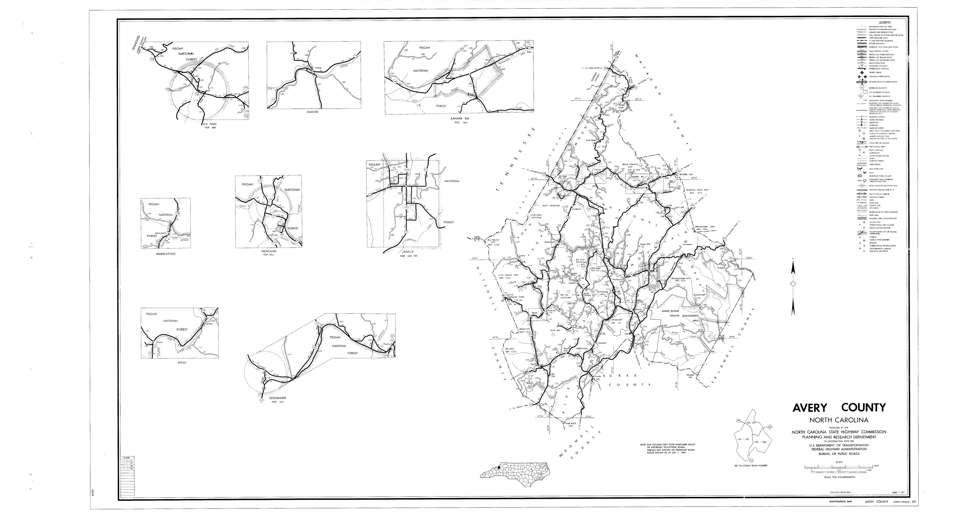
1968 Avery
1968 Wilkes