


Last Updated on January 6, 2020 8:10 am
Ashe-Alleghany NC-Watauga-Tazewell-Smyth-Bland-Wythe-Grayson-
Mercer-
Including the cities of West Jefferson, Sparta, Boone, Tazewell,
Marion, Bland, Wytheville, Independence, Whitetop, Troutdale,
Volney, and Bluefield
335 AM EST Mon Jan 6 2020
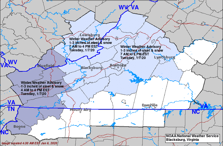
…WINTER WEATHER ADVISORY IN EFFECT FROM 4 AM TO 4 PM EST
TUESDAY…
* WHAT…Mostly snow, but some sleet expected. Total snow and
sleet accumulations of up to 3 inches.
* WHERE…Portions of southwest Virginia, northwest North
Carolina and southeast West Virginia.
* WHEN…From 4 AM to 4 PM EST Tuesday.
* IMPACTS…Plan on slippery road conditions. The hazardous
conditions could impact the morning and afternoon commute.
* ADDITIONAL DETAILS…Most areas will see 1 to 2 inches of snow,
with 3 to 4 inches possible mainly at the higher elevations.
PRECAUTIONARY/PREPAREDNESS ACTIONS…
Slow down and use caution while traveling. Untreated roads and
walkways will likely become snow and sleet covered resulting in
hazardous travel conditions.
The latest road conditions for the state you are calling from can
be obtained by calling 5 1 1.


