


Last Updated on January 17, 2020 6:10 pm
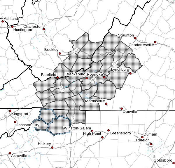
Ashe-Alleghany NC-Surry-Watauga-Wilkes-Tazewell-Smyth-Bland-Giles- Wythe-Pulaski-Montgomery-Grayson-Carroll-Floyd-Craig-Alleghany VA- Bath-Roanoke-Botetourt-Rockbridge-Patrick-Franklin-Bedford- Amherst-Mercer-Summers-Monroe-Eastern Greenbrier- Western Greenbrier- Including the cities of West Jefferson, Sparta, Dobson, Boone, Wilkesboro, Tazewell, Marion, Bland, Pearisburg, Wytheville, Radford, Pulaski, Blacksburg, Independence, Whitetop, Troutdale, Volney, Galax, Floyd, New Castle, Clifton Forge, Covington, Hot Springs, Roanoke, Salem, Fincastle, Lexington, Buena Vista, Stuart, Rocky Mount, Amherst, Bluefield, Hinton, Hix, Union, Lewisburg, White Sulphur Springs, Quinwood, Duo, and Rainelle
236 PM EST Fri Jan 17 2020
…WINTER WEATHER ADVISORY REMAINS IN EFFECT FROM 5 AM TO 7 PM EST SATURDAY…
* WHAT…Mixed precipitation expected. Total snow accumulations of up to one inch and ice accumulations of around one tenth of an inch or less.
* WHERE…Southeast West Virginia, as well as the mountains and foothills of northwest North Carolina and southwest Virginia.
* WHEN…From 5 AM to 7 PM EST Saturday.
* IMPACTS…Expect slippery and potentially hazardous travel conditions beginning early Saturday morning through early evening.
PRECAUTIONARY/PREPAREDNESS ACTIONS… A Winter Weather Advisory means that periods of snow…sleet…or freezing rain will cause travel difficulties. Be prepared for slippery roads and limited visibilities…and use caution while driving.


