Last Updated on March 31, 2025 6:50 am
NCZ001-018-VAZ015-311115-
Ashe NC-Watauga NC-Grayson VA-
644 AM EDT Mon Mar 31 2025
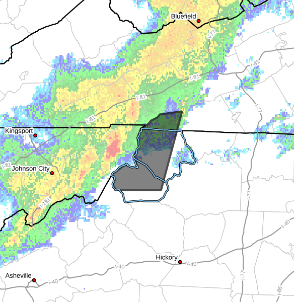
…A STRONG THUNDERSTORM WILL IMPACT
WATAUGA…ASHE AND SOUTHWESTERN GRAYSON COUNTIES THROUGH 715 AM
EDT…
At 643 AM EDT, Doppler radar was tracking a strong thunderstorm near
Mountain City, moving east at 50 mph.
HAZARD…Wind gusts up to 50 mph and half inch hail.
SOURCE…Radar indicated.
IMPACT…Gusty winds could knock down tree limbs and blow around
unsecured objects. Minor hail damage to vegetation is
possible.
Locations impacted include…
Boone…
Jefferson…
West Jefferson…
Beech Mountain…
Lansing…
Deep Gap…
and Ashland.
PRECAUTIONARY/PREPAREDNESS ACTIONS…
If outdoors, consider seeking shelter inside a building.
Locally heavy rain will quickly reduce visibility and result in
ponding of water on roadways, standing water in low lying areas, and
minor flooding of creeks, streams, and areas of poor drainage.
Drivers are urged to slow down and use extra caution to avoid
hydroplaning.