


Last Updated on December 15, 2020 6:52 am
…Wintry precipitation is expected on Wednesday… .A complex low pressure system will bring a wintry mix of snow, sleet, and freezing rain across portions of the Mid Atlantic on Wednesday. Temperatures will be at or below freezing early Wednesday morning due to cold air trapped against the Blue Ridge. Meanwhile, warmer air aloft will advance northward overtop of the cold air to bring wintry mixed precipitation. The system is expected to exit the region by Wednesday evening.
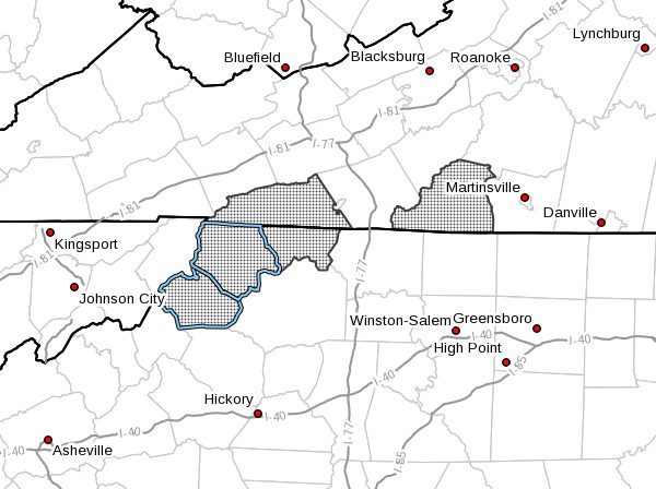
NCZ001-002-018-VAZ015-032-151745-
/O.NEW.KRNK.WS.W.0003.201216T0500Z-201217T0500Z/
Ashe-Alleghany NC-Watauga-Grayson-Patrick-
Including the cities of West Jefferson, Sparta, Boone,
Independence, Whitetop, Troutdale, Volney, and Stuart
435 AM EST Tue Dec 15 2020
…WINTER STORM WARNING IN EFFECT FROM MIDNIGHT TONIGHT TO
MIDNIGHT EST WEDNESDAY NIGHT…
- WHAT…Heavy mixed precipitation expected. Total snow and sleet
accumulations of 1 to 3 inches and ice accumulations of up to
two tenths of an inch. - WHERE…In Virginia, Grayson and Patrick Counties. In North
Carolina, Ashe, Alleghany NC and Watauga Counties. - WHEN…From midnight tonight to midnight EST Wednesday night.
- IMPACTS…Plan on slippery road conditions. The hazardous
conditions could impact the morning or evening commute.
PRECAUTIONARY/PREPAREDNESS ACTIONS…
If you must travel, keep an extra flashlight, food, and water in
your vehicle in case of an emergency.
The latest road conditions for the state you are calling from can
be obtained by calling 5 1 1.


